Recent from talks
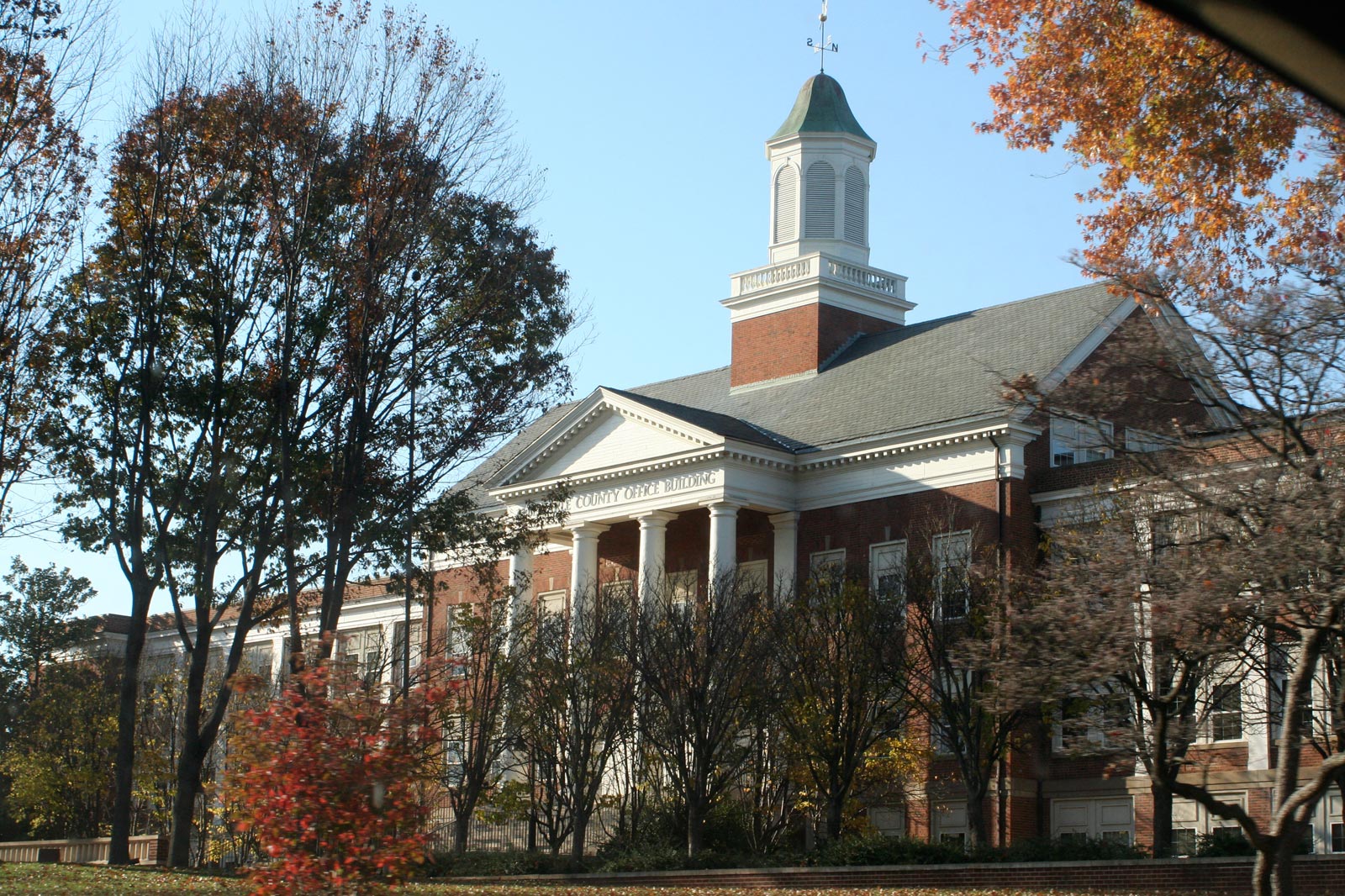
Albemarle County, Virginia
Knowledge base stats:
Talk channels stats:
Members stats:
Albemarle County, Virginia
Albemarle County is a United States county located in the Piedmont region of the Commonwealth of Virginia. Its county seat is Charlottesville, which is an independent city entirely surrounded by the county. Albemarle County is part of the Charlottesville Metropolitan Statistical Area. As of the 2020 census, the population was 112,395.
Albemarle County was created in 1744 from the western portion of Goochland County, though portions of Albemarle were later carved out to create other counties. Albemarle County was named in honor of Willem Anne van Keppel, 2nd Earl of Albemarle. Its most famous inhabitant was Thomas Jefferson, who built his estate home, Monticello, in the county.
At the time of European encounter, the inhabitants of the area that became Albemarle County were a Siouan-speaking tribe called the Saponi. In 1744, the Virginia General Assembly created Albemarle County from the western portion of Goochland County. The county was named in honor of Willem Anne van Keppel, 2nd Earl of Albemarle and titular Governor of Virginia at the time. The large county was partitioned in 1761, forming Buckingham and Amherst counties, at which time the county seat was moved from the formerly central Scottsville to a piece of newly central land, christened Charlottesville. In 1777, Albemarle County was divided and Fluvanna County established, finalizing the boundaries of modern Albemarle County.
Albemarle County is well known for its association with President and Founding Father Thomas Jefferson, who was born in the county at Shadwell, though it was then part of Goochland County. However, his home of Monticello is located in the county. When the American Revolutionary War started in 1775, Jefferson was made colonel of the Albemarle Militia.
During the Civil War, the Battle of Rio Hill was a skirmish in which Union cavalry raided a Confederate camp in Albemarle County, Virginia.
Until the Civil War, the majority of Albemarle County's population consisted of enslaved African Americans.
According to the U.S. Census Bureau, the county has a total area of 726 square miles (1,880 km2), of which 721 square miles (1,870 km2) is land and 5 square miles (13 km2) (0.7%) is water.
The Rivanna River's south fork forms in Albemarle County and was historically important for transportation. The south fork flows in-between Darden Towe Park and Pen Park. Boat ramp access is available at Darden Towe Park. The James River acts as a natural border between Albemarle and Buckingham Counties.
Hub AI
Albemarle County, Virginia AI simulator
(@Albemarle County, Virginia_simulator)
Albemarle County, Virginia
Albemarle County is a United States county located in the Piedmont region of the Commonwealth of Virginia. Its county seat is Charlottesville, which is an independent city entirely surrounded by the county. Albemarle County is part of the Charlottesville Metropolitan Statistical Area. As of the 2020 census, the population was 112,395.
Albemarle County was created in 1744 from the western portion of Goochland County, though portions of Albemarle were later carved out to create other counties. Albemarle County was named in honor of Willem Anne van Keppel, 2nd Earl of Albemarle. Its most famous inhabitant was Thomas Jefferson, who built his estate home, Monticello, in the county.
At the time of European encounter, the inhabitants of the area that became Albemarle County were a Siouan-speaking tribe called the Saponi. In 1744, the Virginia General Assembly created Albemarle County from the western portion of Goochland County. The county was named in honor of Willem Anne van Keppel, 2nd Earl of Albemarle and titular Governor of Virginia at the time. The large county was partitioned in 1761, forming Buckingham and Amherst counties, at which time the county seat was moved from the formerly central Scottsville to a piece of newly central land, christened Charlottesville. In 1777, Albemarle County was divided and Fluvanna County established, finalizing the boundaries of modern Albemarle County.
Albemarle County is well known for its association with President and Founding Father Thomas Jefferson, who was born in the county at Shadwell, though it was then part of Goochland County. However, his home of Monticello is located in the county. When the American Revolutionary War started in 1775, Jefferson was made colonel of the Albemarle Militia.
During the Civil War, the Battle of Rio Hill was a skirmish in which Union cavalry raided a Confederate camp in Albemarle County, Virginia.
Until the Civil War, the majority of Albemarle County's population consisted of enslaved African Americans.
According to the U.S. Census Bureau, the county has a total area of 726 square miles (1,880 km2), of which 721 square miles (1,870 km2) is land and 5 square miles (13 km2) (0.7%) is water.
The Rivanna River's south fork forms in Albemarle County and was historically important for transportation. The south fork flows in-between Darden Towe Park and Pen Park. Boat ramp access is available at Darden Towe Park. The James River acts as a natural border between Albemarle and Buckingham Counties.
Recent media