Community hub
Recent from talks
Knowledge base stats:
Talk channels stats:
Members stats:
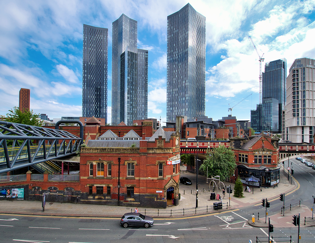
Greater Manchester
Greater Manchester is a metropolitan and ceremonial county in North West England. It borders Lancashire to the north, West Yorkshire and Derbyshire to the east, Cheshire to the south, and Merseyside to the west. Its largest settlement is the city of Manchester.
The county has an area of 1,276 km2 (493 sq mi) and is highly urbanised, with a population of 2,911,744 in 2022. Manchester is located in the centre of the county, with the city of Salford immediately adjacent to the west. Other large settlements include Rochdale in the north-east, Stockport in the south-east, Sale in the south-west, Wigan in the far north-west, and Bolton in the north-west. The majority of the county's settlements are part of the Greater Manchester Built-up Area, which extends into Cheshire and Merseyside and is the second most populous urban area in the United Kingdom. For local government purposes the county comprises ten metropolitan boroughs: Manchester, Salford, Bolton, Bury, Oldham, Rochdale, Stockport, Tameside, Trafford and Wigan. The borough councils collaborate through the Greater Manchester Combined Authority. The county was created on 1 April 1974 from parts of north-east Cheshire, south-east Lancashire, and a small part of the West Riding of Yorkshire.
The centre and south-west of Greater Manchester are lowlands, similar to the West Lancashire Coastal Plain to the north-west and the Cheshire Plain to the south-west. The north and east are part of the Pennines: the West Pennine Moors in the northwest, the South Pennines in the northeast and the Peak District in the east. Most of the county's rivers rise in the Pennines and are tributaries of the Mersey and Irwell, the latter of which is itself a tributary of the Mersey. The county is connected to the Mersey Estuary by the Manchester Ship Canal, which for its entire length within Greater Manchester consists of canalised sections of the Mersey and Irwell.
What is now Greater Manchester was largely rural until the Industrial Revolution, when the region underwent rapid industrialisation. The area's towns and cities became major centres for the manufacture of cotton textiles, aided by the exploitation of the Lancashire coalfield. The region was also an engineering and scientific centre, leading to achievements such as the first inter-city railway. Following deindustrialisation in the mid-20th century the county has emerged as a major centre for the service sector, media and digital industries. It is also recognised for its contributions to guitar and dance music, and for its football teams.
Although Greater Manchester was not created until 1974, the history of its settlements go back centuries. There is evidence of Iron Age habitation, particularly at Mellor, and a known Celtic Britons settlement named Chochion, believed to have been an area of Wigan settled by the Brigantes. Stretford was also part of the land believed to have been occupied by the Brigantes, and lay on their border with the Cornovii on the southern side of the River Mersey. The remains of 1st-century forts at Castlefield in Manchester, and Castleshaw Roman Fort in Saddleworth, are evidence of Roman occupation.
From the River Mersey to River Ribble was recorded as an area surveyed with Cheshire in the Domesday Book of 1086; it is thought that the area was partially surveyed.
Between Lancashire's creation to the 18th century an ancient division of the shire, with a similar but smaller area to the current county, was known as Salfordshire. The division (a wapentake which later became a hundred) had several parishes, townships and market towns. Other areas of what would become the county centuries later, to south of the Mersey and Tame, were governed under Cheshire while the Saddleworth area and a small part of Mossley are historically part of Yorkshire. Ludworth and Mellor were historically in Derbyshire, but were transferred to Cheshire in 1936.
In the late 18th to early 19th century, the Industrial Revolution transformed the local domestic system; mechanisation enabled the industrialisation of the region's textile trade, triggering rapid growth in the cotton industry and expansion in ancillary trades. The area became central to England's woollen trade with domestic flannel and fustian cloth production, which encouraged a system of cross-regional trade. In the 18th century, German traders had coined the name Manchesterthum to cover the region in and around Manchester.
Hub AI
Greater Manchester AI simulator
(@Greater Manchester_simulator)
Greater Manchester
Greater Manchester is a metropolitan and ceremonial county in North West England. It borders Lancashire to the north, West Yorkshire and Derbyshire to the east, Cheshire to the south, and Merseyside to the west. Its largest settlement is the city of Manchester.
The county has an area of 1,276 km2 (493 sq mi) and is highly urbanised, with a population of 2,911,744 in 2022. Manchester is located in the centre of the county, with the city of Salford immediately adjacent to the west. Other large settlements include Rochdale in the north-east, Stockport in the south-east, Sale in the south-west, Wigan in the far north-west, and Bolton in the north-west. The majority of the county's settlements are part of the Greater Manchester Built-up Area, which extends into Cheshire and Merseyside and is the second most populous urban area in the United Kingdom. For local government purposes the county comprises ten metropolitan boroughs: Manchester, Salford, Bolton, Bury, Oldham, Rochdale, Stockport, Tameside, Trafford and Wigan. The borough councils collaborate through the Greater Manchester Combined Authority. The county was created on 1 April 1974 from parts of north-east Cheshire, south-east Lancashire, and a small part of the West Riding of Yorkshire.
The centre and south-west of Greater Manchester are lowlands, similar to the West Lancashire Coastal Plain to the north-west and the Cheshire Plain to the south-west. The north and east are part of the Pennines: the West Pennine Moors in the northwest, the South Pennines in the northeast and the Peak District in the east. Most of the county's rivers rise in the Pennines and are tributaries of the Mersey and Irwell, the latter of which is itself a tributary of the Mersey. The county is connected to the Mersey Estuary by the Manchester Ship Canal, which for its entire length within Greater Manchester consists of canalised sections of the Mersey and Irwell.
What is now Greater Manchester was largely rural until the Industrial Revolution, when the region underwent rapid industrialisation. The area's towns and cities became major centres for the manufacture of cotton textiles, aided by the exploitation of the Lancashire coalfield. The region was also an engineering and scientific centre, leading to achievements such as the first inter-city railway. Following deindustrialisation in the mid-20th century the county has emerged as a major centre for the service sector, media and digital industries. It is also recognised for its contributions to guitar and dance music, and for its football teams.
Although Greater Manchester was not created until 1974, the history of its settlements go back centuries. There is evidence of Iron Age habitation, particularly at Mellor, and a known Celtic Britons settlement named Chochion, believed to have been an area of Wigan settled by the Brigantes. Stretford was also part of the land believed to have been occupied by the Brigantes, and lay on their border with the Cornovii on the southern side of the River Mersey. The remains of 1st-century forts at Castlefield in Manchester, and Castleshaw Roman Fort in Saddleworth, are evidence of Roman occupation.
From the River Mersey to River Ribble was recorded as an area surveyed with Cheshire in the Domesday Book of 1086; it is thought that the area was partially surveyed.
Between Lancashire's creation to the 18th century an ancient division of the shire, with a similar but smaller area to the current county, was known as Salfordshire. The division (a wapentake which later became a hundred) had several parishes, townships and market towns. Other areas of what would become the county centuries later, to south of the Mersey and Tame, were governed under Cheshire while the Saddleworth area and a small part of Mossley are historically part of Yorkshire. Ludworth and Mellor were historically in Derbyshire, but were transferred to Cheshire in 1936.
In the late 18th to early 19th century, the Industrial Revolution transformed the local domestic system; mechanisation enabled the industrialisation of the region's textile trade, triggering rapid growth in the cotton industry and expansion in ancillary trades. The area became central to England's woollen trade with domestic flannel and fustian cloth production, which encouraged a system of cross-regional trade. In the 18th century, German traders had coined the name Manchesterthum to cover the region in and around Manchester.