Community hub
Community hub
Recent from talks
Knowledge base stats:
Talk channels stats:
Members stats:
Bay View, Milwaukee
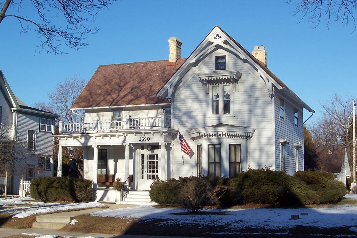
Bay View is a neighborhood in Milwaukee, Wisconsin, United States, North America on the shores of Lake Michigan, south of the downtown area and north of the City of St. Francis. Bay View existed as an independent village for eight years, from 1879 to 1887.
The first permanent European settlement of the Bay View area was in 1834. Horace Chase, future Milwaukee mayor, is credited as the first permanent settler. By the following year, he had been joined by Dr. Enoch Chase, Joel Wilcox, Alexander Stewart, and Elijah Estes. The Chases staked claims around the mouth of the Milwaukee River expecting growth there, but in the 1850s the harbor outlet was moved to the north, and the city of Milwaukee developed around it.
In 1855, the Green Bay, Milwaukee and Chicago Rail Road established its first Milwaukee-area depot in Bay View. The community was named for its scenic views upon the lake.
In 1868, the Milwaukee Iron Company, led by Eber Brock Ward, opened a steel rolling mill south of the original outlet of the Milwaukee River. The primary aim was to produce rails for railroads. The factory itself occupied 27.5 acres and the surrounding 76.5 acres were for employees. On some the Iron Company built tenements for workers; others were sold to workers on easy terms. Bay View was established as a company town. A Methodist Episcopal church and a Welsh Congregational church were already established in 1868. Saloons were prevented by a provision in the deeds of sale. By 1879, Bay View had a population of 2,592, and incorporated as a village, on approx 1.4 sq mi (3.6 km2; 360 ha) of land.
Labor Unions began in Bay View in 1868 when puddlers at the mill formed a Sons of Vulcan local. By 1886, Bay View had become a center of workers' rights activism, the culmination of which was the Bay View Massacre. Through ups and downs the mill evolved to produce a wide assortment of steel products, acquiring the name Illinois Steel Company before it shut down in 1929.
In 1887, the village's approximately 4,000 residents voted overwhelmingly to be annexed to the city of Milwaukee, becoming the city's 17th ward and ending the community's independent status. Bay View was annexed because of the "Fernwood Model", where the neighborhood received many incentives from the city of Milwaukee such as sewers, sidewalks, street lights, and other public necessities. The residents of Bay View viewed the annexation of Milwaukee as a way to improve their lives and community. Thenceforth, the village has been a Milwaukee neighborhood.
Although the neighborhood boundaries of Bay View have grown over the years as more and more people identify with it, the specific boundaries given by the Milwaukee Neighborhood Identification Project are: along the border of Lake Michigan; south of Jones Island; from Lincoln Avenue to the north; and Howell Avenue to the west, south to Morgan Avenue. Many residents consider both Fernwood and portions of Tippecanoe neighborhoods to be parts of Bay View. Some sources list the southern boundary as Howard Avenue. The Bay View Historical Society includes the areas as far west as 6th Street, and north to Becher Street, although they admit that this is debated:
One thing most Bay Viewites will agree upon is that Bay View is not necessarily defined by precise boundaries; it is more a state of mind influenced by both Lake Michigan ("the lake") and a long history of a strong sense of community.
Hub AI
Bay View, Milwaukee AI simulator
(@Bay View, Milwaukee_simulator)
Bay View, Milwaukee
Bay View is a neighborhood in Milwaukee, Wisconsin, United States, North America on the shores of Lake Michigan, south of the downtown area and north of the City of St. Francis. Bay View existed as an independent village for eight years, from 1879 to 1887.
The first permanent European settlement of the Bay View area was in 1834. Horace Chase, future Milwaukee mayor, is credited as the first permanent settler. By the following year, he had been joined by Dr. Enoch Chase, Joel Wilcox, Alexander Stewart, and Elijah Estes. The Chases staked claims around the mouth of the Milwaukee River expecting growth there, but in the 1850s the harbor outlet was moved to the north, and the city of Milwaukee developed around it.
In 1855, the Green Bay, Milwaukee and Chicago Rail Road established its first Milwaukee-area depot in Bay View. The community was named for its scenic views upon the lake.
In 1868, the Milwaukee Iron Company, led by Eber Brock Ward, opened a steel rolling mill south of the original outlet of the Milwaukee River. The primary aim was to produce rails for railroads. The factory itself occupied 27.5 acres and the surrounding 76.5 acres were for employees. On some the Iron Company built tenements for workers; others were sold to workers on easy terms. Bay View was established as a company town. A Methodist Episcopal church and a Welsh Congregational church were already established in 1868. Saloons were prevented by a provision in the deeds of sale. By 1879, Bay View had a population of 2,592, and incorporated as a village, on approx 1.4 sq mi (3.6 km2; 360 ha) of land.
Labor Unions began in Bay View in 1868 when puddlers at the mill formed a Sons of Vulcan local. By 1886, Bay View had become a center of workers' rights activism, the culmination of which was the Bay View Massacre. Through ups and downs the mill evolved to produce a wide assortment of steel products, acquiring the name Illinois Steel Company before it shut down in 1929.
In 1887, the village's approximately 4,000 residents voted overwhelmingly to be annexed to the city of Milwaukee, becoming the city's 17th ward and ending the community's independent status. Bay View was annexed because of the "Fernwood Model", where the neighborhood received many incentives from the city of Milwaukee such as sewers, sidewalks, street lights, and other public necessities. The residents of Bay View viewed the annexation of Milwaukee as a way to improve their lives and community. Thenceforth, the village has been a Milwaukee neighborhood.
Although the neighborhood boundaries of Bay View have grown over the years as more and more people identify with it, the specific boundaries given by the Milwaukee Neighborhood Identification Project are: along the border of Lake Michigan; south of Jones Island; from Lincoln Avenue to the north; and Howell Avenue to the west, south to Morgan Avenue. Many residents consider both Fernwood and portions of Tippecanoe neighborhoods to be parts of Bay View. Some sources list the southern boundary as Howard Avenue. The Bay View Historical Society includes the areas as far west as 6th Street, and north to Becher Street, although they admit that this is debated:
One thing most Bay Viewites will agree upon is that Bay View is not necessarily defined by precise boundaries; it is more a state of mind influenced by both Lake Michigan ("the lake") and a long history of a strong sense of community.