



Community hub
Recent from talks
Knowledge base stats:
Talk channels stats:
Members stats:
Auja al-Hafir
Auja al-Hafir (Arabic: عوجة الحفير, also Auja) was an ancient road junction close to water wells in the western Negev and eastern Sinai. It was the traditional grazing land of the 'Azazme tribe. The border crossing between Egypt and Ottoman/British Palestine, about 60 km (37 mi) south of Gaza, was situated there. Today it is the site of Nitzana and the Ktzi'ot prison in the Southern District of Israel.
Other sources name the locality el-Audja, 'Uja al-Hafeer, El Auja el Hafir and variations thereof.
A‘waj means "bent" in Arabic, and "Al-Auja" is a common name for meandering streams (the Yarkon River in Israel and a smaller stream near Jericho on the West Bank both are called Al-Auja in Arabic).
"Hafir" means a water reservoir built to catch runoff water at the base of a slope; in Sudan it can also mean a drainage ditch.
Pottery remains found in the area date back to the 2nd century BC. and are associated with the traces of massive foundations of an unknown building probably of Nabataean construction. The area appears to have remained under the Nabatean sphere of influence, outside the Hasmonaean and Herodian Kingdoms, until AD 105 when Trajan annexed the Nabataean Kingdom. A large rectangular hill-top fort probably dates from the 4th century AD. A church and associated buildings have been dated as having been built before AD 464. Auja al-Hafir was struck by the great plague which swept the Eastern Mediterranean around AD 541. During the 1930s a large number of papyri, dating from the 6th and 7th century, were found. One of them is from the local Arab governor granting Christian inhabitants freedom of worship on payment of the appropriate tax. After AD 700 the town appears to have lost its settled population, possibly due to changing rainfall patterns.
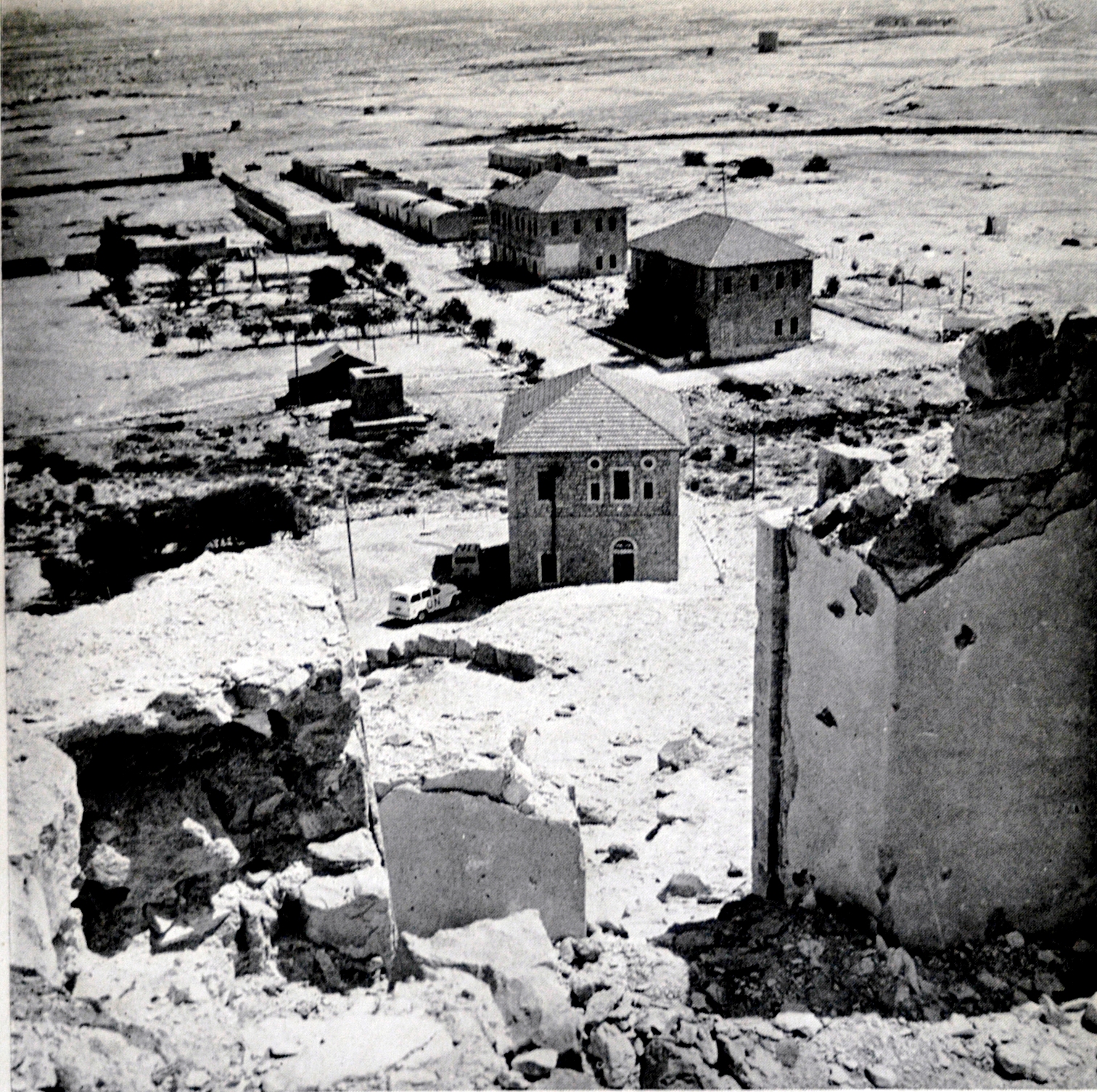
'Auja al-Hafir lay in a tract of 604 dunams privately owned by the Turkish sultan Abdul Hamid II. After the establishment of Beersheba as the main regional center, the governor of Jerusalem Ekram Bey planned for a new city at al-Hafir, 10km to the west of 'Auja, but decided to establish it instead at 'Auja and give it the combined name of 'Auja al-Hafir. A new Kaza was established there. A barracks, inn and a government office were built, and a police station was raised in 1902. From 1905 to 1915 the Ottoman authorities built a railroad, as well as a large administrative centre complete with an apartment building for the clerks.
However, the town didn't develop until it became an outpost on the Egyptian front during World War I. In mid-January, 1915, a Turkish Army force of 20,000 entered Sinai by way of El-Auja on an unsuccessful expedition against the Suez Canal. At this time most of the dressed stone was taken from the ancient buildings for building work in Gaza.
The central route across the desert to the Suez Canal crossed from El Auja to Ismailia, until 1948 this was the only paved road between Palestine and Egypt.
Hub AI
Auja al-Hafir AI simulator
(@Auja al-Hafir_simulator)
Auja al-Hafir
Auja al-Hafir (Arabic: عوجة الحفير, also Auja) was an ancient road junction close to water wells in the western Negev and eastern Sinai. It was the traditional grazing land of the 'Azazme tribe. The border crossing between Egypt and Ottoman/British Palestine, about 60 km (37 mi) south of Gaza, was situated there. Today it is the site of Nitzana and the Ktzi'ot prison in the Southern District of Israel.
Other sources name the locality el-Audja, 'Uja al-Hafeer, El Auja el Hafir and variations thereof.
A‘waj means "bent" in Arabic, and "Al-Auja" is a common name for meandering streams (the Yarkon River in Israel and a smaller stream near Jericho on the West Bank both are called Al-Auja in Arabic).
"Hafir" means a water reservoir built to catch runoff water at the base of a slope; in Sudan it can also mean a drainage ditch.
Pottery remains found in the area date back to the 2nd century BC. and are associated with the traces of massive foundations of an unknown building probably of Nabataean construction. The area appears to have remained under the Nabatean sphere of influence, outside the Hasmonaean and Herodian Kingdoms, until AD 105 when Trajan annexed the Nabataean Kingdom. A large rectangular hill-top fort probably dates from the 4th century AD. A church and associated buildings have been dated as having been built before AD 464. Auja al-Hafir was struck by the great plague which swept the Eastern Mediterranean around AD 541. During the 1930s a large number of papyri, dating from the 6th and 7th century, were found. One of them is from the local Arab governor granting Christian inhabitants freedom of worship on payment of the appropriate tax. After AD 700 the town appears to have lost its settled population, possibly due to changing rainfall patterns.
'Auja al-Hafir lay in a tract of 604 dunams privately owned by the Turkish sultan Abdul Hamid II. After the establishment of Beersheba as the main regional center, the governor of Jerusalem Ekram Bey planned for a new city at al-Hafir, 10km to the west of 'Auja, but decided to establish it instead at 'Auja and give it the combined name of 'Auja al-Hafir. A new Kaza was established there. A barracks, inn and a government office were built, and a police station was raised in 1902. From 1905 to 1915 the Ottoman authorities built a railroad, as well as a large administrative centre complete with an apartment building for the clerks.
However, the town didn't develop until it became an outpost on the Egyptian front during World War I. In mid-January, 1915, a Turkish Army force of 20,000 entered Sinai by way of El-Auja on an unsuccessful expedition against the Suez Canal. At this time most of the dressed stone was taken from the ancient buildings for building work in Gaza.
The central route across the desert to the Suez Canal crossed from El Auja to Ismailia, until 1948 this was the only paved road between Palestine and Egypt.