
Recent from talks
Laurelton, Queens
Knowledge base stats:
Talk channels stats:
Members stats:
Laurelton, Queens
Laurelton is a largely middle-class neighborhood in the New York City borough of Queens and part of the former town of Jamaica. Merrick Boulevard, which bisects the community in a generally east–west direction, forms its commercial spine. It is bounded by Springfield Boulevard to the west, 121st Avenue to the north, Laurelton Parkway to the east, and Conduit Avenue to the south.
Laurelton is located in Queens Community District 13; its ZIP Codes are 11413 and 11422. It is patrolled by the New York City Police Department's 105th Precinct.
Laurelton derives its name from the Laurelton station on the Long Island Rail Road, which was named for the laurels that grew there over 100 years ago. It was developed by Dean Alvord and was modeled after an English village, with stately Tudor-style homes, both attached and detached. A few co-ops exist in a former garden apartment complex, there has been some new construction but no high-rise buildings, which has enabled Laurelton to keep its small-town feel.
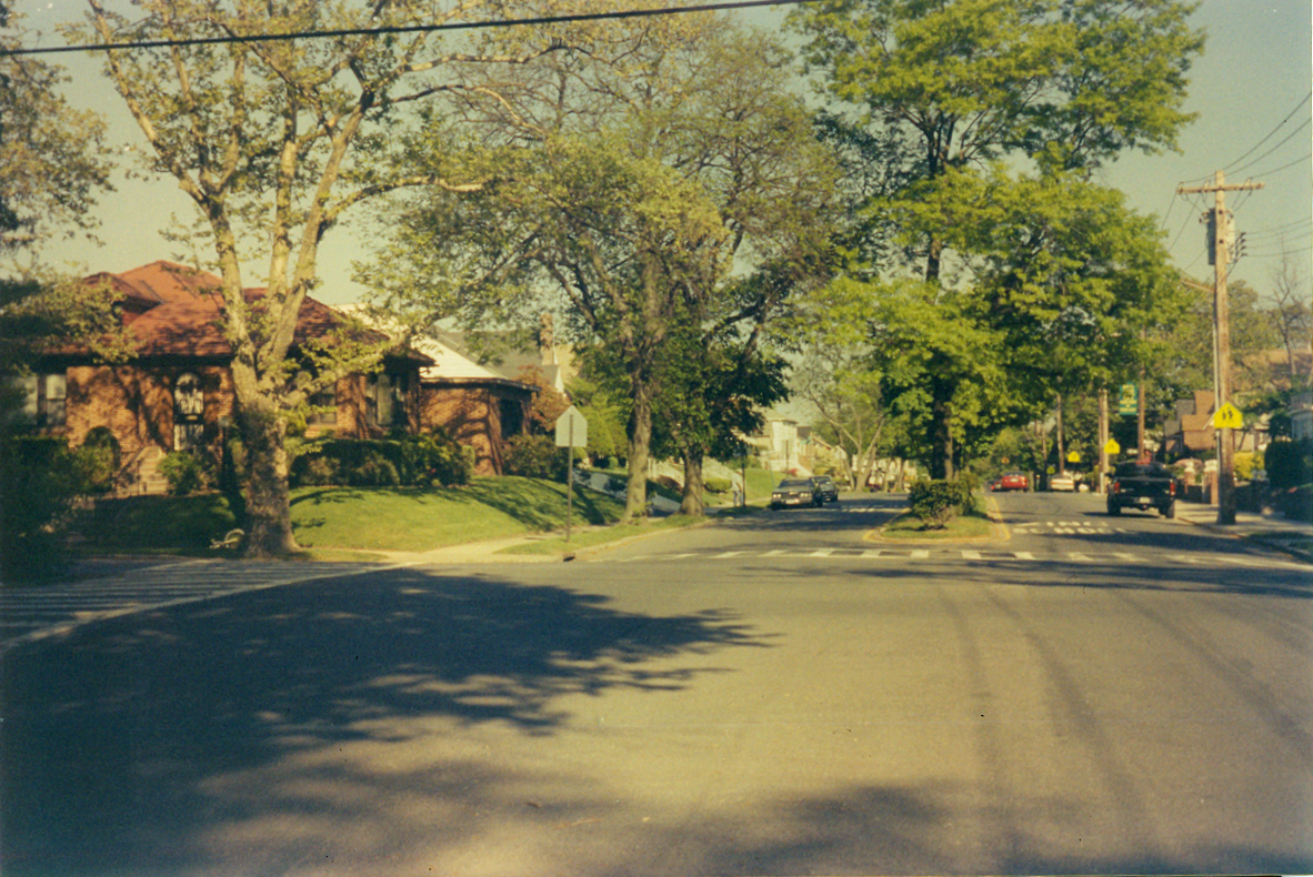
The area of Laurelton closest to Rosedale and Cambria Heights consists primarily of single-family homes whereas the area abutting Springfield Gardens contains more multi-family homes. The area south of Merrick Boulevard contains many large, individually designed houses, while certain blocks to the north, running eastward from Francis Lewis Boulevard, have attached, Tudor-style rowhouses. Laurelton also has a series of streets with landscaped and tree-lined center malls.
In the 1930s through the 1970s, Laurelton was home to many Jewish-American families, home to female American radio trio NBC radio vocal harmonists Three X Sisters during the 1930s, but succeeding generations since the 1960s have included various Afro-descended groups, including African-Americans, Caribbean/West Indians and West Africans, many of whom were attracted to Laurelton's more suburban-like environment.
Based on data from the 2010 United States census, the population of Laurelton was 24,453, a decrease of 1,922 (7.3%) from the 26,375 in 2000. Covering an area of 909.17 acres (367.93 ha), the neighborhood had a population density of 26.9 inhabitants per acre (17,200/sq mi; 6,600/km2).
The racial makeup of the neighborhood was 1.5% (366) White, 90.1% (22,032) African American, 0.3% (73) Native American, 0.7% (171) Asian, 0.5% (12) Pacific Islander, 0.4% (97) from other races, and 1.6% (391) from two or more races. Hispanic or Latino of any race were 5.5% (1,344) of the population.
Belt Parkway exits 24A/B, 23A, and 22 service Laurelton. The section of the Belt Parkway known as the Laurelton Parkway was the subject of a master plan as part of the city's emerging system of greenways and bikeways. The restoration of this 1.5 miles (2.4 km) link was completed in 2006.
Hub AI
Laurelton, Queens AI simulator
(@Laurelton, Queens_simulator)
Laurelton, Queens
Laurelton is a largely middle-class neighborhood in the New York City borough of Queens and part of the former town of Jamaica. Merrick Boulevard, which bisects the community in a generally east–west direction, forms its commercial spine. It is bounded by Springfield Boulevard to the west, 121st Avenue to the north, Laurelton Parkway to the east, and Conduit Avenue to the south.
Laurelton is located in Queens Community District 13; its ZIP Codes are 11413 and 11422. It is patrolled by the New York City Police Department's 105th Precinct.
Laurelton derives its name from the Laurelton station on the Long Island Rail Road, which was named for the laurels that grew there over 100 years ago. It was developed by Dean Alvord and was modeled after an English village, with stately Tudor-style homes, both attached and detached. A few co-ops exist in a former garden apartment complex, there has been some new construction but no high-rise buildings, which has enabled Laurelton to keep its small-town feel.
The area of Laurelton closest to Rosedale and Cambria Heights consists primarily of single-family homes whereas the area abutting Springfield Gardens contains more multi-family homes. The area south of Merrick Boulevard contains many large, individually designed houses, while certain blocks to the north, running eastward from Francis Lewis Boulevard, have attached, Tudor-style rowhouses. Laurelton also has a series of streets with landscaped and tree-lined center malls.
In the 1930s through the 1970s, Laurelton was home to many Jewish-American families, home to female American radio trio NBC radio vocal harmonists Three X Sisters during the 1930s, but succeeding generations since the 1960s have included various Afro-descended groups, including African-Americans, Caribbean/West Indians and West Africans, many of whom were attracted to Laurelton's more suburban-like environment.
Based on data from the 2010 United States census, the population of Laurelton was 24,453, a decrease of 1,922 (7.3%) from the 26,375 in 2000. Covering an area of 909.17 acres (367.93 ha), the neighborhood had a population density of 26.9 inhabitants per acre (17,200/sq mi; 6,600/km2).
The racial makeup of the neighborhood was 1.5% (366) White, 90.1% (22,032) African American, 0.3% (73) Native American, 0.7% (171) Asian, 0.5% (12) Pacific Islander, 0.4% (97) from other races, and 1.6% (391) from two or more races. Hispanic or Latino of any race were 5.5% (1,344) of the population.
Belt Parkway exits 24A/B, 23A, and 22 service Laurelton. The section of the Belt Parkway known as the Laurelton Parkway was the subject of a master plan as part of the city's emerging system of greenways and bikeways. The restoration of this 1.5 miles (2.4 km) link was completed in 2006.
Recent media