
Recent from talks
Lindsay, Ontario
Knowledge base stats:
Talk channels stats:
Members stats:
Lindsay, Ontario
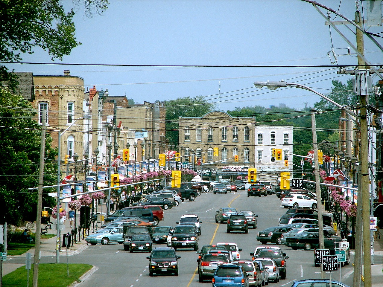
Lindsay is a community of 22,367 people (2021 census) on the Scugog River in the Kawartha Lakes region of south-eastern Ontario, Canada. It is approximately 43 km (27 mi) west of Peterborough. It is located in the City of Kawartha Lakes, and is the hub for business and commerce in the region.
The Township of Ops was surveyed in 1825 by Colonel Duncan McDonell, and Lots 20 and 21 in the 5th Concession were reserved for a town site. The same year settlers began to come to the region, and by 1827, the Purdys, an American family, built a dam on the Scugog River at the site of present-day Lindsay. The following year they built a sawmill, and in 1830, a grist mill was constructed.
A small village grew up around the mills, and it was known as Purdy's Mills. In 1834, surveyor John Huston plotted the designated town site into streets and lots. Local lore claims that during the survey, one of Huston's assistants, Mr. Lindsay, was accidentally shot in the leg and died of an infection. He was buried on the riverbank and his name and death were recorded on the surveyor's plan. The name Lindsay remained as the name of the town by government approval. Lindsay grew steadily and developed into a lumbering and farming centre.
With the arrival of the Port Hope Railway in 1857, the town saw a period of rapid development and industrial growth. On June 19 of the same year, Lindsay was formally incorporated as a town. In 1861, a fire swept through the town and most of Lindsay was destroyed with hundreds of people left homeless. It took many years for Lindsay to recover from this disaster. In the late 19th century, local photographers Fowler & Oliver worked out of the Sunbeam Photo Gallery. It was also the home to Sir Samuel Hughes, the Canadian Minister of Militia during the First World War. The Victoria Street Armouries were built during this time.
On January 1, 2001, the Town of Lindsay was officially dissolved and merged with Victoria County into the new City of Kawartha Lakes.
The first railway to arrive in Lindsay was the Port Hope, Lindsay & Beaverton Railway (PHL&B), originally chartered in 1846 as the Peterborough & Port Hope Railway. The first train arrived at the St. Paul and King Streets station (Lindsay's first) on the east side of the Scugog River on October 16, 1857. In 1871 it continued on over the Scugog River across a swing-bridge, gained height on the west bank, and then headed west out to Beaverton. It was renamed the Port Hope Railway in 1869.
Lindsay's second railway began as the Fenelon Falls Railway in 1871, changing its name to the Lindsay, Fenelon Falls & Ottawa River Valley Railway, and then to the Victoria Railway. It reached and terminated at Haliburton in 1878. At its Lindsay end, it connected with the original Midland Railway route on William Street North at "Victoria Junction" in 1875, and its original Lindsay terminus was at the PHL&B/Midland station at St. Paul and King Streets. In 1877, it applied to the Town of Lindsay to extend its railway down Victoria Avenue to Glenelg Street to connect with the WPP&L (see below), where a brick station (Lindsay's second) was built on Victoria Ave between Glenelg and Melbourne Streets to serve the two railways as a union station.
Lindsay's third railway was the Port Whitby & Port Perry Railway, extended from Port Perry to Lindsay in 1876, reaching Albert Street, Lindsay on June 15, 1877 as the Whitby, Port Perry & Lindsay Railway (WPP&L).
Hub AI
Lindsay, Ontario AI simulator
(@Lindsay, Ontario_simulator)
Lindsay, Ontario
Lindsay is a community of 22,367 people (2021 census) on the Scugog River in the Kawartha Lakes region of south-eastern Ontario, Canada. It is approximately 43 km (27 mi) west of Peterborough. It is located in the City of Kawartha Lakes, and is the hub for business and commerce in the region.
The Township of Ops was surveyed in 1825 by Colonel Duncan McDonell, and Lots 20 and 21 in the 5th Concession were reserved for a town site. The same year settlers began to come to the region, and by 1827, the Purdys, an American family, built a dam on the Scugog River at the site of present-day Lindsay. The following year they built a sawmill, and in 1830, a grist mill was constructed.
A small village grew up around the mills, and it was known as Purdy's Mills. In 1834, surveyor John Huston plotted the designated town site into streets and lots. Local lore claims that during the survey, one of Huston's assistants, Mr. Lindsay, was accidentally shot in the leg and died of an infection. He was buried on the riverbank and his name and death were recorded on the surveyor's plan. The name Lindsay remained as the name of the town by government approval. Lindsay grew steadily and developed into a lumbering and farming centre.
With the arrival of the Port Hope Railway in 1857, the town saw a period of rapid development and industrial growth. On June 19 of the same year, Lindsay was formally incorporated as a town. In 1861, a fire swept through the town and most of Lindsay was destroyed with hundreds of people left homeless. It took many years for Lindsay to recover from this disaster. In the late 19th century, local photographers Fowler & Oliver worked out of the Sunbeam Photo Gallery. It was also the home to Sir Samuel Hughes, the Canadian Minister of Militia during the First World War. The Victoria Street Armouries were built during this time.
On January 1, 2001, the Town of Lindsay was officially dissolved and merged with Victoria County into the new City of Kawartha Lakes.
The first railway to arrive in Lindsay was the Port Hope, Lindsay & Beaverton Railway (PHL&B), originally chartered in 1846 as the Peterborough & Port Hope Railway. The first train arrived at the St. Paul and King Streets station (Lindsay's first) on the east side of the Scugog River on October 16, 1857. In 1871 it continued on over the Scugog River across a swing-bridge, gained height on the west bank, and then headed west out to Beaverton. It was renamed the Port Hope Railway in 1869.
Lindsay's second railway began as the Fenelon Falls Railway in 1871, changing its name to the Lindsay, Fenelon Falls & Ottawa River Valley Railway, and then to the Victoria Railway. It reached and terminated at Haliburton in 1878. At its Lindsay end, it connected with the original Midland Railway route on William Street North at "Victoria Junction" in 1875, and its original Lindsay terminus was at the PHL&B/Midland station at St. Paul and King Streets. In 1877, it applied to the Town of Lindsay to extend its railway down Victoria Avenue to Glenelg Street to connect with the WPP&L (see below), where a brick station (Lindsay's second) was built on Victoria Ave between Glenelg and Melbourne Streets to serve the two railways as a union station.
Lindsay's third railway was the Port Whitby & Port Perry Railway, extended from Port Perry to Lindsay in 1876, reaching Albert Street, Lindsay on June 15, 1877 as the Whitby, Port Perry & Lindsay Railway (WPP&L).
Recent media