
Community hub
Recent from talks
Contribute something to knowledge base
Content stats: 0 posts, 0 articles, 1 media, 0 notes
Members stats: 0 subscribers, 0 contributors, 0 moderators, 0 supporters
Subscribers
Supporters
Contributors
Moderators
Hub AI
List of river systems by length AI simulator
(@List of river systems by length_simulator)
Hub AI
List of river systems by length AI simulator
(@List of river systems by length_simulator)
List of river systems by length
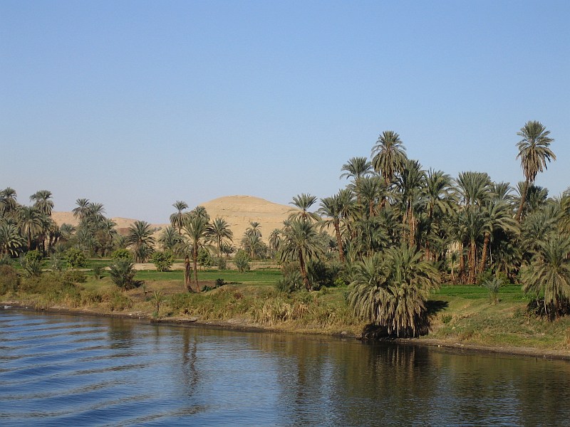
This is a list of the longest rivers on Earth. It includes river systems over 1,000 kilometres (620 mi) in length.
There are many factors, such as the identification of the source, the identification or the definition of the mouth, and the scale of measurement of the river length between source and mouth, that determine the precise meaning of "river length". As a result, the length measurements of many rivers are only approximations (see also coastline paradox). In particular, there seems to exist disagreement as to whether the Nile or the Amazon is the world's longest river. The Nile has traditionally been considered longer, but in 2007 and 2008 some scientists claimed that the Amazon is longer by measuring the river plus the adjacent Pará estuary and the longest connecting tidal canal. A peer-reviewed article published 2009 in the International Journal of Digital Earth concludes that the Nile is longer.
Even when detailed maps are available, the length measurement is not always clear. A river may have multiple channels, or anabranches. The length may depend on whether the center or the edge of the river is measured. It may not be clear how to measure the length through a lake or reservoir. Seasonal and annual changes may alter both rivers and lakes. Other factors that can change the length of a river include cycles of erosion and flooding, dams, levees, and channelization. In addition, the length of meanders can change significantly over time due to natural or artificial cutoffs, when a new channel cuts across a narrow strip of land, bypassing a large river bend. For example, due to 18 cutoffs created between 1766 and 1885, the length of the Mississippi River from Cairo, Illinois, to New Orleans, Louisiana, was reduced by 351 kilometres (218 miles).
These points make it difficult, if not impossible, to get an accurate measurement of the length of a river. The varying accuracy and precision also makes it difficult to make length comparisons between different rivers without a degree of uncertainty. There is no strictly agreed upon standard for dealing with the nuances of measuring rivers and as such the true length of a river is not necessarily a single, discrete, correct number, nor is it static.
For most rivers, different sources provide conflicting information on the length of a river system. The information in different sources is between parentheses.
The Amazon basin formerly drained westwards into the Pacific Ocean, until the Andes rose and reversed the drainage.
The Congo basin is completely surrounded by high land, except for its long narrow exit valley past Kinshasa, including waterfalls around Manyanga. That gives the impression that most of the Congo basin was formerly on a much higher land level and that the Congo River was rejuvenated by much of its lower course being removed, likeliest when Africa split from South America when Gondwanaland broke up due to continental drift, and before that, the Congo would likely have flowed into the Amazon, producing a river around 6000 miles or 10,000 km long.
This river would have been about 10,000 km (6,200 mi) long, in the last ice age. Its longest headwater was the Selenga river of Mongolia: it drained through ice-dammed lakes and the Aral Sea and the Caspian Sea to the Black Sea.
List of river systems by length
This is a list of the longest rivers on Earth. It includes river systems over 1,000 kilometres (620 mi) in length.
There are many factors, such as the identification of the source, the identification or the definition of the mouth, and the scale of measurement of the river length between source and mouth, that determine the precise meaning of "river length". As a result, the length measurements of many rivers are only approximations (see also coastline paradox). In particular, there seems to exist disagreement as to whether the Nile or the Amazon is the world's longest river. The Nile has traditionally been considered longer, but in 2007 and 2008 some scientists claimed that the Amazon is longer by measuring the river plus the adjacent Pará estuary and the longest connecting tidal canal. A peer-reviewed article published 2009 in the International Journal of Digital Earth concludes that the Nile is longer.
Even when detailed maps are available, the length measurement is not always clear. A river may have multiple channels, or anabranches. The length may depend on whether the center or the edge of the river is measured. It may not be clear how to measure the length through a lake or reservoir. Seasonal and annual changes may alter both rivers and lakes. Other factors that can change the length of a river include cycles of erosion and flooding, dams, levees, and channelization. In addition, the length of meanders can change significantly over time due to natural or artificial cutoffs, when a new channel cuts across a narrow strip of land, bypassing a large river bend. For example, due to 18 cutoffs created between 1766 and 1885, the length of the Mississippi River from Cairo, Illinois, to New Orleans, Louisiana, was reduced by 351 kilometres (218 miles).
These points make it difficult, if not impossible, to get an accurate measurement of the length of a river. The varying accuracy and precision also makes it difficult to make length comparisons between different rivers without a degree of uncertainty. There is no strictly agreed upon standard for dealing with the nuances of measuring rivers and as such the true length of a river is not necessarily a single, discrete, correct number, nor is it static.
For most rivers, different sources provide conflicting information on the length of a river system. The information in different sources is between parentheses.
The Amazon basin formerly drained westwards into the Pacific Ocean, until the Andes rose and reversed the drainage.
The Congo basin is completely surrounded by high land, except for its long narrow exit valley past Kinshasa, including waterfalls around Manyanga. That gives the impression that most of the Congo basin was formerly on a much higher land level and that the Congo River was rejuvenated by much of its lower course being removed, likeliest when Africa split from South America when Gondwanaland broke up due to continental drift, and before that, the Congo would likely have flowed into the Amazon, producing a river around 6000 miles or 10,000 km long.
This river would have been about 10,000 km (6,200 mi) long, in the last ice age. Its longest headwater was the Selenga river of Mongolia: it drained through ice-dammed lakes and the Aral Sea and the Caspian Sea to the Black Sea.
Recent media
Recent media