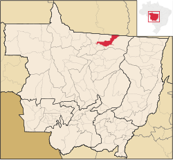
Matupá is a municipality in the state of Mato Grosso in the Central-West Region of Brazil.[2][3][4][5]
The city is served by Orlando Villas-Bôas Regional Airport.
| Climate data for Matupá (1991–2020) | |||||||||||||
|---|---|---|---|---|---|---|---|---|---|---|---|---|---|
| Month | Jan | Feb | Mar | Apr | May | Jun | Jul | Aug | Sep | Oct | Nov | Dec | Year |
| Mean daily maximum °C (°F) | 31.2 (88.2) |
31.2 (88.2) |
31.4 (88.5) |
32.0 (89.6) |
32.5 (90.5) |
33.2 (91.8) |
34.3 (93.7) |
35.8 (96.4) |
35.1 (95.2) |
33.5 (92.3) |
32.3 (90.1) |
31.4 (88.5) |
32.8 (91.0) |
| Daily mean °C (°F) | 25.0 (77.0) |
24.9 (76.8) |
25.1 (77.2) |
25.5 (77.9) |
25.4 (77.7) |
24.7 (76.5) |
24.6 (76.3) |
26.0 (78.8) |
26.5 (79.7) |
26.0 (78.8) |
25.7 (78.3) |
25.2 (77.4) |
25.4 (77.7) |
| Mean daily minimum °C (°F) | 21.2 (70.2) |
21.1 (70.0) |
21.2 (70.2) |
21.1 (70.0) |
20.3 (68.5) |
18.1 (64.6) |
16.8 (62.2) |
18.0 (64.4) |
20.3 (68.5) |
21.3 (70.3) |
21.4 (70.5) |
21.3 (70.3) |
20.2 (68.4) |
| Average precipitation mm (inches) | 324.6 (12.78) |
308.0 (12.13) |
316.6 (12.46) |
164.1 (6.46) |
36.1 (1.42) |
6.6 (0.26) |
4.3 (0.17) |
15.4 (0.61) |
90.9 (3.58) |
179.5 (7.07) |
215.4 (8.48) |
338.8 (13.34) |
2,000.3 (78.75) |
| Average relative humidity (%) | 75.5 | 74.7 | 71.2 | 69.1 | 72.5 | 72.7 | 65.7 | 58.4 | 60.4 | 65.7 | 65.7 | 71.6 | 68.6 |
| Mean monthly sunshine hours | 142.3 | 114.0 | 127.6 | 165.6 | 229.8 | 279.0 | 291.7 | 230.8 | 152.9 | 184.4 | 154.3 | 136.9 | 2,209.3 |
| Source: Instituto Nacional de Meteorologia (precipiation 1981–2010)[6][7][8][9][10][11][12][13] | |||||||||||||
Capital: Cuiabá | |||||||||||||||||
| Centro-Sul Mato-Grossense |
|  | |||||||||||||||
| Nordeste Mato-Grossense |
| ||||||||||||||||
| Norte Mato-Grossense |
| ||||||||||||||||
| Sudeste Mato-Grossense |
| ||||||||||||||||
| Sudoeste Mato-Grossense |
| ||||||||||||||||
10°03′25″S 54°55′58″W / 10.05694°S 54.93278°W
This Mato Grosso, Brazil location article is a stub. You can help Wikipedia by expanding it. |