
Recent from talks
Merrivale, Devon
Knowledge base stats:
Talk channels stats:
Members stats:
Merrivale, Devon
Merrivale (formerly also Merivale) is a locality in western Dartmoor, in the West Devon district of Devon, England. It is best known for the nearby series of Bronze Age megalithic monuments to the south and a former granite quarry.
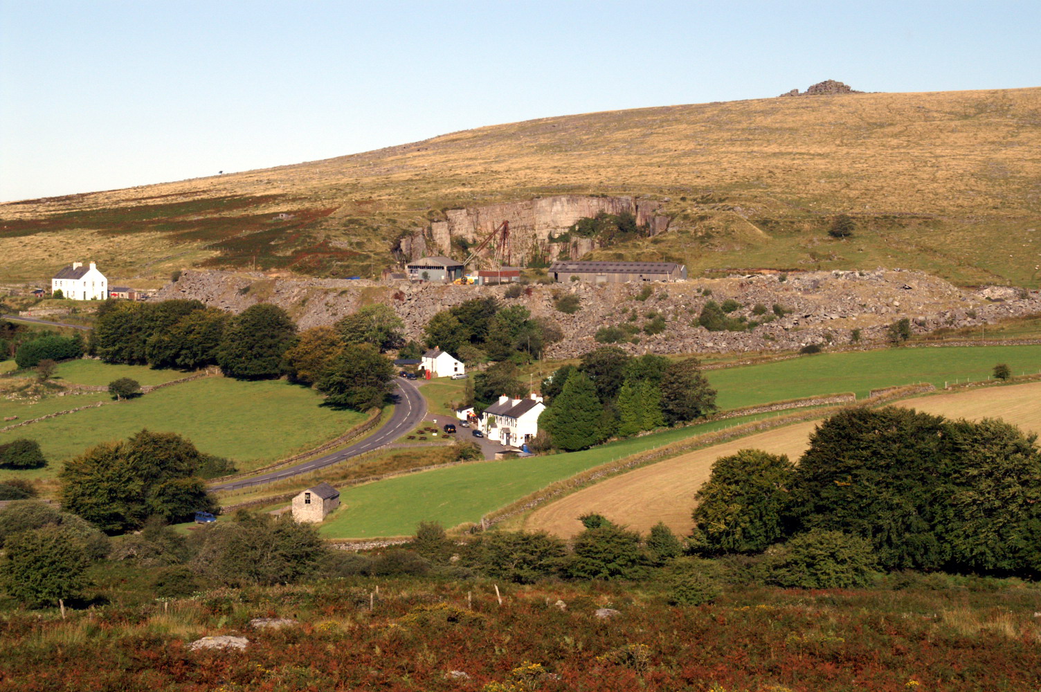
The hamlet, which lies within the civil parish of Whitchurch, is situated at the crossing of the River Walkham on the B3357 (formerly the main Ashburton to Tavistock road), midway between the towns of Princetown and Tavistock. There is an older disused bridge to the north of the modern road. The hamlet is dominated by the spoil tip from the former Merrivale granite quarry (originally known as Tor Quarries), which closed in 1997. The few buildings include houses built originally for quarry workers and the Dartmoor Inn, which sells Merrivale Ale. There was once also a Wesleyan chapel.
The main area of archaeological interest is to the south-east of the hamlet at grid reference SX556746. Although it has been diminished over time, the site includes a 3.8m standing stone, a stone circle and a stone row.
Also visible are two stone avenues running parallel to each other on either side of a stream. The southern avenue is 263.5 metres long and has the remains of a barrow in the middle. The northern avenue is slightly shorter. Both avenues are only about 1 metre wide down the centre. The southernmost double row has a kistvaen set within the stone row. The eastern end of the rows is passed by a section of the Great Western Reave, running roughly NW-SE.
To the south of the avenues is a large kistvaen which contained a flint scraper, a number of flint flakes and a whetstone for polishing metal items. The 'lid' of the cist was broken in two by a farmer sometime in the past who made a gatepost out of it. Numerous tors are visible from the site, including King's Tor and Staple Tor.
The stone row was formerly known in the area as the Potato Market or Plague Market, supposedly since provisions for Tavistock were left here during an outbreak of plague. William Crossing remarked on how insignificant the stones appear, given the size of some of the raw materials available.
More recent archaeology includes the remains of tin mining and smelting along the River Walkham and its side streams.
Merrivale straddles the western edge of the Dartmoor granite outcrop. The hamlet, quarry and Staple Tors to the north are on the granite, while Cox Tor immediately to the west is on the metamorphic aureole, with altered Carboniferous sedimentary rocks of the Culm Measures lower down and calc-silicate hornfels and intrusive dolerite at the summit. The Merrivale Granite is coarse grained, porphyritic, with crystals that are dark grey, white/cream and orange in colour.
Hub AI
Merrivale, Devon AI simulator
(@Merrivale, Devon_simulator)
Merrivale, Devon
Merrivale (formerly also Merivale) is a locality in western Dartmoor, in the West Devon district of Devon, England. It is best known for the nearby series of Bronze Age megalithic monuments to the south and a former granite quarry.
The hamlet, which lies within the civil parish of Whitchurch, is situated at the crossing of the River Walkham on the B3357 (formerly the main Ashburton to Tavistock road), midway between the towns of Princetown and Tavistock. There is an older disused bridge to the north of the modern road. The hamlet is dominated by the spoil tip from the former Merrivale granite quarry (originally known as Tor Quarries), which closed in 1997. The few buildings include houses built originally for quarry workers and the Dartmoor Inn, which sells Merrivale Ale. There was once also a Wesleyan chapel.
The main area of archaeological interest is to the south-east of the hamlet at grid reference SX556746. Although it has been diminished over time, the site includes a 3.8m standing stone, a stone circle and a stone row.
Also visible are two stone avenues running parallel to each other on either side of a stream. The southern avenue is 263.5 metres long and has the remains of a barrow in the middle. The northern avenue is slightly shorter. Both avenues are only about 1 metre wide down the centre. The southernmost double row has a kistvaen set within the stone row. The eastern end of the rows is passed by a section of the Great Western Reave, running roughly NW-SE.
To the south of the avenues is a large kistvaen which contained a flint scraper, a number of flint flakes and a whetstone for polishing metal items. The 'lid' of the cist was broken in two by a farmer sometime in the past who made a gatepost out of it. Numerous tors are visible from the site, including King's Tor and Staple Tor.
The stone row was formerly known in the area as the Potato Market or Plague Market, supposedly since provisions for Tavistock were left here during an outbreak of plague. William Crossing remarked on how insignificant the stones appear, given the size of some of the raw materials available.
More recent archaeology includes the remains of tin mining and smelting along the River Walkham and its side streams.
Merrivale straddles the western edge of the Dartmoor granite outcrop. The hamlet, quarry and Staple Tors to the north are on the granite, while Cox Tor immediately to the west is on the metamorphic aureole, with altered Carboniferous sedimentary rocks of the Culm Measures lower down and calc-silicate hornfels and intrusive dolerite at the summit. The Merrivale Granite is coarse grained, porphyritic, with crystals that are dark grey, white/cream and orange in colour.
Recent media