This article relies largely or entirely on a single source. (July 2017) |
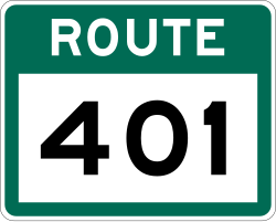
 Route 401 | ||||
|---|---|---|---|---|
| Howley Road | ||||
| Route information | ||||
| Maintained by Newfoundland and Labrador Department of Transportation and Infrastructure | ||||
| Length | 13 km (8.1 mi) | |||
| Major junctions | ||||
| South end | End of asphalt pavement in Howley | |||
| North end | ||||
| Location | ||||
| Country | Canada | |||
| Province | Newfoundland and Labrador | |||
| Highway system | ||||
|
| ||||
| ||||
Route 401, also known as Howley Road, is a 13-kilometre-long (8.1 mi) minor highway in the western region of Newfoundland in the Canadian province of Newfoundland and Labrador. The highway begins at a junction with the Trans-Canada Highway (Route 1)[1] and continues to its southern terminus, the community of Howley. There are no other major intersections or communities along the entire length of Route 401. As with most highways in Newfoundland and Labrador, Route 401 is a two-lane highway in its entirety. Route 401 in NL is one of just a couple highways in Newfoundland that now have a kilometer-marker signs, installed by the local community sandy Lake fire department to help locating fires and accidents.
| Location | km | mi | Destinations | Notes | |
|---|---|---|---|---|---|
| | 0.0 | 0.0 | Northern terminus | ||
| Howley | 13 | 8.1 | End of provincial maintenance | Southern terminus; road continues as a gravel road | |
| 1.000 mi = 1.609 km; 1.000 km = 0.621 mi | |||||
This Newfoundland and Labrador road, road transport or highway-related article is a stub. You can help Wikipedia by expanding it. |