Recent from talks
Par, Cornwall
Knowledge base stats:
Talk channels stats:
Members stats:
Par, Cornwall
Par (Cornish: Porth, meaning creek or harbour) is a village and fishing port with a harbour on the south coast of Cornwall, England, United Kingdom. The village is situated in the civil parish of Tywardreath and Par, although West Par and the docks lie in the parish of St Blaise.
Par is approximately 3.5 miles (5.6 km) east of St Austell. Par has a population of around 1,600 (in 2012).
It became developed in the second quarter of the 19th century when the harbour was developed, to serve copper mines and other mineral sites in and surrounding the Luxulyan Valley; china clay later became the dominant traffic as copper working declined, and the harbour and the china clay dries remain as distinctive features of the industrial heritage; however the mineral activity is much reduced.
Par Harbour and the beach at Par Sands are south of the village, and the latter includes a large static caravan holiday park; another small beach is at Spit Point west of the harbour. Between these two beaches the South West Coast Path takes an inland diversion through the village.
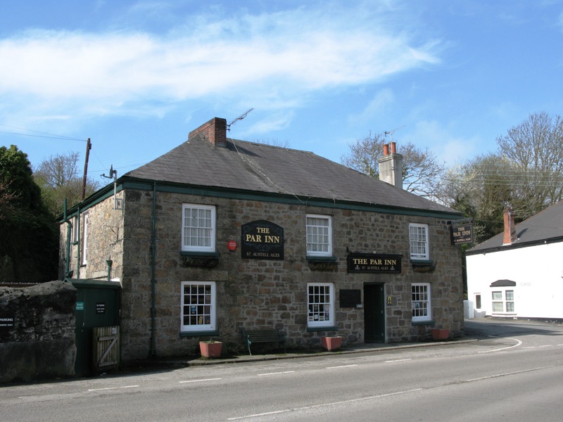
Par lies in a triangle of streets which form a one-way traffic system. There is a variety of shops, a post office, a public house and other businesses.
The Anglican church of St Mary the Virgin at Biscovey was completed in 1849. It was built mainly from the local reddish coloured Biscovey slates. The parish of Par was formed out of parts of St Blazey and Tywardreath parishes in 1846. In the churchyard is an inscribed cross shaft removed from the highroad in 1896. This stone is a sepulchral monument to a son of Ullicus erected by Alroron. The church was the first to be designed by the notable architect G. E. Street. The design is an original and subtle adaptation of the Early English style. The chancel, nave and south aisle are well proportioned and the steeple is placed at the west end of the south aisle. The church is a Grade II* listed building. The Church of the Good Shepherd at Par Green was designed by E. H. Sedding and built of granite with Polyphant stone dressings in 1896. It is in the Early English style; the sanctuary was embellished by Stephen Dykes Bower in 1948.
Before 1800 the village was a small group of houses below the cliff overlooking the mouth of the River Par; the river was crossed by a ferry. During the first years of the nineteenth century small scale workings of china stone, china clay, copper and granite were developed.
Joseph Austen, born 1782, was an important Fowey businessman; he later changed his name to Joseph Treffry, and as that name is much better known it is used here. He acquired an interest on many mines and pits, and he re-opened the dormant Lanescot copper mine on the hill overlooking Par, and developed it further. With adjacent workings it became the rich and highly productive Fowey Consols mine. Treffry sought to build a tramway connection to Fowey Harbour from his workings, but was unable to acquire the necessary land, and instead he decided to develop a harbour at Par. He purchased the ferry and replaced it with a bridge in 1824, and started improvement of the harbour in 1829; it was completed in 1840.
Hub AI
Par, Cornwall AI simulator
(@Par, Cornwall_simulator)
Par, Cornwall
Par (Cornish: Porth, meaning creek or harbour) is a village and fishing port with a harbour on the south coast of Cornwall, England, United Kingdom. The village is situated in the civil parish of Tywardreath and Par, although West Par and the docks lie in the parish of St Blaise.
Par is approximately 3.5 miles (5.6 km) east of St Austell. Par has a population of around 1,600 (in 2012).
It became developed in the second quarter of the 19th century when the harbour was developed, to serve copper mines and other mineral sites in and surrounding the Luxulyan Valley; china clay later became the dominant traffic as copper working declined, and the harbour and the china clay dries remain as distinctive features of the industrial heritage; however the mineral activity is much reduced.
Par Harbour and the beach at Par Sands are south of the village, and the latter includes a large static caravan holiday park; another small beach is at Spit Point west of the harbour. Between these two beaches the South West Coast Path takes an inland diversion through the village.
Par lies in a triangle of streets which form a one-way traffic system. There is a variety of shops, a post office, a public house and other businesses.
The Anglican church of St Mary the Virgin at Biscovey was completed in 1849. It was built mainly from the local reddish coloured Biscovey slates. The parish of Par was formed out of parts of St Blazey and Tywardreath parishes in 1846. In the churchyard is an inscribed cross shaft removed from the highroad in 1896. This stone is a sepulchral monument to a son of Ullicus erected by Alroron. The church was the first to be designed by the notable architect G. E. Street. The design is an original and subtle adaptation of the Early English style. The chancel, nave and south aisle are well proportioned and the steeple is placed at the west end of the south aisle. The church is a Grade II* listed building. The Church of the Good Shepherd at Par Green was designed by E. H. Sedding and built of granite with Polyphant stone dressings in 1896. It is in the Early English style; the sanctuary was embellished by Stephen Dykes Bower in 1948.
Before 1800 the village was a small group of houses below the cliff overlooking the mouth of the River Par; the river was crossed by a ferry. During the first years of the nineteenth century small scale workings of china stone, china clay, copper and granite were developed.
Joseph Austen, born 1782, was an important Fowey businessman; he later changed his name to Joseph Treffry, and as that name is much better known it is used here. He acquired an interest on many mines and pits, and he re-opened the dormant Lanescot copper mine on the hill overlooking Par, and developed it further. With adjacent workings it became the rich and highly productive Fowey Consols mine. Treffry sought to build a tramway connection to Fowey Harbour from his workings, but was unable to acquire the necessary land, and instead he decided to develop a harbour at Par. He purchased the ferry and replaced it with a bridge in 1824, and started improvement of the harbour in 1829; it was completed in 1840.
Recent media