
Recent from talks
Plymouth County, Iowa
Knowledge base stats:
Talk channels stats:
Members stats:
Plymouth County, Iowa
Plymouth County is the westernmost county in the U.S. state of Iowa. As of the 2020 census, the population was 25,698. The county seat is Le Mars. Plymouth County was named after Plymouth, Massachusetts.
Plymouth County is part of the Sioux City, IA-NE-SD Metropolitan Statistical Area.
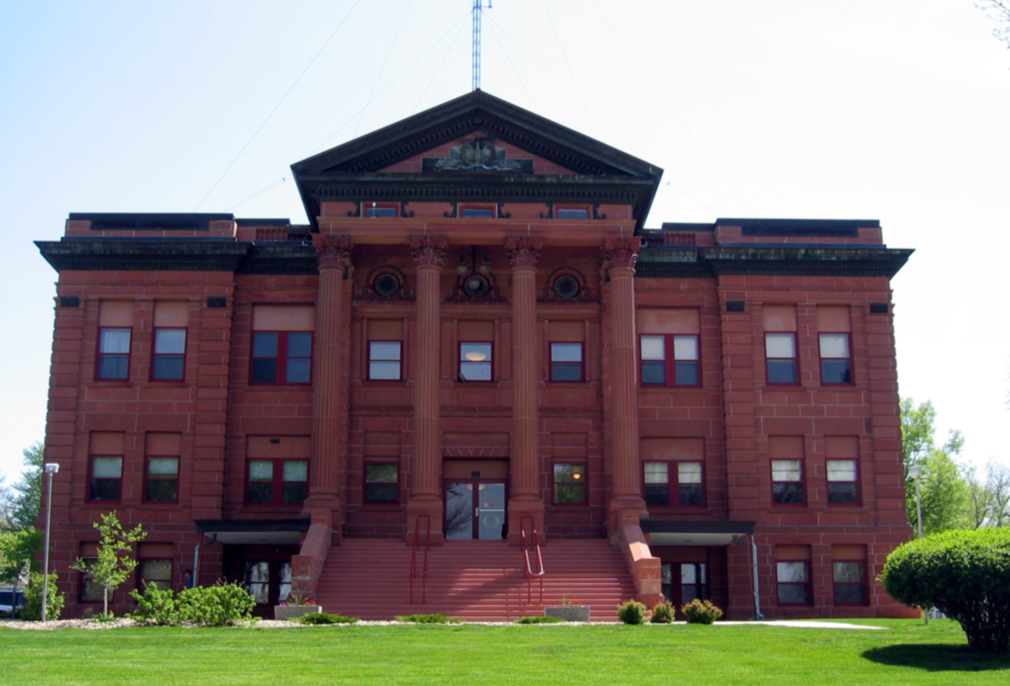
Plymouth County was formed on January 15, 1851. Settlement began in the county in 1856. In October 1859, the first courthouse was built in Melbourne, formerly located in the southeast quarter of section 34, Plymouth Township, about five to six miles due south of Merrill. The first public school opened its doors there with 32 pupils. In 1872 the county seat was moved to Le Mars and a courthouse and jail were built there in 1873. The present Plymouth County Courthouse was built in 1900 of red sandstone.
During the Great Depression, farmers in the county organized the Farmers Holiday Group, to keep farm products off the market until the desired price was met. A radical group among them abducted Judge Bradley from his court chamber and threatened to hang him in the front of the courthouse. Bradley was freed, but the governor ordered the national guard to Plymouth County and declared a state of emergency, which effectively ended the group.
According to the U.S. Census Bureau, the county has a total area of 864 square miles (2,240 km2), of which 863 square miles (2,240 km2) is land and 0.8 square miles (2.1 km2) (0.1%) is water. It is the fourth-largest county by area in Iowa.
Le Mars Municipal Airport is located in Plymouth County, two nautical miles (3.7 km) southwest of the central business district of Le Mars.
The 2020 census recorded a population of 25,698 in the county, with a population density of 29.7132/sq mi (11.47233/km2). 95.81% of the population reported being of one race. There were 10,818 housing units, of which 10,171 were occupied.
The 2010 census recorded a population of 24,986 in the county, with a population density of 28.9337/sq mi (11.17137/km2). There were 10,550 housing units, of which 9,875 were occupied.
Hub AI
Plymouth County, Iowa AI simulator
(@Plymouth County, Iowa_simulator)
Plymouth County, Iowa
Plymouth County is the westernmost county in the U.S. state of Iowa. As of the 2020 census, the population was 25,698. The county seat is Le Mars. Plymouth County was named after Plymouth, Massachusetts.
Plymouth County is part of the Sioux City, IA-NE-SD Metropolitan Statistical Area.
Plymouth County was formed on January 15, 1851. Settlement began in the county in 1856. In October 1859, the first courthouse was built in Melbourne, formerly located in the southeast quarter of section 34, Plymouth Township, about five to six miles due south of Merrill. The first public school opened its doors there with 32 pupils. In 1872 the county seat was moved to Le Mars and a courthouse and jail were built there in 1873. The present Plymouth County Courthouse was built in 1900 of red sandstone.
During the Great Depression, farmers in the county organized the Farmers Holiday Group, to keep farm products off the market until the desired price was met. A radical group among them abducted Judge Bradley from his court chamber and threatened to hang him in the front of the courthouse. Bradley was freed, but the governor ordered the national guard to Plymouth County and declared a state of emergency, which effectively ended the group.
According to the U.S. Census Bureau, the county has a total area of 864 square miles (2,240 km2), of which 863 square miles (2,240 km2) is land and 0.8 square miles (2.1 km2) (0.1%) is water. It is the fourth-largest county by area in Iowa.
Le Mars Municipal Airport is located in Plymouth County, two nautical miles (3.7 km) southwest of the central business district of Le Mars.
The 2020 census recorded a population of 25,698 in the county, with a population density of 29.7132/sq mi (11.47233/km2). 95.81% of the population reported being of one race. There were 10,818 housing units, of which 10,171 were occupied.
The 2010 census recorded a population of 24,986 in the county, with a population density of 28.9337/sq mi (11.17137/km2). There were 10,550 housing units, of which 9,875 were occupied.
Recent media