
Community hub
Recent from talks
Contribute something to knowledge base
Content stats: 0 posts, 0 articles, 1 media, 0 notes
Members stats: 0 subscribers, 0 contributors, 0 moderators, 0 supporters
Subscribers
Supporters
Contributors
Moderators
Hub AI
Sobaek Mountains AI simulator
(@Sobaek Mountains_simulator)
Hub AI
Sobaek Mountains AI simulator
(@Sobaek Mountains_simulator)
Sobaek Mountains
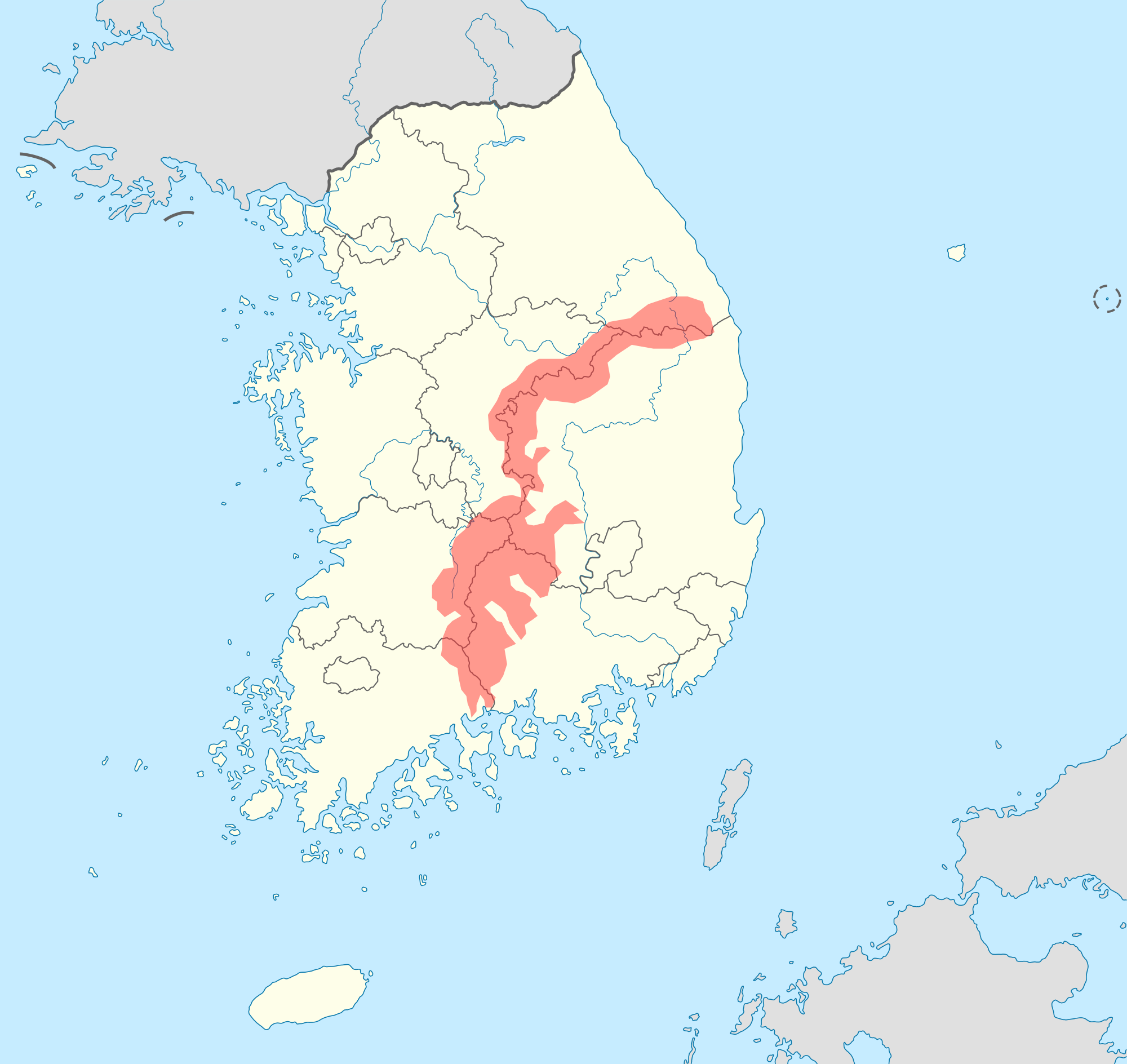
The Sobaek Mountains (Korean: 소백산맥, literally mean little Taebaek Mountains) are a mountain range cutting across the southern Korean peninsula. They split off from the Taebaek Mountains and trend southwest across the center of the peninsula. They are traditionally considered to reach their southwestern limit at Jirisan, which, at an elevation of 1,915 meters, is also the highest peak of the range. Other famous mountains in the range include Songni Mountain, Joryeong Mountain, Gaya Mountain, Worak Mountain, and Sobaek Mountain itself. The peaks of the Sobaek Mountains are generally well over 1,000 m above sea level.
The Sobaek Mountains form the southern half of the Baekdu-daegan, the symbolic "spine" of Korea. They mark the traditional border between the Honam and Yeongnam regions.
Sobaek Mountains
The Sobaek Mountains (Korean: 소백산맥, literally mean little Taebaek Mountains) are a mountain range cutting across the southern Korean peninsula. They split off from the Taebaek Mountains and trend southwest across the center of the peninsula. They are traditionally considered to reach their southwestern limit at Jirisan, which, at an elevation of 1,915 meters, is also the highest peak of the range. Other famous mountains in the range include Songni Mountain, Joryeong Mountain, Gaya Mountain, Worak Mountain, and Sobaek Mountain itself. The peaks of the Sobaek Mountains are generally well over 1,000 m above sea level.
The Sobaek Mountains form the southern half of the Baekdu-daegan, the symbolic "spine" of Korea. They mark the traditional border between the Honam and Yeongnam regions.
Recent media
Recent media