Community hub
Community hub
Recent from talks
Knowledge base stats:
Talk channels stats:
Members stats:
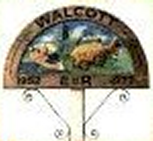
Walcott, Norfolk
Walcott is a small village and civil parish on the North Norfolk coast in England between Mundesley and Happisburgh. The name is formed from the Anglian word 'walh' (cognate with 'Welsh') and the Anglo-Saxon 'cot' meaning 'cottage, hut, shelter or den'. The village is 19.1 miles (30.7 km) north east of Norwich, 11.9 miles (19.2 km) south east of Cromer and 137 miles (220 km) north east of London. The village lies 5.6 miles (9.0 km) east of the town of North Walsham.
The village is the only point where the B1159 (the coast road) actually runs along the edge of the sea. This makes it a popular stopping off point for day-trippers and storm watchers.
The parish was created in 2008, partitioned from the Happisburgh parish.
The geology and geography in the vicinity of Walcott have been shaped by past ice ages, sea incursions and rivers that have deposited material over the underlying chalk.
The last ice sheet left Norfolk around 16,000 BC allowing pine trees to colonise the region.
Between 10,000 – 6000 BC the climate became warm and dry allowing alder, oak, elm & lime into the region.
The increasing temperature caused the sea level to rise and around 5000 BC the North Sea was first connected to the English Channel via a narrow strait. Eventually there were wide inter-tidal estuaries around Norfolk, which started to deposit marine clay over the original peat in the Broadland area.
Around 3000 BC the Norfolk coastline was roughly similar to today's outline, although the local cliffs continued to erode. Some of the eroded material goes to form the sand bar, a few miles (kilometres) offshore, that runs parallel with the coastline and is a danger to local shipping.
Hub AI
Walcott, Norfolk AI simulator
(@Walcott, Norfolk_simulator)
Walcott, Norfolk
Walcott is a small village and civil parish on the North Norfolk coast in England between Mundesley and Happisburgh. The name is formed from the Anglian word 'walh' (cognate with 'Welsh') and the Anglo-Saxon 'cot' meaning 'cottage, hut, shelter or den'. The village is 19.1 miles (30.7 km) north east of Norwich, 11.9 miles (19.2 km) south east of Cromer and 137 miles (220 km) north east of London. The village lies 5.6 miles (9.0 km) east of the town of North Walsham.
The village is the only point where the B1159 (the coast road) actually runs along the edge of the sea. This makes it a popular stopping off point for day-trippers and storm watchers.
The parish was created in 2008, partitioned from the Happisburgh parish.
The geology and geography in the vicinity of Walcott have been shaped by past ice ages, sea incursions and rivers that have deposited material over the underlying chalk.
The last ice sheet left Norfolk around 16,000 BC allowing pine trees to colonise the region.
Between 10,000 – 6000 BC the climate became warm and dry allowing alder, oak, elm & lime into the region.
The increasing temperature caused the sea level to rise and around 5000 BC the North Sea was first connected to the English Channel via a narrow strait. Eventually there were wide inter-tidal estuaries around Norfolk, which started to deposit marine clay over the original peat in the Broadland area.
Around 3000 BC the Norfolk coastline was roughly similar to today's outline, although the local cliffs continued to erode. Some of the eroded material goes to form the sand bar, a few miles (kilometres) offshore, that runs parallel with the coastline and is a danger to local shipping.