Main page


Community Hub0 subscribers
Community Hub
Westerlo
View on Wikipediafrom Wikipedia
 | This article needs additional citations for verification. (May 2022) |
Westerlo (Dutch pronunciation: [ˈʋɛstərloː]) is a municipality located in the Belgian province of Antwerp. The municipality comprises seven towns:
Key Information


- Westerlo centrum
- Oevel
- Tongerlo
- Heultje
- Voortkapel
- Oosterwijk
- Zoerle-Parwijs
In 2021, Westerlo had a total population of 25,288.[2] The total area is 55.13 km2.
Places of interest
[edit]- Castle of Westerlo has been in the possession of the House of Merode uninterruptedly since the late 15th century. It has served as the most important country estate of the senior branch since the 16th century. In 1910-12 Countess Jeanne de Merode built a new neogothic castle for herself which serves as the town hall of Westerlo since the 1970s.
- Tongerlo Abbey contains a very old and fine copy of Leonardo da Vinci's The Last Supper. It is also known as home of the Tongerlo Abbey beer, but this is no longer brewed at the abbey.
Gallery
[edit]-
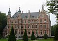 Westerlo, town hall
 -
 Westerlo, church
 -
 Tongerlo, church
 -
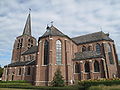 Oevel, church
 -
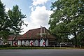 Hof van Overwijs


See also
[edit]References
[edit]- ^ "Wettelijke Bevolking per gemeente op 1 januari 2018". Statbel. Retrieved 9 March 2019.
- ^ "Bevolking per statistische sector - Sector 11035B". Statistics Belgium. Retrieved 11 May 2022.
External links
[edit] Media related to Westerlo at Wikimedia Commons
- Official website (in Dutch)


| International | |
|---|---|
| National | |
| Geographic | |
| Other | |

 | This Antwerp Province location article is a stub. You can help Wikipedia by expanding it. |
Westerlo
View on Grokipediafrom Grokipedia
History
Early settlement and medieval origins
Archaeological evidence from sites within Westerlo, such as Zoerle-Parwijs, reveals prehistoric human activity, including Bronze Age pits containing charred grain, pottery fragments, and charcoal indicative of early agricultural practices in the sandy Campine soils.[5] These findings suggest sporadic settlement attempts predating more sustained occupation, though the region's poor drainage and forested nature limited density until later periods.[5] From the 6th to 10th centuries, the area featured a relatively open landscape with small settlement clusters on fertile pockets amid heaths and woods, reflecting early medieval subsistence patterns.[6] Systematic development accelerated in the 12th century with the establishment of villages like Westerlo centrum and Tongerlo, tied to monastic initiatives for land clearance and farming. Tongerlo Abbey, founded in 1130 by Giselbert of Kasterlee through donation of local lands to Premonstratensian canons from the Antwerp priory of St. Michael, became central to this transformation.[7] The Norbertines drove reclamation of heathlands and forests, creating tenant farms and expanding arable land, which underpinned the economic and demographic growth of surrounding hamlets.[8] This patronage not only fostered agriculture, including sheep rearing, but also established religious institutions that shaped medieval social structures in Westerlo.[9]Municipal formation and 20th-century developments
In the wake of Belgium's independence from the United Kingdom of the Netherlands in 1830, Westerlo emerged as an independent rural municipality within Antwerp province, retaining its agrarian character while the nation pursued industrialization primarily in Wallonia and urban Flanders.[10] Local administration followed the centralized model inherited from the French era, with Westerlo functioning as a separate commune focused on farming amid sandy Campine soils that delayed mechanized shifts seen elsewhere.[11] The 20th century marked key administrative consolidations to address fragmented governance. On January 1, 1971, Westerlo merged with the neighboring communes of Tongerlo and Zoerle-Parwijs, integrating rural parishes and abbey lands to form a unified entity better suited for regional coordination.[12] This was followed by the national municipal fusion law, effective January 1, 1977, which incorporated Oevel—a locality with emerging light industry—into Westerlo, reducing Belgium's communes from 2,359 to 596 overall and creating the present municipality spanning 55.12 square kilometers with seven deelgemeenten: Westerlo centrum, Oevel, Tongerlo, Zoerle-Parwijs, Bonheiden, Ongend, and Ramsdonk.[13][14] These mergers, driven by federal policy to enhance efficiency and economies of scale, centralized services like archiving—preserving records from pre-fusion entities since 1795—without significant boundary disputes in Westerlo's case.[15] Post-World War II recovery influenced local developments, aligning with Belgium's rapid reconstruction through infrastructure investments that improved road networks and utilities in the Kempen area, supporting a gradual transition from subsistence agriculture to diversified activities in Oevel's industrial zones.[16] By mid-century, these changes bolstered administrative capacity, evident in expanded municipal facilities, though Westerlo retained a predominantly rural profile compared to urbanized peers.[17]Geography
Location and administrative divisions
Westerlo lies in the Antwerp province of the Flemish Region in northern Belgium, at coordinates approximately 51°05′N 04°55′E. The municipality is positioned roughly 44 kilometers southeast of Antwerp by road and 35 kilometers east of Mechelen, placing it within the Campine (Kempen) area amid sandy soils and mixed landscapes.[18][19] It connects to regional transport networks primarily via the N152 provincial road, which provides access from the E313 motorway exit at Olen-Herentals, facilitating links to nearby urban centers without a local railway station.[20] Administratively, Westerlo functions as a single municipality encompassing seven distinct villages or deeltgemeenten—Heultje, Oevel, Oosterwijk, Tongerlo, Voortkapel, Westerlo, and Zoerle-Parwijs—whose boundaries derive from cadastral records and municipal fusions primarily in 1971 (incorporating Tongerlo and Zoerle-Parwijs) and 1977 (adding Oevel).[21] These divisions reflect historical parish and former communal territories overlaid on the modern administrative unit, with Westerlo serving as the central hub for governance and services. The total municipal area spans about 55 square kilometers, delineated by precise GIS boundaries maintained by Flemish authorities for planning and electoral purposes.[22]Topography and natural features
Westerlo occupies a portion of the Campine (Kempen) region in northeastern Belgium, featuring predominantly flat to gently rolling terrain typical of the area's Pleistocene cover sands. Elevations range from about 10 to 20 meters above sea level, with minimal relief that supports straightforward drainage across the landscape.[23][24] The underlying geology consists of Cenozoic deposits overlain by sandy Pleistocene sediments, forming an open, low-relief basin environment.[25] The soils are chiefly sandy and gravelly, derived from fluvial and aeolian processes in the Campine Basin, which facilitate rapid infiltration and limit water retention compared to clay-rich lowlands elsewhere in Flanders.[25][26] Hydrology is characterized by small brooks and ditches that convey surface runoff toward the Grote Nete river system, with forested pockets and heath remnants providing localized natural cover amid otherwise agricultural expanses; wetlands are scarce due to historical drainage and the permeable substrate.[27][28]Demographics
Population statistics and trends
As of 31 December 2024, the municipality of Westerlo recorded a population of 25,682 inhabitants.[21] Covering an area of 55.13 km², this equates to a population density of approximately 466 inhabitants per square kilometer, marking an increase from the 415 per km² recorded in 2006.[21] [2] The population has exhibited consistent growth over the past four decades, rising from 19,560 in 1981 to 25,682 in 2024—a cumulative increase of about 31%.[21] This trend accelerated post-1990s, with a 24% rise from 20,727 in 1991 to 2024 levels, reflecting suburban expansion and commuter inflows toward nearby urban centers like Antwerp and Turnhout.[21] Recent annual increments have moderated, with gains of 157 from 2022 to 2023 and 65 from 2023 to 2024, yielding an average growth rate of roughly 0.25% in the latest year.[21]| Year | Population (31 December) |
|---|---|
| 1981 | 19,560 |
| 1991 | 20,727 |
| 2001 | 22,201 |
| 2011 | 24,372 |
| 2020 | 25,290 |
| 2021 | 25,304 |
| 2022 | 25,460 |
| 2023 | 25,617 |
| 2024 | 25,682 |