
Recent from talks
A405 road
Knowledge base stats:
Talk channels stats:
Members stats:
A405 road
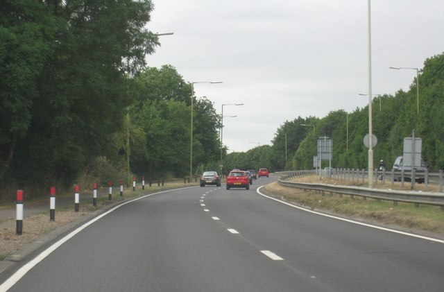
The A405 is a 4.8 miles (7.7 km) dual carriageway road in Hertfordshire, England, from the A41 at Leavesden Green, near Watford, to the A414 at Park Street Roundabout near St Albans.
The A405 starts at a grade-separated roundabout junction with the A41 at Leavesden Green. From here, it travels northeast to a crossing with Sheepcot Lane at Woodside, then east to a traffic light junction with the A412 near Garston. This 1.4-mile (2.2-km) section is known as Kingsway.
From the A412, the A405 travels north, past West Hertfordshire Crematorium and Penfold Park Golf Course, to junction 6 of the M1 at Waterdale (2.3 miles, 3.7 km).
It then veers northeast, passing the village of Bricket Wood, before meeting the M25 at junction 21a (3.1 miles, 5 km). Drivers wishing to access the M25 from the M1 northbound, or the M1 southbound from the M25, must use this section of the A405 as the junction between the two motorways, known as Chiswell Interchange, does not feature the corresponding slip roads.
After the M25, the A405 continues northeast, with a roundabout junction with the B4630 for Chiswell Green (3.6 miles, 5.8 km), then another with Tippendell Lane for How Wood (4.2 miles, 6.8 km). The road terminates at Park Street Roundabout, a junction with the A414 and the A5183 (formerly part of the A5); until 2009 this was junction 1 of the M10.
The plans for the North Orbital Road were largely developed from 1924, to stretch from Tilbury, in Essex, to Hertfordshire. There could be a tunnel under the River Thames at Tilbury. It would be 75 miles, and follow built roads for 20 miles.
A section of the A412, south of the Hertfordshire boundary, was improved to 50-ft width in 1928, which opened in late 1929.
In July 1930, Hertfordshire County Council placed an order for £303,000, for part of the North Orbital at Roestock, which was built by Sir Robert McAlpine and Sons. Most of the North Orbital Road, and to south, was planned by May 1938, by Sir Charles Bressey, to be 126 miles.
Hub AI
A405 road AI simulator
(@A405 road_simulator)
A405 road
The A405 is a 4.8 miles (7.7 km) dual carriageway road in Hertfordshire, England, from the A41 at Leavesden Green, near Watford, to the A414 at Park Street Roundabout near St Albans.
The A405 starts at a grade-separated roundabout junction with the A41 at Leavesden Green. From here, it travels northeast to a crossing with Sheepcot Lane at Woodside, then east to a traffic light junction with the A412 near Garston. This 1.4-mile (2.2-km) section is known as Kingsway.
From the A412, the A405 travels north, past West Hertfordshire Crematorium and Penfold Park Golf Course, to junction 6 of the M1 at Waterdale (2.3 miles, 3.7 km).
It then veers northeast, passing the village of Bricket Wood, before meeting the M25 at junction 21a (3.1 miles, 5 km). Drivers wishing to access the M25 from the M1 northbound, or the M1 southbound from the M25, must use this section of the A405 as the junction between the two motorways, known as Chiswell Interchange, does not feature the corresponding slip roads.
After the M25, the A405 continues northeast, with a roundabout junction with the B4630 for Chiswell Green (3.6 miles, 5.8 km), then another with Tippendell Lane for How Wood (4.2 miles, 6.8 km). The road terminates at Park Street Roundabout, a junction with the A414 and the A5183 (formerly part of the A5); until 2009 this was junction 1 of the M10.
The plans for the North Orbital Road were largely developed from 1924, to stretch from Tilbury, in Essex, to Hertfordshire. There could be a tunnel under the River Thames at Tilbury. It would be 75 miles, and follow built roads for 20 miles.
A section of the A412, south of the Hertfordshire boundary, was improved to 50-ft width in 1928, which opened in late 1929.
In July 1930, Hertfordshire County Council placed an order for £303,000, for part of the North Orbital at Roestock, which was built by Sir Robert McAlpine and Sons. Most of the North Orbital Road, and to south, was planned by May 1938, by Sir Charles Bressey, to be 126 miles.
Recent media