
Community hub
0 subscribers8 pages, 0 posts
Recent from talks
All channels
Be the first to start a discussion here.
Be the first to start a discussion here.
Be the first to start a discussion here.
Be the first to start a discussion here.
Contribute something
Welcome to the community hub built to collect knowledge and have discussions related to Ala-Archa.
Nothing was collected or created yet.
Ala-Archa
View on Wikipediafrom Wikipedia
| Ala-Archa | |
|---|---|
 | |
 | |
| Native name | Ала-Арча (Kyrgyz) |
| Location | |
| Country | Kyrgyzstan |
| Region | Chüy Region |
| District | Alamüdün District |
| City | Bishkek |
| Physical characteristics | |
| Mouth | Chu |
• coordinates | 43°03′44″N 74°38′18″E / 43.0623°N 74.6382°E |
| Length | 78 km (48 mi) |
| Basin size | 270 km2 (100 sq mi) |
| Basin features | |
| Progression | Chu→ Betpak-Dala desert |
| Tributaries | |
| • right | Kashka-Suu |
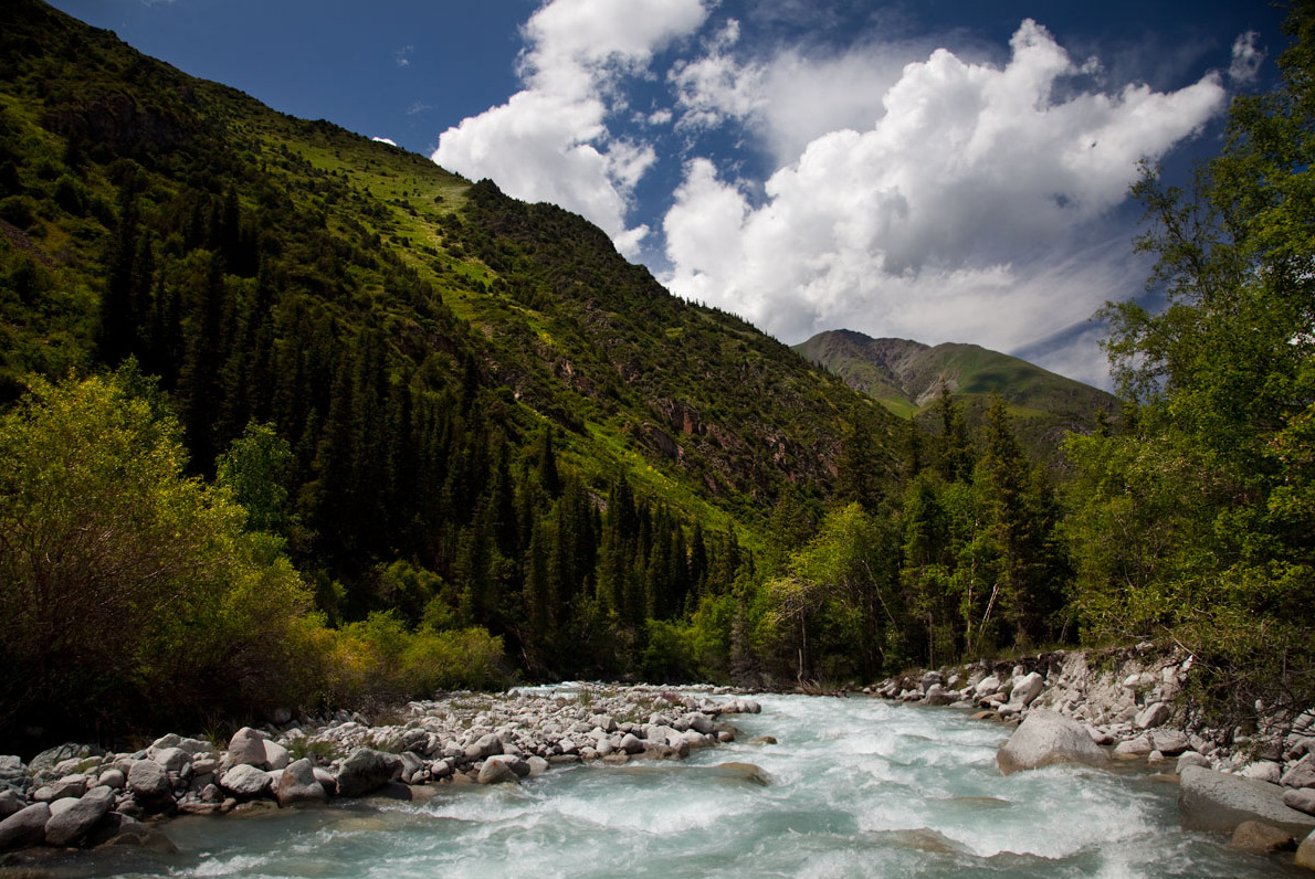
The Ala-Archa (Kyrgyz: Ала-Арча, also Аларча) is a river flowing through Alamüdün District of Chüy Region of Kyrgyzstan. It rises on the northern slopes of Kyrgyz Ala-Too and flows north to enter the river Chu in Chüy Valley. The Ala-Archa is 78 kilometres (48 mi) long and has a basin area of 270 square kilometres (100 sq mi).[1] Its water comes mostly from glaciers and snow.[2]
Course
[edit]The river runs through Ala Archa National Park and through Bishkek. Other settlements in the river basin are Kashka-Suu, Baytik, Orto-Say, Tash-Döbö and Mayevka.
References
[edit]- ^ "Аларча" [Alarcha] (PDF). Кыргызстандын Географиясы [Geography of Kyrgyzstan] (in Kyrgyz). Bishkek. 2004. p. 181.
{{cite encyclopedia}}: CS1 maint: location missing publisher (link) - ^ Чүй облусу:Энциклопедия [Encyclopedia of Chüy Oblast] (in Kyrgyz and Russian). Bishkek: Chief Editorial Board of Kyrgyz Encyclopedia. 1994. p. 718. ISBN 5-89750-083-5.