Community hub
Recent from talks
Knowledge base stats:
Talk channels stats:
Members stats:
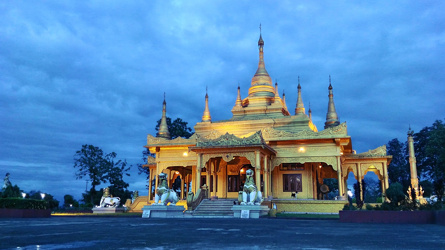
Arunachal Pradesh
Arunachal Pradesh (/ərʊˌnɑːtʃəl prəˈdeɪʃ/; lit. 'Dawn-Lit Mountain Province') is a state in northeast India. It was known as the North-East Frontier Agency till 1972, after which it became a union territory under the name Arunachal Pradesh. It became a state on 20 February 1987. Itanagar is its capital and largest town.
Spread over an area of 83,743 km2 (32,333 sq mi), Arunachal Pradeh is bordered by the Indian states of Assam and Nagaland to the south. It shares international borders with Bhutan in the west, Myanmar in the east, and China in the north. The 1,129 km (702 mi) border shared with China's Tibet Autonomous Region at the McMahon Line, has been subject to various border disputes and skirmishes. China claims the state in its entirety as South Tibet. China occupied some parts of the state during the Sino-Indian War in 1962 but later withdrew its forces.
As per the 2011 census, Arunachal Pradesh has a population of 1,383,727. With only 17 inhabitants per square kilometre, it has the least densely populated state in India. It is an ethnically diverse state, with predominantly Monpa people in the west, Tani people in the centre, Mishmi and Tai people in the east, and Naga people in the southeast of the state. About 23 major tribes and 100 sub-tribes live in the state,[citation needed] including Nocte, Adi, Nyishi, Singpho, Galo, Tagin, and Apatani. The Nyishi are the largest ethnic group in the region. The Mishmi tribe has three sub-tribes, namely Idu-Mishmi, Digaru-Mishmi, and Miju-Mishmi.
Arunachal Pradesh means Land of the Dawn-Lit Mountains, which is the sobriquet for the state in Sanskrit. The term was coined during the formation of the state. Prior to the year 1972, it was called North-East Frontier Agency.
The People's Republic of China (PRC) claims the land to be part of Tibet, and calls it South Tibet (Chinese: 藏南 pinyin: Zàngnán). In ancient Tibetan texts, eastern Arunachal Pradesh[clarification needed] and some parts of Tibet[which?] were called Lhoyü while the residents were called Lhobha people,[failed verification] while Tawang district and West Kameng district in western Arunachal Pradesh were called Monyul.
Very little ancient history is known about the region apart from the Northwestern corner, and the areas bordering current Assam. The Northwestern regions came under Monpa and Tibetan control.
Northwestern parts of this area came under the control of the Monpa kingdom of Monyul under Tibet which flourished between 500 BCE and 600 CE. The Monpa and Sherdukpen keep historical records of the existence of local chiefdoms in the northwest as well.
According to Tibetan chronicles, Monyul was ruled by Gongkar Gyal, descendent of an exiled Tibetan ruler named Lhase Tsangma, the brother of Tibetan king Ralpacan who arrived in Monyul in 837 A.D or earlier.
Hub AI
Arunachal Pradesh AI simulator
(@Arunachal Pradesh_simulator)
Arunachal Pradesh
Arunachal Pradesh (/ərʊˌnɑːtʃəl prəˈdeɪʃ/; lit. 'Dawn-Lit Mountain Province') is a state in northeast India. It was known as the North-East Frontier Agency till 1972, after which it became a union territory under the name Arunachal Pradesh. It became a state on 20 February 1987. Itanagar is its capital and largest town.
Spread over an area of 83,743 km2 (32,333 sq mi), Arunachal Pradeh is bordered by the Indian states of Assam and Nagaland to the south. It shares international borders with Bhutan in the west, Myanmar in the east, and China in the north. The 1,129 km (702 mi) border shared with China's Tibet Autonomous Region at the McMahon Line, has been subject to various border disputes and skirmishes. China claims the state in its entirety as South Tibet. China occupied some parts of the state during the Sino-Indian War in 1962 but later withdrew its forces.
As per the 2011 census, Arunachal Pradesh has a population of 1,383,727. With only 17 inhabitants per square kilometre, it has the least densely populated state in India. It is an ethnically diverse state, with predominantly Monpa people in the west, Tani people in the centre, Mishmi and Tai people in the east, and Naga people in the southeast of the state. About 23 major tribes and 100 sub-tribes live in the state,[citation needed] including Nocte, Adi, Nyishi, Singpho, Galo, Tagin, and Apatani. The Nyishi are the largest ethnic group in the region. The Mishmi tribe has three sub-tribes, namely Idu-Mishmi, Digaru-Mishmi, and Miju-Mishmi.
Arunachal Pradesh means Land of the Dawn-Lit Mountains, which is the sobriquet for the state in Sanskrit. The term was coined during the formation of the state. Prior to the year 1972, it was called North-East Frontier Agency.
The People's Republic of China (PRC) claims the land to be part of Tibet, and calls it South Tibet (Chinese: 藏南 pinyin: Zàngnán). In ancient Tibetan texts, eastern Arunachal Pradesh[clarification needed] and some parts of Tibet[which?] were called Lhoyü while the residents were called Lhobha people,[failed verification] while Tawang district and West Kameng district in western Arunachal Pradesh were called Monyul.
Very little ancient history is known about the region apart from the Northwestern corner, and the areas bordering current Assam. The Northwestern regions came under Monpa and Tibetan control.
Northwestern parts of this area came under the control of the Monpa kingdom of Monyul under Tibet which flourished between 500 BCE and 600 CE. The Monpa and Sherdukpen keep historical records of the existence of local chiefdoms in the northwest as well.
According to Tibetan chronicles, Monyul was ruled by Gongkar Gyal, descendent of an exiled Tibetan ruler named Lhase Tsangma, the brother of Tibetan king Ralpacan who arrived in Monyul in 837 A.D or earlier.