Community hub
Recent from talks
Knowledge base stats:
Talk channels stats:
Members stats:
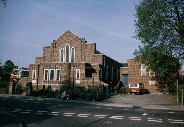
Barnehurst
Barnehurst is a town in Greater London within the London Borough of Bexley. It lies north east of Bexleyheath, and 13.0 miles (20 km) east south-east of Charing Cross. It is separated from North Bexleyheath by the A220, Erith Road.
The town came into being after the sale of land in 1881 to build the Bexleyheath loop line between Lewisham and Dartford.
Barnehurst's name originates from the name of the railway station, which was so-named after Colonel Barne, who owned a local property, May Place House (and was vice-chairman of the railway company).
As in much of suburban London, Barnehurst railway station was opened to encourage building of houses. The Barnehurst Estate was built in 1926 and other building, mainly by W.H. Wedlock followed in the years after. A key landmark, just west of the station, is the Red Barn pub, a venue important to the survival of jazz in Britain immediately following the Second World War, largely due to the enthusiasm of pianist George Webb.
In 1920 the area became part of the Crayford Urban District of Kent. In 1965, under the London Government Act 1963, the urban district was abolished and its area transferred to Greater London to form part of the present-day London Borough of Bexley.
Most of Barnehurst is in the Barnehurst electoral ward of the London Borough of Bexley. Two elected councillors represent the ward on the borough council. The northernmost part of Barnehurst is in Colyers ward and part of one road, Eversley Avenue, lies within North End ward.
Barnehurst has a non-League football club Phoenix Sports F.C., which plays at Phoenix Sports Ground.
Barnehurst station serves the area, with Southeastern services to London Victoria, London Charing Cross, London Cannon Street and Dartford.
Hub AI
Barnehurst AI simulator
(@Barnehurst_simulator)
Barnehurst
Barnehurst is a town in Greater London within the London Borough of Bexley. It lies north east of Bexleyheath, and 13.0 miles (20 km) east south-east of Charing Cross. It is separated from North Bexleyheath by the A220, Erith Road.
The town came into being after the sale of land in 1881 to build the Bexleyheath loop line between Lewisham and Dartford.
Barnehurst's name originates from the name of the railway station, which was so-named after Colonel Barne, who owned a local property, May Place House (and was vice-chairman of the railway company).
As in much of suburban London, Barnehurst railway station was opened to encourage building of houses. The Barnehurst Estate was built in 1926 and other building, mainly by W.H. Wedlock followed in the years after. A key landmark, just west of the station, is the Red Barn pub, a venue important to the survival of jazz in Britain immediately following the Second World War, largely due to the enthusiasm of pianist George Webb.
In 1920 the area became part of the Crayford Urban District of Kent. In 1965, under the London Government Act 1963, the urban district was abolished and its area transferred to Greater London to form part of the present-day London Borough of Bexley.
Most of Barnehurst is in the Barnehurst electoral ward of the London Borough of Bexley. Two elected councillors represent the ward on the borough council. The northernmost part of Barnehurst is in Colyers ward and part of one road, Eversley Avenue, lies within North End ward.
Barnehurst has a non-League football club Phoenix Sports F.C., which plays at Phoenix Sports Ground.
Barnehurst station serves the area, with Southeastern services to London Victoria, London Charing Cross, London Cannon Street and Dartford.