Recent from talks
Bavarian Alps
Knowledge base stats:
Talk channels stats:
Members stats:
Bavarian Alps
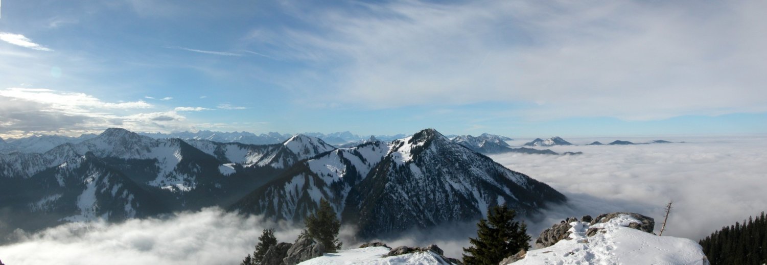
The Bavarian Alps (German: Bayerische Alpen, pronounced [ˈbaɪ(ə)ʁɪʃə ˈʔalpn̩]) is a collective name for several mountain ranges of the Northern Limestone Alps within the German state of Bavaria.
The term in its wider sense refers to that part of the Eastern Alps that lies on Bavarian state territory. However, it is traditionally understood that the Bavarian Alps are only those ranges between the rivers Lech and Saalach (Altbayern). In this narrower sense, the Allgäu Alps in Swabia, which have only been part of Bavaria in more recent times, and the Berchtesgaden Alps in the east are not considered part of the Bavarian Alps.
The term is frequently used, but does not correspond to the common classification of the Eastern Alps (AVE) developed by the German, Austrian and South Tyrol Alpine Clubs. It should not be confused with the term Bavarian Prealps either. The latter only covers the Bavarian section of the Prealps between the River Loisach in the west and the River Inn in the east.
According to the Italian Partizione Delle Alpi classification, the Bavarian Alps (Alpi Bavaresi) comprise the Allgäu and Lechtal Alps as well as the adjacent Achen Lake mountains.
A rising number of mega charcoal pieces dated to the Bronze Age suggests increased slash and burn activities, possibly linked to the creation of open space for pasturing. These results provide evidence of human interaction with the mountain environment, beginning in the Neolithic Age and clear evidence of mountain pasture use beginning during the Iron Age at 750 BC. Based on palynology and pedoanthracology it is, however, difficult to clearly differentiate between pasturing, hunting, and other human interactions with the environment.
The Bavarian Alps in their broader sense include the following parts of the mountain ranges listed − in this tabular overview sorted according to AVE roughly from west to east and with maximum heights above sea level (NN). The highest peaks and elevations shown relate to that part of the mountain group that lies in Bavaria, and not to the overall group. For example, the highest mountain of the Allgäu Alps, the 2,657 m above sea level (AA) high Großer Krottenkopf, lies in Tyrol and is not shown in the table.
The highest peak in the Bavarian Alps and in Germany as a whole is the Zugspitze. It lies in the western part of the Wetterstein range and has a high Alpine character with its height of 2,962 m above NN as well as its two small glaciers.
By clicking on the word "List" in the various rows of the Lists column, a list other mountains in the particular range may be viewed (noting that some of them will be outside Bavaria or the Bavarian Alps). The table may be sorted by clicking on the sort symbols in the column headers.
Hub AI
Bavarian Alps AI simulator
(@Bavarian Alps_simulator)
Bavarian Alps
The Bavarian Alps (German: Bayerische Alpen, pronounced [ˈbaɪ(ə)ʁɪʃə ˈʔalpn̩]) is a collective name for several mountain ranges of the Northern Limestone Alps within the German state of Bavaria.
The term in its wider sense refers to that part of the Eastern Alps that lies on Bavarian state territory. However, it is traditionally understood that the Bavarian Alps are only those ranges between the rivers Lech and Saalach (Altbayern). In this narrower sense, the Allgäu Alps in Swabia, which have only been part of Bavaria in more recent times, and the Berchtesgaden Alps in the east are not considered part of the Bavarian Alps.
The term is frequently used, but does not correspond to the common classification of the Eastern Alps (AVE) developed by the German, Austrian and South Tyrol Alpine Clubs. It should not be confused with the term Bavarian Prealps either. The latter only covers the Bavarian section of the Prealps between the River Loisach in the west and the River Inn in the east.
According to the Italian Partizione Delle Alpi classification, the Bavarian Alps (Alpi Bavaresi) comprise the Allgäu and Lechtal Alps as well as the adjacent Achen Lake mountains.
A rising number of mega charcoal pieces dated to the Bronze Age suggests increased slash and burn activities, possibly linked to the creation of open space for pasturing. These results provide evidence of human interaction with the mountain environment, beginning in the Neolithic Age and clear evidence of mountain pasture use beginning during the Iron Age at 750 BC. Based on palynology and pedoanthracology it is, however, difficult to clearly differentiate between pasturing, hunting, and other human interactions with the environment.
The Bavarian Alps in their broader sense include the following parts of the mountain ranges listed − in this tabular overview sorted according to AVE roughly from west to east and with maximum heights above sea level (NN). The highest peaks and elevations shown relate to that part of the mountain group that lies in Bavaria, and not to the overall group. For example, the highest mountain of the Allgäu Alps, the 2,657 m above sea level (AA) high Großer Krottenkopf, lies in Tyrol and is not shown in the table.
The highest peak in the Bavarian Alps and in Germany as a whole is the Zugspitze. It lies in the western part of the Wetterstein range and has a high Alpine character with its height of 2,962 m above NN as well as its two small glaciers.
By clicking on the word "List" in the various rows of the Lists column, a list other mountains in the particular range may be viewed (noting that some of them will be outside Bavaria or the Bavarian Alps). The table may be sorted by clicking on the sort symbols in the column headers.
Recent media