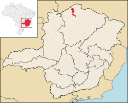
Cônego Marinho is a municipality in the north of the state of Minas Gerais in Brazil. As of 2020[update] the population was 7,686 in an area of 1,618 km2 (625 sq mi).[1]
Neighboring municipalities are: Montalvânia, Bonito de Minas, Januária, Itacarambi, São João das Missões, and Miravânia. The national park of Caverna do Peruaçu lies to the north. It was created in 2004 and has an area of 56,649.00 ha. It is important for its rock formations, the canyon cut out by the Peruaçu river and its many caverns. See Itacarambi for more information in Portuguese.
The economy is based on agriculture with emphasis on cattle raising. There were 8,500 head in 2006. The main agricultural crops were corn, manioc, sugarcane, rice, and coffee. The GDP was R$18,750,000 in 2005.
(For the complete list see Frigoletto)
15°17′43″S 44°24′45″W / 15.29528°S 44.41250°W
This geographical article relating to Intermediate Geographic Region of Montes Claros is a stub. You can help Wikipedia by expanding it. |