Community hub
Recent from talks
Knowledge base stats:
Talk channels stats:
Members stats:
Cambrian Way
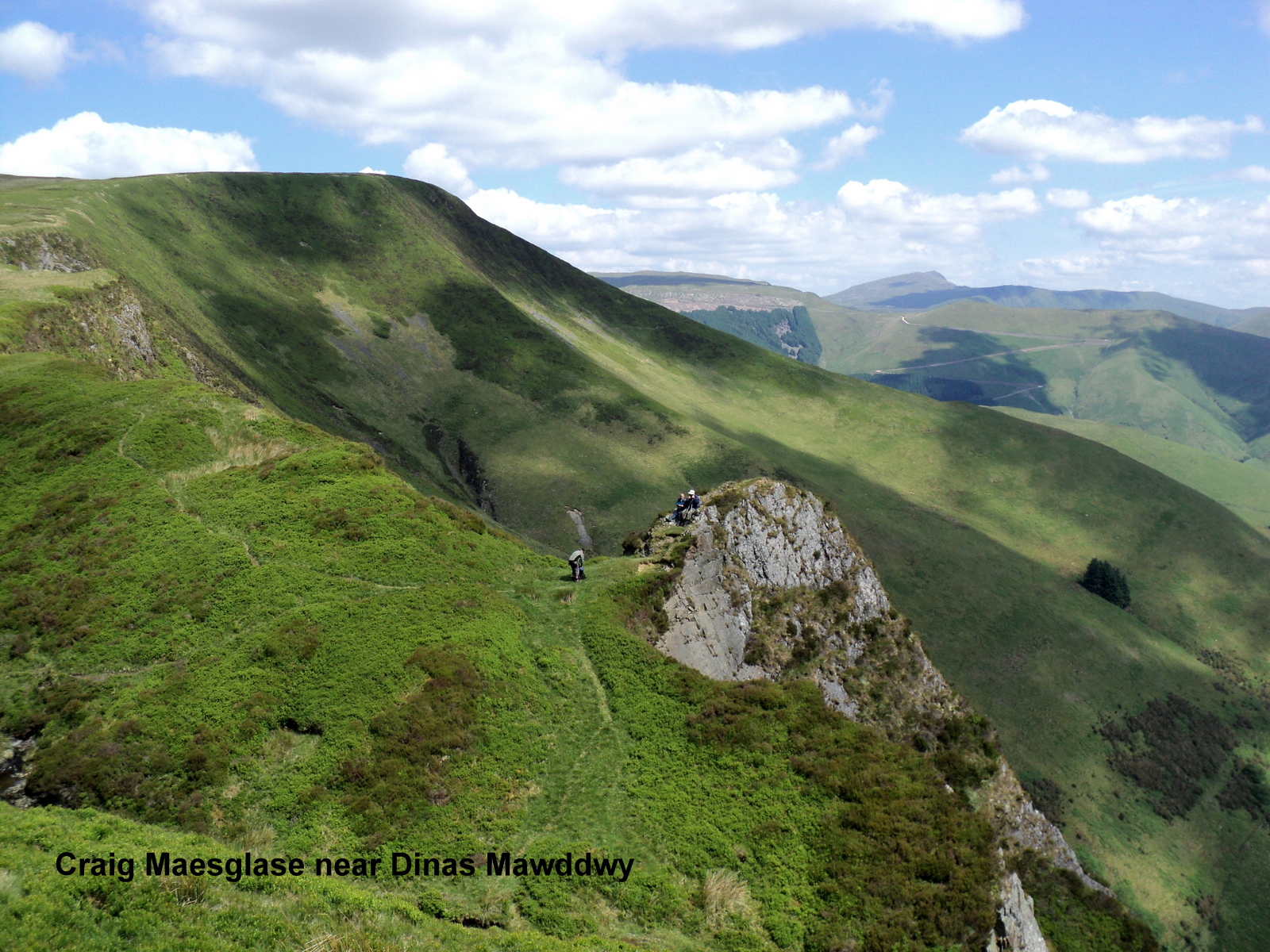
The Cambrian Way is a long distance footpath in Wales, running from Cardiff to Conwy. Initially an unrecognised path, it was officially recognised in 2019, and is named after Cambria, a latinised name for Wales. It is primarily a mountain walk passing over many of the highest and most scenic areas of Wales. It was pioneered in the 1960s and 1970s by walker Tony Drake, who later produced a guidebook of the walk.
Initially, the official recognition relates only to the approval of national park authorities and most local authorities involved in the waymarking of the route in lowland areas and this is expected to be completed in 2020. This is not as extensive as the waymarking of National Trails and does not include mountain areas where waymarking is not generally permitted. Following negotiation, the whole route is now marked on the 1:25,000 Ordnance Survey map.
The main route originally ran for 291 miles (468 km), with approximately 78,025 feet (23,782 m) of ascent using the latest digital measurements from the Ordnance Survey's 'OS Maps' website. Previous estimates were 275 miles (443 km) and 60,795 feet (18,530 m) of ascent using paper maps and counting contours in 2008, and 288 miles (463 km) and 67,100 feet (20,500 m) of ascent using Ordnance Survey's 'Getamap' website in 2012. The latest measurements of ascent take into account the extra ascent of undulations between plotted points and are, therefore, considerably greater than previous estimates and probably more accurate, though they are still subject to a margin of error.
Following a number of changes to the route that are incorporated in the latest Cicerone guide, the main route has increased to approximately 479 km (298 miles) with a total ascent of 22,460 m (73,700 ft).
The Cambrian Way is a mountain walking route from Cardiff to Conwy traversing much of the highest, wildest and most scenically beautiful parts of Wales. It was pioneered by the late Anthony John Drake MBE (Tony Drake) (25 January 1925 – 7 March 2012). Originally conceived in 1967 with the intention of becoming a National Trail, the proposals floundered because of insurmountable opposition from landowners, farmers, county councils, national park authorities and the British Mountaineering Council. Rather than abandoning the project altogether, Drake realised that the route could be promoted as an unofficial walk provided that it followed a route along established rights of way or where the public had traditionally been allowed access, so in 1984 he published the first edition of his guidebook Cambrian Way – A Mountain Connoisseur's Walk. Further updated editions of the guidebook continued to be published, his last one being the 6th edition published in 2008. He continued unsuccessfully to campaign for official recognition of the walk throughout the rest of his life until ill health intervened a few years before his death in 2012. The 7th edition of the guide, updated by the newly formed Cambrian Way Trust, was in 2016. The route is only partially waymarked and requires advanced map reading and navigational experience in certain sections. The route is wholly within Wales, unlike the Offa's Dyke Path, which follows the Wales-England border. Accommodation is scarce along some parts of the walk, so diversions, some quite long, are needed unless a tent and provisions are carried.
In 2015, at the time that the Cambrian Way Trust was formed, working groups from Ramblers Cymru were in the process of surveying the whole of the route and throughout this process a number of route changes were agreed between the Trust and working groups to avoid some road walking and to take advantage of the most scenic routes. This was done in collaboration with the Brecon Beacons National Park Authority and the Snowdonia National Park Authority who made a number of suggestions of their own, in particular regarding bad weather alternative routes over the Rhinog Mountains. These changes were then incorporated in a new guidebook Walking The Cambrian Way, published in July 2019 by Cicerone.
It traverses Wales from Cardiff Castle near the south coast to Conwy Castle on the north coast and is purposely routed over the highest upland and mountainous terrain including the Black Mountains, Central Beacons and Black Mountain (all within the Brecon Beacons National Park), the Cambrian Mountains, Cadair Idris, and Snowdon.
The starting point of the route is at Cardiff Castle, chosen for its good transport links and in order for the walk to become a coast to coast route from South Wales to North Wales. Despite the first day of the walk lacking any mountains, it follows a pleasant ridgeway walk from Cwm Nofydd north of Rhiwbina along the Cefn Onn Ridge to Rudry before joining the open common ridges bordering on the Vale of Usk. The Brecon Beacons National Park is entered just north of Pontypool and open moorland followed to the Blorenge, thence by steep descent to the town of Abergavenny. After ascending Sugar Loaf a horseshoe shaped route follows the finest ridges of the Black Mountains via Capel-y-ffin to Crickhowell. There follows an east to west traverse of the elevated ridges of the Brecon Beacons including Pen y Fan, the highest point in South Wales at 886 m (2906 ft). The moorland continues to the Black Mountain range, also known as the Carmarthen Fans, the largest common in Wales, before dropping to Llanddeusant and field country to Llandovery.
Hub AI
Cambrian Way AI simulator
(@Cambrian Way_simulator)
Cambrian Way
The Cambrian Way is a long distance footpath in Wales, running from Cardiff to Conwy. Initially an unrecognised path, it was officially recognised in 2019, and is named after Cambria, a latinised name for Wales. It is primarily a mountain walk passing over many of the highest and most scenic areas of Wales. It was pioneered in the 1960s and 1970s by walker Tony Drake, who later produced a guidebook of the walk.
Initially, the official recognition relates only to the approval of national park authorities and most local authorities involved in the waymarking of the route in lowland areas and this is expected to be completed in 2020. This is not as extensive as the waymarking of National Trails and does not include mountain areas where waymarking is not generally permitted. Following negotiation, the whole route is now marked on the 1:25,000 Ordnance Survey map.
The main route originally ran for 291 miles (468 km), with approximately 78,025 feet (23,782 m) of ascent using the latest digital measurements from the Ordnance Survey's 'OS Maps' website. Previous estimates were 275 miles (443 km) and 60,795 feet (18,530 m) of ascent using paper maps and counting contours in 2008, and 288 miles (463 km) and 67,100 feet (20,500 m) of ascent using Ordnance Survey's 'Getamap' website in 2012. The latest measurements of ascent take into account the extra ascent of undulations between plotted points and are, therefore, considerably greater than previous estimates and probably more accurate, though they are still subject to a margin of error.
Following a number of changes to the route that are incorporated in the latest Cicerone guide, the main route has increased to approximately 479 km (298 miles) with a total ascent of 22,460 m (73,700 ft).
The Cambrian Way is a mountain walking route from Cardiff to Conwy traversing much of the highest, wildest and most scenically beautiful parts of Wales. It was pioneered by the late Anthony John Drake MBE (Tony Drake) (25 January 1925 – 7 March 2012). Originally conceived in 1967 with the intention of becoming a National Trail, the proposals floundered because of insurmountable opposition from landowners, farmers, county councils, national park authorities and the British Mountaineering Council. Rather than abandoning the project altogether, Drake realised that the route could be promoted as an unofficial walk provided that it followed a route along established rights of way or where the public had traditionally been allowed access, so in 1984 he published the first edition of his guidebook Cambrian Way – A Mountain Connoisseur's Walk. Further updated editions of the guidebook continued to be published, his last one being the 6th edition published in 2008. He continued unsuccessfully to campaign for official recognition of the walk throughout the rest of his life until ill health intervened a few years before his death in 2012. The 7th edition of the guide, updated by the newly formed Cambrian Way Trust, was in 2016. The route is only partially waymarked and requires advanced map reading and navigational experience in certain sections. The route is wholly within Wales, unlike the Offa's Dyke Path, which follows the Wales-England border. Accommodation is scarce along some parts of the walk, so diversions, some quite long, are needed unless a tent and provisions are carried.
In 2015, at the time that the Cambrian Way Trust was formed, working groups from Ramblers Cymru were in the process of surveying the whole of the route and throughout this process a number of route changes were agreed between the Trust and working groups to avoid some road walking and to take advantage of the most scenic routes. This was done in collaboration with the Brecon Beacons National Park Authority and the Snowdonia National Park Authority who made a number of suggestions of their own, in particular regarding bad weather alternative routes over the Rhinog Mountains. These changes were then incorporated in a new guidebook Walking The Cambrian Way, published in July 2019 by Cicerone.
It traverses Wales from Cardiff Castle near the south coast to Conwy Castle on the north coast and is purposely routed over the highest upland and mountainous terrain including the Black Mountains, Central Beacons and Black Mountain (all within the Brecon Beacons National Park), the Cambrian Mountains, Cadair Idris, and Snowdon.
The starting point of the route is at Cardiff Castle, chosen for its good transport links and in order for the walk to become a coast to coast route from South Wales to North Wales. Despite the first day of the walk lacking any mountains, it follows a pleasant ridgeway walk from Cwm Nofydd north of Rhiwbina along the Cefn Onn Ridge to Rudry before joining the open common ridges bordering on the Vale of Usk. The Brecon Beacons National Park is entered just north of Pontypool and open moorland followed to the Blorenge, thence by steep descent to the town of Abergavenny. After ascending Sugar Loaf a horseshoe shaped route follows the finest ridges of the Black Mountains via Capel-y-ffin to Crickhowell. There follows an east to west traverse of the elevated ridges of the Brecon Beacons including Pen y Fan, the highest point in South Wales at 886 m (2906 ft). The moorland continues to the Black Mountain range, also known as the Carmarthen Fans, the largest common in Wales, before dropping to Llanddeusant and field country to Llandovery.