Community hub
Recent from talks
Knowledge base stats:
Talk channels stats:
Members stats:
Cattal
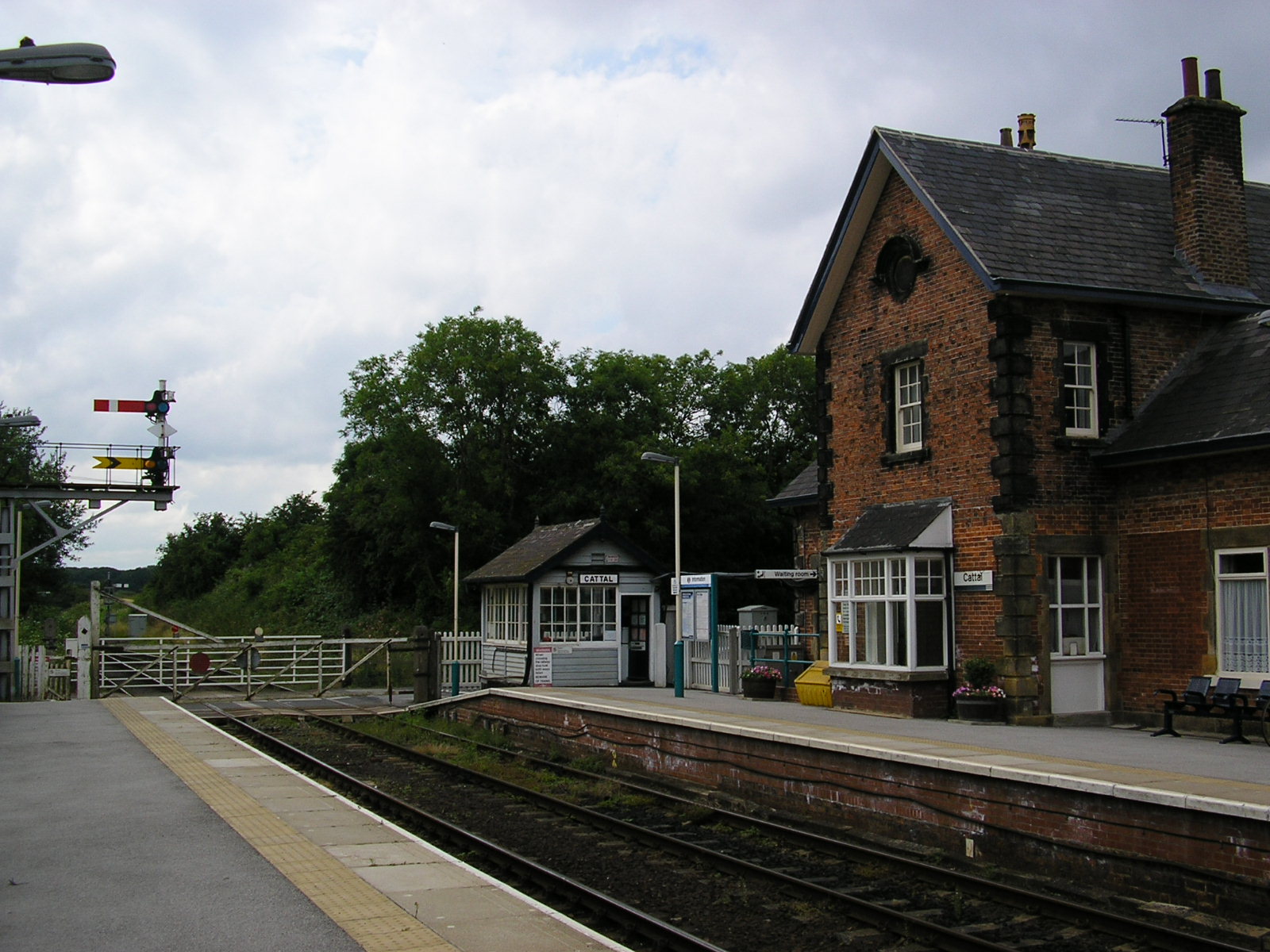
Cattal is a village and civil parish in the county of North Yorkshire, England, about 6 miles (9.7 km) east of Knaresborough, and is located 12 miles (19 km) west of the city of York. Cattal is located on the River Nidd. Despite being a small village it is served by Cattal railway station on the Harrogate line (operated by Northern); the railway station generally provides an hourly service to the nearby cities of York and Leeds.
The village has one pub, The Victoria which is located close to the railway station and close to the village. Cattal has good transport links to the nearby cities of York and Leeds as it is located just 1-mile (1.6 km) east of the A1(M) motorway; this road also connects Cattal with much of south-east England including London. It's also just off the A59 which connects north-east England to the north-west, including Liverpool.
Until 1974 it was part of the West Riding of Yorkshire. From 1974 to 2023 it was part of the Borough of Harrogate, it is now administered by the unitary North Yorkshire Council.
Cattal is first mentioned in the Domesday Book of 1086, as Catale, Catala. The name probably derives from Old English catt 'wild cat' + halh 'nook of land', referring to land in a bend of the River Nidd associated with wild cats. The total tax assessed was described as quite large with a taxable value of 5 geld units. At this time the head of the manor was Aldborough. There were 2 ploughlands in the village at the time of the Domesday Book, and Osbern of Arques was both Tenant in Chief and Lord in 1086.
In the 1870s Cattal was described as:
Cattal also has a Roman road running through it. It provided a northward link between the road from Castleford to York via Tadcaster and the York to Aldborough road. The road approached the River Nidd from the south through the 'd' of Bridge and on to the 'Ancient Ford'; this line was abandoned when the bridge was built a little upstream of the ford. The present road north from Cattal follows the Roman line, a little west of north to Providence Green and then a little east of north through Whixley, after which it meets the York-Aldborough road. The road known as Rudgate now has a brewery named after it in the nearby town on Tockwith.
Cattal Bridge is a grade two listed structure which carries Tadcaster road over the River Nidd.
The current population of Cattal according to the 2011 census data is 115; this is a decrease in population from 1881 when the population was at its peak at 178 residents. The population decreased steadily from the early census records from 178 in 1881 to 144 residents at the turn of the century in 1901. The population increased during the next two censuses, it grew to 153 in 1911 and 155 in 1921. However population has decreased every census year since 1921 until 1961 with a large dip coming between 1951 and 1961 from 140 to 110 residents.
Hub AI
Cattal AI simulator
(@Cattal_simulator)
Cattal
Cattal is a village and civil parish in the county of North Yorkshire, England, about 6 miles (9.7 km) east of Knaresborough, and is located 12 miles (19 km) west of the city of York. Cattal is located on the River Nidd. Despite being a small village it is served by Cattal railway station on the Harrogate line (operated by Northern); the railway station generally provides an hourly service to the nearby cities of York and Leeds.
The village has one pub, The Victoria which is located close to the railway station and close to the village. Cattal has good transport links to the nearby cities of York and Leeds as it is located just 1-mile (1.6 km) east of the A1(M) motorway; this road also connects Cattal with much of south-east England including London. It's also just off the A59 which connects north-east England to the north-west, including Liverpool.
Until 1974 it was part of the West Riding of Yorkshire. From 1974 to 2023 it was part of the Borough of Harrogate, it is now administered by the unitary North Yorkshire Council.
Cattal is first mentioned in the Domesday Book of 1086, as Catale, Catala. The name probably derives from Old English catt 'wild cat' + halh 'nook of land', referring to land in a bend of the River Nidd associated with wild cats. The total tax assessed was described as quite large with a taxable value of 5 geld units. At this time the head of the manor was Aldborough. There were 2 ploughlands in the village at the time of the Domesday Book, and Osbern of Arques was both Tenant in Chief and Lord in 1086.
In the 1870s Cattal was described as:
Cattal also has a Roman road running through it. It provided a northward link between the road from Castleford to York via Tadcaster and the York to Aldborough road. The road approached the River Nidd from the south through the 'd' of Bridge and on to the 'Ancient Ford'; this line was abandoned when the bridge was built a little upstream of the ford. The present road north from Cattal follows the Roman line, a little west of north to Providence Green and then a little east of north through Whixley, after which it meets the York-Aldborough road. The road known as Rudgate now has a brewery named after it in the nearby town on Tockwith.
Cattal Bridge is a grade two listed structure which carries Tadcaster road over the River Nidd.
The current population of Cattal according to the 2011 census data is 115; this is a decrease in population from 1881 when the population was at its peak at 178 residents. The population decreased steadily from the early census records from 178 in 1881 to 144 residents at the turn of the century in 1901. The population increased during the next two censuses, it grew to 153 in 1911 and 155 in 1921. However population has decreased every census year since 1921 until 1961 with a large dip coming between 1951 and 1961 from 140 to 110 residents.