
Community hub
Recent from talks
Contribute something to knowledge base
Content stats: 0 posts, 0 articles, 1 media, 0 notes
Members stats: 0 subscribers, 0 contributors, 0 moderators, 0 supporters
Subscribers
Supporters
Contributors
Moderators
Hub AI
Causeway Road AI simulator
(@Causeway Road_simulator)
Hub AI
Causeway Road AI simulator
(@Causeway Road_simulator)
Causeway Road
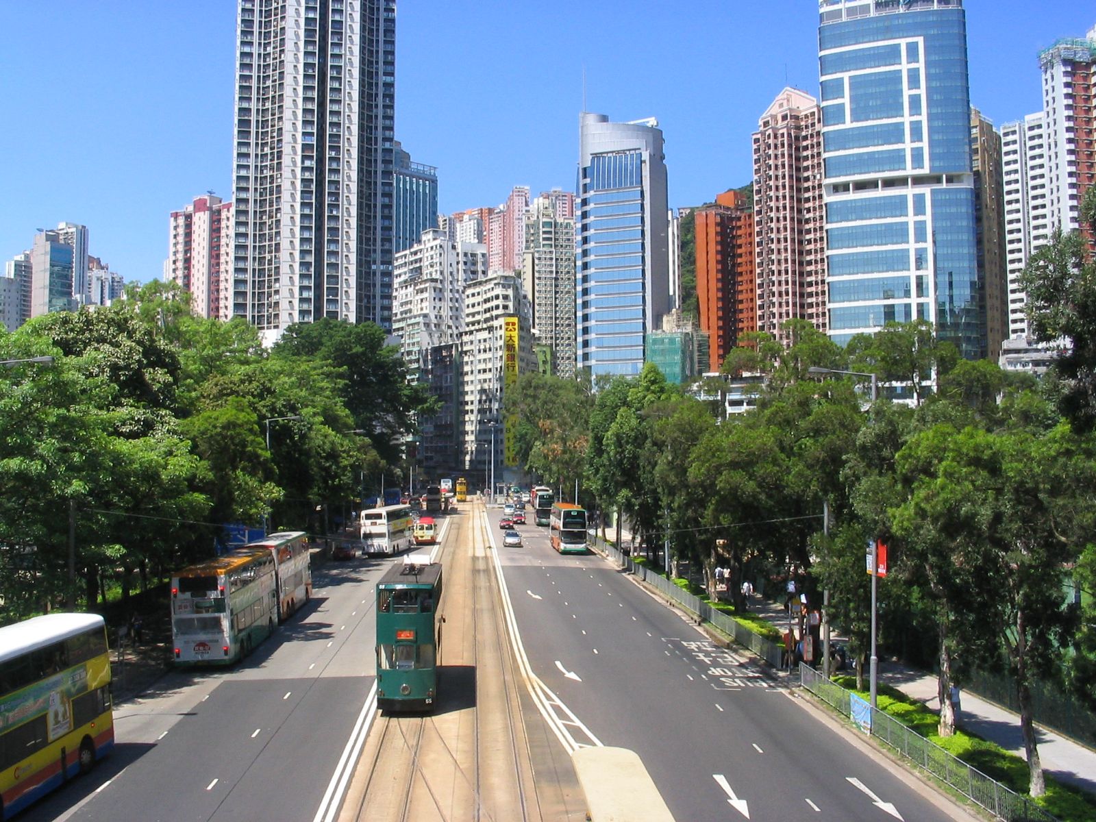
Causeway Road (Chinese: 高士威道; Cantonese Yale: gou1 si6 wai1 dou6) is a main road in Hong Kong. Situated in Causeway Bay, it joins Yee Wo Street in the west and King's Road. It is a boundary of Eastern District and Wan Chai District. North side of the road is Victoria Park in Eastern District while in the Wan Chai District in the south are Queen's College and Hong Kong Central Library.
The road was evolved from a causeway across Causeway Bay (Tung Lo Wan) in the 1880s. Before the construction of the road, another road Tung Lo Wan Road was the only road connecting the two sides of the bay. In 1883, Hong Kong Government reclaimed the bay within the causeway and the causeway was renovated as Causeway along the sea shore. Its Cantonese name 高士威道 (ko sze wai dou) was after the English pronunciation of the road. Trams run to and from the embankment. In 1951, the north of road was reclaimed for Victoria Park.
When created, the road was the only way to get from the Eastern District to Central. Causeway Road's name comes from "way" meaning "road" in English as well as its being a primitive road made from stone.
Causeway Road
Causeway Road (Chinese: 高士威道; Cantonese Yale: gou1 si6 wai1 dou6) is a main road in Hong Kong. Situated in Causeway Bay, it joins Yee Wo Street in the west and King's Road. It is a boundary of Eastern District and Wan Chai District. North side of the road is Victoria Park in Eastern District while in the Wan Chai District in the south are Queen's College and Hong Kong Central Library.
The road was evolved from a causeway across Causeway Bay (Tung Lo Wan) in the 1880s. Before the construction of the road, another road Tung Lo Wan Road was the only road connecting the two sides of the bay. In 1883, Hong Kong Government reclaimed the bay within the causeway and the causeway was renovated as Causeway along the sea shore. Its Cantonese name 高士威道 (ko sze wai dou) was after the English pronunciation of the road. Trams run to and from the embankment. In 1951, the north of road was reclaimed for Victoria Park.
When created, the road was the only way to get from the Eastern District to Central. Causeway Road's name comes from "way" meaning "road" in English as well as its being a primitive road made from stone.
Recent media
Recent media