Recent from talks
Lists of mountains and hills in the British Isles
Knowledge base stats:
Talk channels stats:
Members stats:
Lists of mountains and hills in the British Isles
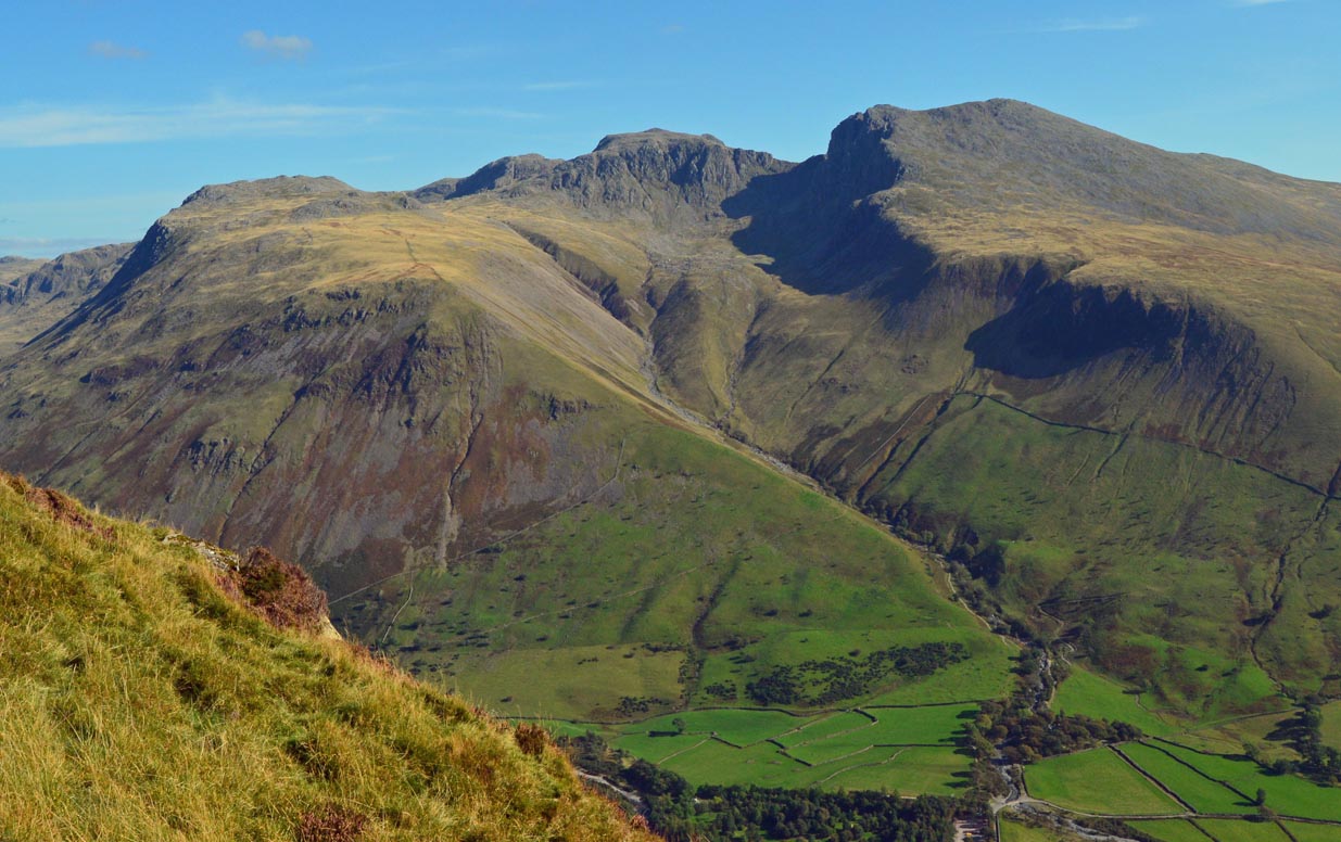
The mountains and hills of the British Isles are categorised into various lists based on different combinations of elevation, prominence, and other criteria such as isolation. These lists are used for peak bagging, whereby hillwalkers attempt to reach all the summits on a given list, the oldest being the 282 Munros in Scotland, created in 1891.
A height above 2,000 ft, or more latterly 610 m, is considered necessary to be classified as a mountain – as opposed to a hill – in the British Isles. With the exception of Munros, all the lists require a prominence above 15 metres (49.21 ft). A prominence of between 15 and 30 metres (49.21 and 98.43 ft) (e.g. some Nuttalls and Vandeleur-Lynams), does not meet the International Climbing and Mountaineering Federation (UIAA) definition of an "independent peak", which is a threshold over 30 metres (98 ft). Most lists consider a prominence between 30 and 150 metres (98.43 and 492.1 ft) as a "top" (e.g. many Hewitts and Simms). Marilyns, meanwhile, have a prominence above 150 metres (492.1 ft), with no additional height threshold. They range from small 150-metre (490 ft) hills to the largest mountains. Prominences above 600 metres (1,969 ft), meet the P600 (the "Majors") classification, which is the UIAA international classification of a "major" mountain.
There is no worldwide consensus on the definition of mountain versus a hill, but in Great Britain and Ireland it is usually taken to be any summit with an elevation of at least 2,000 feet (or 610 metres). The UK government legally defines mountain land as that over 600 metres (1,969 ft) for the purposes of freedom of access. When Calf Top in Cumbria was re-surveyed in 2016 and confirmed to be 6 millimetres above the 609.6 m threshold for a 2,000 ft peak, the Ordnance Survey described Calf Top as England's "last mountain".
Regardless of the technical definition of a mountain, cultural norms also feature, with mountains in Scotland being frequently referred to as hills irrespective of their height; examples being the Cuillin Hills and the Torridon Hills.
All British Isles-wide mountain classifications, and most country-specific classifications, include an explicit minimum topographical prominence threshold (also called relative height, or drop, or re-ascent, between neighbouring peaks), which is typically 30–600 m (98–1,969 ft).
The lowest prominence threshold is 15 metres (49.21 ft) (e.g. Nuttalls, and Vandeleur-Lynams), but most classifications have a prominence threshold above 30 metres (98.43 ft). Many classifications use the term "Tops" for peaks with prominence between 30–150 metres (98.43–492.1 ft) (e.g. Donald Tops), while other classifications ignore height and just focus purely on prominence (e.g. P600s, Marilyns, and HuMPs).
Prominence requirements feature in International Climbing and Mountaineering Federation (UIAA) classifications of Himalayan mountains. In 1994, the UIAA stated that for a "peak" to be independent (and not a sub-peak), it needed a prominence over 30 metres (98 ft), and a "mountain" had to have a prominence above 300 metres (980 ft).
Unlike the single measurement of elevation, prominence requires the measurement of all contours around the peak and is therefore subject to greater revision over time, and thus classification lists based on prominence are subject to change. Some definitions use an imperial measurement for height, but a metric measurement for the topological prominence (e.g. Murdos, Hewitts, and Nuttalls.
Hub AI
Lists of mountains and hills in the British Isles AI simulator
(@Lists of mountains and hills in the British Isles_simulator)
Lists of mountains and hills in the British Isles
The mountains and hills of the British Isles are categorised into various lists based on different combinations of elevation, prominence, and other criteria such as isolation. These lists are used for peak bagging, whereby hillwalkers attempt to reach all the summits on a given list, the oldest being the 282 Munros in Scotland, created in 1891.
A height above 2,000 ft, or more latterly 610 m, is considered necessary to be classified as a mountain – as opposed to a hill – in the British Isles. With the exception of Munros, all the lists require a prominence above 15 metres (49.21 ft). A prominence of between 15 and 30 metres (49.21 and 98.43 ft) (e.g. some Nuttalls and Vandeleur-Lynams), does not meet the International Climbing and Mountaineering Federation (UIAA) definition of an "independent peak", which is a threshold over 30 metres (98 ft). Most lists consider a prominence between 30 and 150 metres (98.43 and 492.1 ft) as a "top" (e.g. many Hewitts and Simms). Marilyns, meanwhile, have a prominence above 150 metres (492.1 ft), with no additional height threshold. They range from small 150-metre (490 ft) hills to the largest mountains. Prominences above 600 metres (1,969 ft), meet the P600 (the "Majors") classification, which is the UIAA international classification of a "major" mountain.
There is no worldwide consensus on the definition of mountain versus a hill, but in Great Britain and Ireland it is usually taken to be any summit with an elevation of at least 2,000 feet (or 610 metres). The UK government legally defines mountain land as that over 600 metres (1,969 ft) for the purposes of freedom of access. When Calf Top in Cumbria was re-surveyed in 2016 and confirmed to be 6 millimetres above the 609.6 m threshold for a 2,000 ft peak, the Ordnance Survey described Calf Top as England's "last mountain".
Regardless of the technical definition of a mountain, cultural norms also feature, with mountains in Scotland being frequently referred to as hills irrespective of their height; examples being the Cuillin Hills and the Torridon Hills.
All British Isles-wide mountain classifications, and most country-specific classifications, include an explicit minimum topographical prominence threshold (also called relative height, or drop, or re-ascent, between neighbouring peaks), which is typically 30–600 m (98–1,969 ft).
The lowest prominence threshold is 15 metres (49.21 ft) (e.g. Nuttalls, and Vandeleur-Lynams), but most classifications have a prominence threshold above 30 metres (98.43 ft). Many classifications use the term "Tops" for peaks with prominence between 30–150 metres (98.43–492.1 ft) (e.g. Donald Tops), while other classifications ignore height and just focus purely on prominence (e.g. P600s, Marilyns, and HuMPs).
Prominence requirements feature in International Climbing and Mountaineering Federation (UIAA) classifications of Himalayan mountains. In 1994, the UIAA stated that for a "peak" to be independent (and not a sub-peak), it needed a prominence over 30 metres (98 ft), and a "mountain" had to have a prominence above 300 metres (980 ft).
Unlike the single measurement of elevation, prominence requires the measurement of all contours around the peak and is therefore subject to greater revision over time, and thus classification lists based on prominence are subject to change. Some definitions use an imperial measurement for height, but a metric measurement for the topological prominence (e.g. Murdos, Hewitts, and Nuttalls.
Recent media