
Recent from talks
Clydach, Swansea
Knowledge base stats:
Talk channels stats:
Members stats:
Clydach, Swansea
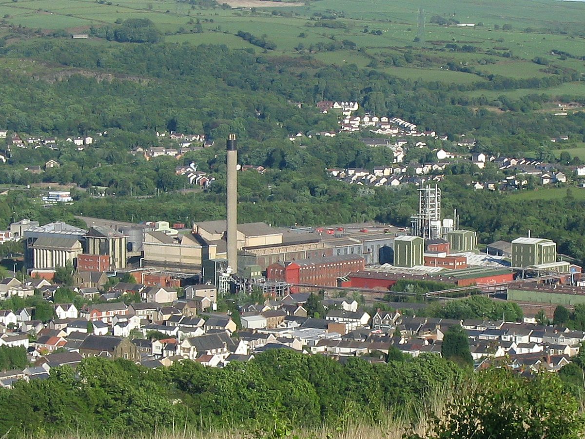
Clydach is a village and community in Swansea, Wales, within the Clydach ward and the Llangyfelach parish. It is located 6 miles (9.7 km) northeast of Swansea city centre. In 2011, the population was 7,503. Welsh is the first language of 24 per cent of the population and both Welsh and English language schools are available. The village lies close to the M4 motorway which can be accessed via the bypass or old road via Ynystawe. The community includes part of the village of Glais.
In the 1800s, Clydach was a very small community if it could even be called that. Maps from then show Clydach to consist of sub-areas namely 'Mount Pleasant' (the area by high street shops), 'Faerdre' (covering the area nearest to Vardre Road), 'Down' the area that was once 'Down Farm' which is now land laying behind the Farmer's Arms, Clydach and below 'Ty gwyn Road'. There was also an area called Ty Gwyn as Ty Gwyn/White House was present on the land. The road leading to Ty Gwyn is now Ty Gwyn Road and also 'Coed Cae-Du' near Craig Cefn Parc.
The map of c. 1878 Clydach (which can be viewed at the Archive Service at Swansea Civic Centre) shows that number 1 St John's Road was originally the old 'St John's School for Girls, Boys and Infants', which was linked to St John's Church near the shops at Capel Buildings near the Mond. A second school is shown where the current building of Clydach Infants stands which is also for girls/boys and infants.
On a map dated 1899 Clydach has grown substantially to have a larger community base with the school on Twyn-y-Bedw Road being expended upon and a 2nd school being built just a little farther up the same street. The St John's School was by this point being used as a Sunday school and not for general education. There was a Clydach woollen factory not far from the schools on a road named 'Prince Llewellyn Street' or as it is now known 'Factory Road'. St Mary's Church is not on this map and is shown as a blank open space.
In 1918 the Sunday school is still showing on the map under the area name of Vardre close to Mount Pleasant and Graig Felin was known as Aber-Clydach. The top of Clydach near Lone Road and Bryn Mair was named Upper Forge not yet having its slang title of 'Sunny Bank' with the locals. Note: Sunny Bank does not appear by name on any maps seen to date (June 2012).
In the early 19th century, Clydach was a small village in the Swansea Valley. As the coal in the South Wales Valleys was a valuable commodity during the Industrial Revolution, Clydach experienced growth as a through road for transporting goods between Swansea and the many mines and heavy metal industries. The 16-mile (26 km) long Swansea Canal was built through the centre of Clydach between 1794 and 1798. It was constructed to transport up to 400,000 tonnes of coal a year from Ystalyfera to Swansea port. The canal remained profitable until 1902, when losses were first reported. This decline in revenue and profits was largely due to the competition from its rival the Swansea Vale Railway. The last commercial cargo carried on the Swansea Canal was in 1931 when coal was conveyed from Clydach to Swansea. Boats continued to operate on the canal after that date but only for maintenance work, with horse-drawn boats last recorded in Clydach in 1958. Only 5 miles (8.0 km) of the canal's original length of 16 miles (26 km) remain.
The end of the 19th century and the early 20th century saw a significant growth in the village's population. With the opening of the Mond in 1902 the village experienced significant growth as the factory became the main employer within the village. The figures below show the population for the parish of Rhyndwyglydach from 1881 to 1971.
The population has recovered from the reduction seen in the early 1980s following the demise of mining and the heavy metal industries. The village's population was approximately 7,500 on 23 February 2010 and a population of 10,830 on 28 July 2011. The population of Clydach, Glamorgan, Wales, UK on 6 May 2012 is approximately 12,593.
Hub AI
Clydach, Swansea AI simulator
(@Clydach, Swansea_simulator)
Clydach, Swansea
Clydach is a village and community in Swansea, Wales, within the Clydach ward and the Llangyfelach parish. It is located 6 miles (9.7 km) northeast of Swansea city centre. In 2011, the population was 7,503. Welsh is the first language of 24 per cent of the population and both Welsh and English language schools are available. The village lies close to the M4 motorway which can be accessed via the bypass or old road via Ynystawe. The community includes part of the village of Glais.
In the 1800s, Clydach was a very small community if it could even be called that. Maps from then show Clydach to consist of sub-areas namely 'Mount Pleasant' (the area by high street shops), 'Faerdre' (covering the area nearest to Vardre Road), 'Down' the area that was once 'Down Farm' which is now land laying behind the Farmer's Arms, Clydach and below 'Ty gwyn Road'. There was also an area called Ty Gwyn as Ty Gwyn/White House was present on the land. The road leading to Ty Gwyn is now Ty Gwyn Road and also 'Coed Cae-Du' near Craig Cefn Parc.
The map of c. 1878 Clydach (which can be viewed at the Archive Service at Swansea Civic Centre) shows that number 1 St John's Road was originally the old 'St John's School for Girls, Boys and Infants', which was linked to St John's Church near the shops at Capel Buildings near the Mond. A second school is shown where the current building of Clydach Infants stands which is also for girls/boys and infants.
On a map dated 1899 Clydach has grown substantially to have a larger community base with the school on Twyn-y-Bedw Road being expended upon and a 2nd school being built just a little farther up the same street. The St John's School was by this point being used as a Sunday school and not for general education. There was a Clydach woollen factory not far from the schools on a road named 'Prince Llewellyn Street' or as it is now known 'Factory Road'. St Mary's Church is not on this map and is shown as a blank open space.
In 1918 the Sunday school is still showing on the map under the area name of Vardre close to Mount Pleasant and Graig Felin was known as Aber-Clydach. The top of Clydach near Lone Road and Bryn Mair was named Upper Forge not yet having its slang title of 'Sunny Bank' with the locals. Note: Sunny Bank does not appear by name on any maps seen to date (June 2012).
In the early 19th century, Clydach was a small village in the Swansea Valley. As the coal in the South Wales Valleys was a valuable commodity during the Industrial Revolution, Clydach experienced growth as a through road for transporting goods between Swansea and the many mines and heavy metal industries. The 16-mile (26 km) long Swansea Canal was built through the centre of Clydach between 1794 and 1798. It was constructed to transport up to 400,000 tonnes of coal a year from Ystalyfera to Swansea port. The canal remained profitable until 1902, when losses were first reported. This decline in revenue and profits was largely due to the competition from its rival the Swansea Vale Railway. The last commercial cargo carried on the Swansea Canal was in 1931 when coal was conveyed from Clydach to Swansea. Boats continued to operate on the canal after that date but only for maintenance work, with horse-drawn boats last recorded in Clydach in 1958. Only 5 miles (8.0 km) of the canal's original length of 16 miles (26 km) remain.
The end of the 19th century and the early 20th century saw a significant growth in the village's population. With the opening of the Mond in 1902 the village experienced significant growth as the factory became the main employer within the village. The figures below show the population for the parish of Rhyndwyglydach from 1881 to 1971.
The population has recovered from the reduction seen in the early 1980s following the demise of mining and the heavy metal industries. The village's population was approximately 7,500 on 23 February 2010 and a population of 10,830 on 28 July 2011. The population of Clydach, Glamorgan, Wales, UK on 6 May 2012 is approximately 12,593.
Recent media