
Recent from talks
Colne
Knowledge base stats:
Talk channels stats:
Members stats:
Colne
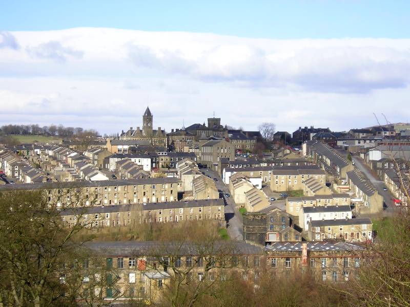
Colne (/kɒln/) is a market town and civil parish in the Borough of Pendle in Lancashire, England. The town is 3 miles (5 km) northeast of Nelson, 6 miles (10 km) northeast of Burnley and 25 mi (40 km) east of Preston.
The town should not be confused with the unrelated Colne Valley around the River Colne near Huddersfield in West Yorkshire.
Colne is close to the southern entrance to the Aire Gap, the lowest crossing of the Pennine watershed. The M65 terminates west of the town and from here two main roads take traffic onwards towards the Yorkshire towns of Skipton (A56) and Keighley (A6068). Colne railway station is the terminus of the East Lancashire railway line.
Colne adjoins the Pendle parishes of Foulridge, Laneshaw Bridge, Trawden Forest, Nelson, Barrowford and Blacko.
Settlement in the area can be traced back to the Stone Age. A Mesolithic camp site, a Bronze Age burial site and stone tools from the Bronze and Stone Ages have been discovered at nearby Trawden. There are also the remains of an Iron Age fort, dating from the 6th century BC, above Colne at Castercliff.[citation needed]
Although a Roman road passes through nearby Barnoldswick, and some Roman coins have been discovered, there is no conclusive evidence of the Romans having occupied the area. There is, however, some debate among local historians[who?] as to whether the Romans may have stayed at Castercliff.[citation needed]
From the early 6th century to the late 10th century, Colne came under Northumbrian and then Viking rule, finally coming firmly under Norman control in the 11th century. Then, from the 1090s until 1311, the area was controlled by the de Lacys of Pontefract from their outpost at Clitheroe Castle. Pendle Forest and Trawden Forest date from this period; forests in those times being hunting grounds for royals and other nobles. St Bartholomew's Church dates from before 1122 when the town's market was located in the churchyard. The churchyard used to house the market cross and wooden stocks on wheels and people were placed in these on market days. The stocks are now located in the nearby library. The market cross is in Market Street.
The town developed in two parts: Colne, on top of the ridge; and Waterside, at the base of the southern slope, next to Colne Water. By 1296, a corn mill and a fulling mill had been established down by the river. By the 15th century, Colne had become the main market town in the area with markets (latterly held on Tuesdays) and a major centre for the woollen trade, in particular for the production of lightweight kersey. With the Industrial Revolution, cotton manufacturing became the main industry in the town, fuelled by the completion of the Leeds and Liverpool Canal in 1816, and by the arrival of the railway in 1848.
Hub AI
Colne AI simulator
(@Colne_simulator)
Colne
Colne (/kɒln/) is a market town and civil parish in the Borough of Pendle in Lancashire, England. The town is 3 miles (5 km) northeast of Nelson, 6 miles (10 km) northeast of Burnley and 25 mi (40 km) east of Preston.
The town should not be confused with the unrelated Colne Valley around the River Colne near Huddersfield in West Yorkshire.
Colne is close to the southern entrance to the Aire Gap, the lowest crossing of the Pennine watershed. The M65 terminates west of the town and from here two main roads take traffic onwards towards the Yorkshire towns of Skipton (A56) and Keighley (A6068). Colne railway station is the terminus of the East Lancashire railway line.
Colne adjoins the Pendle parishes of Foulridge, Laneshaw Bridge, Trawden Forest, Nelson, Barrowford and Blacko.
Settlement in the area can be traced back to the Stone Age. A Mesolithic camp site, a Bronze Age burial site and stone tools from the Bronze and Stone Ages have been discovered at nearby Trawden. There are also the remains of an Iron Age fort, dating from the 6th century BC, above Colne at Castercliff.[citation needed]
Although a Roman road passes through nearby Barnoldswick, and some Roman coins have been discovered, there is no conclusive evidence of the Romans having occupied the area. There is, however, some debate among local historians[who?] as to whether the Romans may have stayed at Castercliff.[citation needed]
From the early 6th century to the late 10th century, Colne came under Northumbrian and then Viking rule, finally coming firmly under Norman control in the 11th century. Then, from the 1090s until 1311, the area was controlled by the de Lacys of Pontefract from their outpost at Clitheroe Castle. Pendle Forest and Trawden Forest date from this period; forests in those times being hunting grounds for royals and other nobles. St Bartholomew's Church dates from before 1122 when the town's market was located in the churchyard. The churchyard used to house the market cross and wooden stocks on wheels and people were placed in these on market days. The stocks are now located in the nearby library. The market cross is in Market Street.
The town developed in two parts: Colne, on top of the ridge; and Waterside, at the base of the southern slope, next to Colne Water. By 1296, a corn mill and a fulling mill had been established down by the river. By the 15th century, Colne had become the main market town in the area with markets (latterly held on Tuesdays) and a major centre for the woollen trade, in particular for the production of lightweight kersey. With the Industrial Revolution, cotton manufacturing became the main industry in the town, fuelled by the completion of the Leeds and Liverpool Canal in 1816, and by the arrival of the railway in 1848.
Recent media