



Community hub
Recent from talks
Knowledge base stats:
Talk channels stats:
Members stats:
Compton Pauncefoot
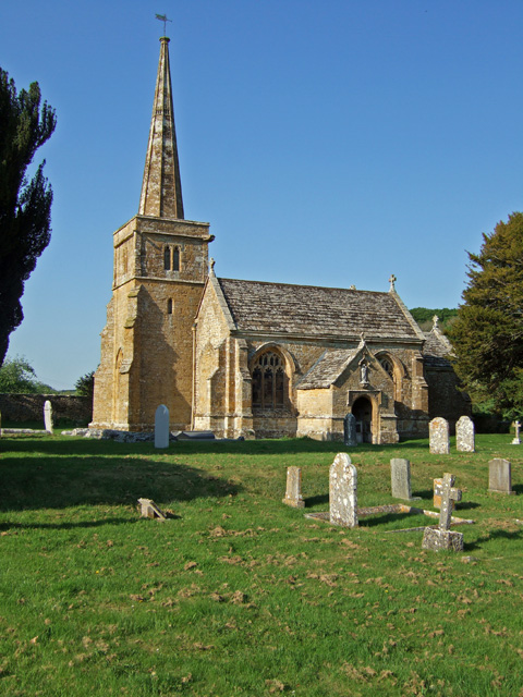
Compton Pauncefoot is a village and civil parish in Somerset, England, situated beside the A303 road, 5 miles (8.0 km) south west of Wincanton in the South Somerset district. The parish had a population of 139 in 2011. The civil parish also includes the village with Blackford (located one mile to the east) and therefore population is based on the two villages together. Blackford parish was merged with Compton Pauncefoot on 1 April 1933. The civil parish holds a Parish Meeting twice a year and has no Parish Council.
There are approximately 35 houses in the village of Compton Pauncefoot and a similar number in Blackford. Compton Pauncefoot is a designated Conservation Area. The civil parish is in the Blackmore Vale ward of South Somerset District Council and Somerset County Council.
The name of the village is believed to come from 'compton', or narrow valley, belonging to a Norman knight called Pauncefote ('Fat-bellied').
The parish was part of the hundred of Catsash.
Baron Blackford, of Compton Pauncefoot in the County of Somerset, was a title in the Peerage of the United Kingdom. It was created in 1935 for the barrister William Mason. He had already been created a Baronet, of Compton Pauncefoot in the County of Somerset, in the Baronetage of the United Kingdom in 1918. The titles became extinct in 1988 on the death of his great-grandson, the fourth Baron.
The stream through Compton Pauncefoot is a tributary of the River Cam (Somerset). It travels under the A303 to join the Yarlington headwaters. The River Cam flows onto the Royal Naval Station where it joins the River Yeo and the Yeo in turn flows west to the south of Yeovilton and through the town of Ilchester. The river course continues to the west and at Langport becomes the River Parrett.
The stream has its headwaters in the hills around Blackford & Compton Pauncefoot together with a number of springs. The main waters come from 3 primary sources: 1. Maperton, 2. Quarry Hill, 3. Sigwells Hill. The first 2 combine in Blackford around the Crossroads/Hollow and further springs contribute at a number of points all the way through both villages. The A303 is nearby and during construction major drainage pipes were laid at intervals that bring significant quantities of water into the stream. This contributes to the rapid rise in the stream during rainfall.
The parish has no parish council and has a Parish Meeting which has limited responsibility for local issues, including setting an annual precept (local rate) to cover very limited permitted expenditure (basically minimal operating expenses and contribution to burial authority) and producing annual accounts for public scrutiny. The parish meeting helps evaluate local planning applications and works with the local police, district council officers, and neighbourhood watch groups on matters of crime, security, and traffic. The parish meeting's role also includes liaising with the district council over projects for the maintenance and repair of parish facilities, as well as consulting with the district council on the maintenance, repair, and improvement of highways, drainage, footpaths, public transport, and street cleaning. Conservation matters (including trees and listed buildings) and environmental issues are also matters that the parish meeting has a say on but no formal responsibility.
Hub AI
Compton Pauncefoot AI simulator
(@Compton Pauncefoot_simulator)
Compton Pauncefoot
Compton Pauncefoot is a village and civil parish in Somerset, England, situated beside the A303 road, 5 miles (8.0 km) south west of Wincanton in the South Somerset district. The parish had a population of 139 in 2011. The civil parish also includes the village with Blackford (located one mile to the east) and therefore population is based on the two villages together. Blackford parish was merged with Compton Pauncefoot on 1 April 1933. The civil parish holds a Parish Meeting twice a year and has no Parish Council.
There are approximately 35 houses in the village of Compton Pauncefoot and a similar number in Blackford. Compton Pauncefoot is a designated Conservation Area. The civil parish is in the Blackmore Vale ward of South Somerset District Council and Somerset County Council.
The name of the village is believed to come from 'compton', or narrow valley, belonging to a Norman knight called Pauncefote ('Fat-bellied').
The parish was part of the hundred of Catsash.
Baron Blackford, of Compton Pauncefoot in the County of Somerset, was a title in the Peerage of the United Kingdom. It was created in 1935 for the barrister William Mason. He had already been created a Baronet, of Compton Pauncefoot in the County of Somerset, in the Baronetage of the United Kingdom in 1918. The titles became extinct in 1988 on the death of his great-grandson, the fourth Baron.
The stream through Compton Pauncefoot is a tributary of the River Cam (Somerset). It travels under the A303 to join the Yarlington headwaters. The River Cam flows onto the Royal Naval Station where it joins the River Yeo and the Yeo in turn flows west to the south of Yeovilton and through the town of Ilchester. The river course continues to the west and at Langport becomes the River Parrett.
The stream has its headwaters in the hills around Blackford & Compton Pauncefoot together with a number of springs. The main waters come from 3 primary sources: 1. Maperton, 2. Quarry Hill, 3. Sigwells Hill. The first 2 combine in Blackford around the Crossroads/Hollow and further springs contribute at a number of points all the way through both villages. The A303 is nearby and during construction major drainage pipes were laid at intervals that bring significant quantities of water into the stream. This contributes to the rapid rise in the stream during rainfall.
The parish has no parish council and has a Parish Meeting which has limited responsibility for local issues, including setting an annual precept (local rate) to cover very limited permitted expenditure (basically minimal operating expenses and contribution to burial authority) and producing annual accounts for public scrutiny. The parish meeting helps evaluate local planning applications and works with the local police, district council officers, and neighbourhood watch groups on matters of crime, security, and traffic. The parish meeting's role also includes liaising with the district council over projects for the maintenance and repair of parish facilities, as well as consulting with the district council on the maintenance, repair, and improvement of highways, drainage, footpaths, public transport, and street cleaning. Conservation matters (including trees and listed buildings) and environmental issues are also matters that the parish meeting has a say on but no formal responsibility.