
Recent from talks
David Glacier
Knowledge base stats:
Talk channels stats:
Members stats:
David Glacier
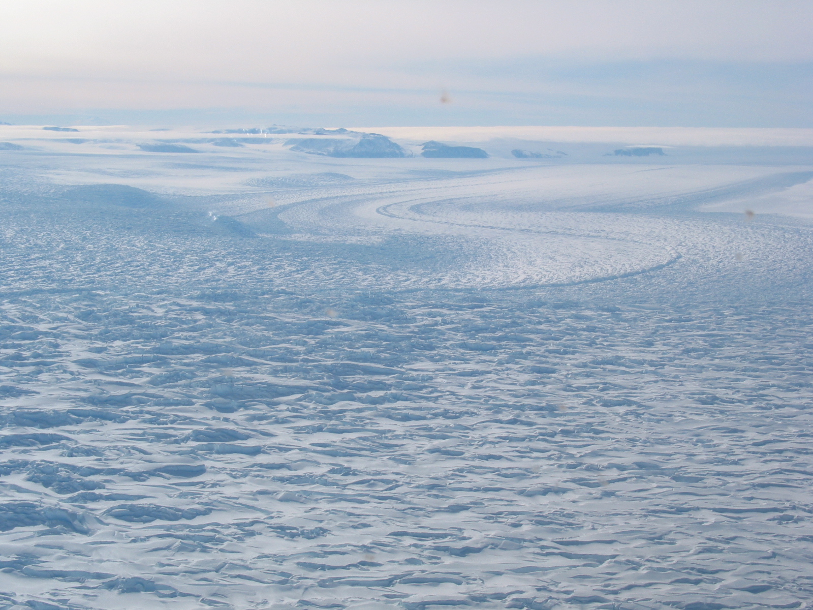
The David Glacier (75°19′S 162°00′E / 75.317°S 162.000°E) is a glacier over 600 nautical miles (1,100 km; 690 mi) long, flowing east from the polar plateau through the Prince Albert Mountains to the coast of Victoria Land, Antarctica. It enters Ross Sea between Cape Philippi and Cape Reynolds to form the floating Drygalski Ice Tongue. It is the most imposing outlet glacier in Victoria Land. It is fed by two main flows which drain an area larger than 200,000 square kilometres, with an estimated ice discharge rate of 7.8 ± 0.7 km3/year. The David Glacier was discovered by Ernest Shackleton's "Northern Party," in November 1908, under the leadership of Prof. T.W. Edgeworth David, of Sydney University, for whom the feature was named.
The David Glacier flows eastward in a broad stream that gradually narrows towards the coast. The northern flow drains from Talos Dome to the Ross Sea, but the main branch of the stream is fed by a network of tributaries which drain a common area of the inner plateau around Dome C and converge in a spectacular icefall known as the David Cauldron. Mount Kring, Mount Wood and the Martin Nunataks are to the north of the David Glacier's head. The Ricker Hills and Trio Nunataks are to the south. The Hollingsworth Glacier joins the David Glacier from the southeast to the east of the Trio Nunataks. East of this the glacier descends through the David Cauldron, then continues east. It is joined from the north by the Woodberry Glacier, flowing between Evans Heights and Mount Fearon, and past Mount Priestley to the east. In its lower section the David Glacier flows past the D'Urville Wall, Mount Neumayer and Cape Philippi to the north, in the Prince Albert Mountains, and past Hughes Bluff and Cape Reynolds to the south, to form the Drygalski Ice Tongue, which enters the Ross Sea between Relief Inlet to the north and Geikie Inlet to the south.
Features of the glacier, its tributaries and the terrain through which they flow include:
74°59′S 157°54′E / 74.983°S 157.900°E. A sharply defined nunatak on the northern margin of the upper reaches of David Glacier, 13 nautical miles (24 km; 15 mi) southwest of Mount Wood. Previously uncharted, it was used (with Mount Wood) as a reference for establishing a United States Antarctic Research Program (USARP) field party on Nov. 6, 1962. Named by D.B.McC. Rainey of the Cartographic Branch of the New Zealand Dept. of Lands and Survey for Staff Sergeant Arthur L. Kring, USMC, navigator on many United States Navy VX-6 Squadron flights during the 1962–63 season when New Zealand field parties received logistic support by that squadron.
74°49′S 158°24′E / 74.817°S 158.400°E. An isolated nunatak lying northward of David Glacier and 13 nautical miles (24 km; 15 mi) northeast of Mount Kring. Named by D.B. McC. Rainey of the Cartographic Branch of the New Zealand Dept. of Lands and Survey. Named after the foster parents of Staff Sgt. Arthur L. Kring, USMC, navigator with the United States Navy VX-6 Squadron which provided logistic support for the NZGSAE (1962–63).
74°57′S 158°46′E / 74.950°S 158.767°E. Two isolated nunataks situated along the northern margin of David Glacier, 9 nautical miles (17 km; 10 mi) southeast of Mount Wood. Mapped by the United States Geological Survey (USGS) from surveys and United States Navy air photos, 1956–62. Named by the United States Advisory Committee on Antarctic Names (US-ACAN) for Robert D. Martin, USGS topographic engineer at McMurdo Station, 1961–62.
75°33′S 159°57′E / 75.550°S 159.950°E. A broad glacier of low gradient, draining the vicinity east of the Ricker Hills and flowing northeast to enter David Glacier just east of Trio Nunataks. Mapped by USGS from surveys and United States Navy air photos, 1956–62. Named by US-ACAN for Jerry L. Hollingsworth, meteorologist with the South Pole Station winter party, 1966.
75°20′S 160°50′E / 75.333°S 160.833°E. An icefall of turbulent iceblocks on the David Glacier. Named by the Southern Party of the NZGSAE, 1962–63, in association with David Glacier.
Hub AI
David Glacier AI simulator
(@David Glacier_simulator)
David Glacier
The David Glacier (75°19′S 162°00′E / 75.317°S 162.000°E) is a glacier over 600 nautical miles (1,100 km; 690 mi) long, flowing east from the polar plateau through the Prince Albert Mountains to the coast of Victoria Land, Antarctica. It enters Ross Sea between Cape Philippi and Cape Reynolds to form the floating Drygalski Ice Tongue. It is the most imposing outlet glacier in Victoria Land. It is fed by two main flows which drain an area larger than 200,000 square kilometres, with an estimated ice discharge rate of 7.8 ± 0.7 km3/year. The David Glacier was discovered by Ernest Shackleton's "Northern Party," in November 1908, under the leadership of Prof. T.W. Edgeworth David, of Sydney University, for whom the feature was named.
The David Glacier flows eastward in a broad stream that gradually narrows towards the coast. The northern flow drains from Talos Dome to the Ross Sea, but the main branch of the stream is fed by a network of tributaries which drain a common area of the inner plateau around Dome C and converge in a spectacular icefall known as the David Cauldron. Mount Kring, Mount Wood and the Martin Nunataks are to the north of the David Glacier's head. The Ricker Hills and Trio Nunataks are to the south. The Hollingsworth Glacier joins the David Glacier from the southeast to the east of the Trio Nunataks. East of this the glacier descends through the David Cauldron, then continues east. It is joined from the north by the Woodberry Glacier, flowing between Evans Heights and Mount Fearon, and past Mount Priestley to the east. In its lower section the David Glacier flows past the D'Urville Wall, Mount Neumayer and Cape Philippi to the north, in the Prince Albert Mountains, and past Hughes Bluff and Cape Reynolds to the south, to form the Drygalski Ice Tongue, which enters the Ross Sea between Relief Inlet to the north and Geikie Inlet to the south.
Features of the glacier, its tributaries and the terrain through which they flow include:
74°59′S 157°54′E / 74.983°S 157.900°E. A sharply defined nunatak on the northern margin of the upper reaches of David Glacier, 13 nautical miles (24 km; 15 mi) southwest of Mount Wood. Previously uncharted, it was used (with Mount Wood) as a reference for establishing a United States Antarctic Research Program (USARP) field party on Nov. 6, 1962. Named by D.B.McC. Rainey of the Cartographic Branch of the New Zealand Dept. of Lands and Survey for Staff Sergeant Arthur L. Kring, USMC, navigator on many United States Navy VX-6 Squadron flights during the 1962–63 season when New Zealand field parties received logistic support by that squadron.
74°49′S 158°24′E / 74.817°S 158.400°E. An isolated nunatak lying northward of David Glacier and 13 nautical miles (24 km; 15 mi) northeast of Mount Kring. Named by D.B. McC. Rainey of the Cartographic Branch of the New Zealand Dept. of Lands and Survey. Named after the foster parents of Staff Sgt. Arthur L. Kring, USMC, navigator with the United States Navy VX-6 Squadron which provided logistic support for the NZGSAE (1962–63).
74°57′S 158°46′E / 74.950°S 158.767°E. Two isolated nunataks situated along the northern margin of David Glacier, 9 nautical miles (17 km; 10 mi) southeast of Mount Wood. Mapped by the United States Geological Survey (USGS) from surveys and United States Navy air photos, 1956–62. Named by the United States Advisory Committee on Antarctic Names (US-ACAN) for Robert D. Martin, USGS topographic engineer at McMurdo Station, 1961–62.
75°33′S 159°57′E / 75.550°S 159.950°E. A broad glacier of low gradient, draining the vicinity east of the Ricker Hills and flowing northeast to enter David Glacier just east of Trio Nunataks. Mapped by USGS from surveys and United States Navy air photos, 1956–62. Named by US-ACAN for Jerry L. Hollingsworth, meteorologist with the South Pole Station winter party, 1966.
75°20′S 160°50′E / 75.333°S 160.833°E. An icefall of turbulent iceblocks on the David Glacier. Named by the Southern Party of the NZGSAE, 1962–63, in association with David Glacier.
Recent media