Recent from talks
Dima Hasao district
Knowledge base stats:
Talk channels stats:
Members stats:
Dima Hasao district
Dima Hasao district (/ˈdɪmə həˈsaʊ/), is an administrative district in the state of Assam, India. As of 2011, it is the least populous district of Assam.
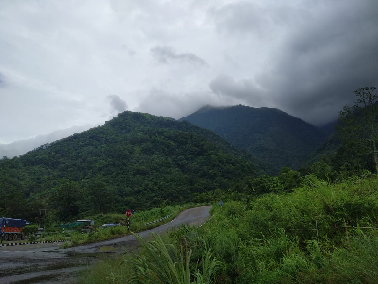
Dima Hasao district is one of two autonomous hill districts of Assam. The district headquarters Haflong is the only hill station in the state.
"Dima Hasao" means "Dimasa Hills" in the Dimasa language.
From c. 1500, Dima Hasao was part of the Dimasa Kingdom (or Kachar kingdom), with its capital at Maibang and Dimapur. As per Ahom Buranji, the kingdom stretched from the Kopili river in present-day Nagaon district to the Dhansiri river in present-day Golaghat district. This included parts of Cachar and North Cachar (Dima Hasao), the districts of Hojai, Nagaon, Golaghat and Karbi Anglong of Assam and Dimapur district, in Nagaland.
In the colonial period, Khaspur in present-day Cachar district was the administrative centre. However an internal schism led to the division of the old Kachar Kingdom into two parts. The last Dimasa king, Govinda Chandra Hasnusa, assigned Kashi Chandra the hilly tract of Kachar (i.e. the area between Mahur river and the Naga Hills in the south, the Doyang river on the west, the Dhansiri River on the east and Jamuna river in the north.) for administrative purposes. Soon the latter declared his independence over the hilly portion. That led to the treacherous murder of Kashi Chandra by Raja Govinda Chandra Hasnusa.[citation needed] Incensed, the son of Kashi Chandra, Tularam Senapati, incessantly created political turbulence, asserting his sovereignty over hilly portion of Kachar Kingdom. Finally, with British assistance, Tularam succeeded in carving out his own territory from Kachar Kingdom. David Scott, agent to the British Raj in 1829 made an arrangement to recognise Tularam as the ruler of hilly tract of Kachar. In 1850, Tularam died and the frequent Angami raids and a grave incident at Semkhor village paved the ground to extend British influence over Tularam's territory. In 1852, his territory was annexed and made part of the Nowgong district of British Assam as a subdivision, with Asalu as its headquarter.
In 1866, this sub-division was abolished and apportioned into three parts among the Cachar, Naga Hills district, and Nowgong district. The present area of the Dima Hasao district was included in the old Cachar district. In 1880, this portion was constituted into a sub-division with headquarters at Gunjung under Cachar district. This headquarters was shifted to Haflong in 1895. Since then, Haflong continued to be the headquarters till 1951.
On 17 November 1951, United Mikir and North Cachar Hills District was created with area occupying present-day Dima Hasao district, Karbi Anglong and West Karbi Anglong district. On 2 February 1970, the government declared an independent administrative district, viz. North Cachar Hills District with the geographical boundary of present-day Dimapur Hasao district. On 30 March 2010, the district was further renamed to Dima Hasao district.
The district headquarters are located at Haflong. Dima Hasao district occupies an area of 4,888 square kilometres (1,887 sq mi), It is the second-largest district of Assam after Karbi Anglong. Dima Hasao District is surrounded by Karbi Anglong district and Nagaland on the northeast, Manipur on the east, Hojai District to the north, West Karbi Anglong district on the northwest, Meghalaya on the west and Cachar district in the south.
Hub AI
Dima Hasao district AI simulator
(@Dima Hasao district_simulator)
Dima Hasao district
Dima Hasao district (/ˈdɪmə həˈsaʊ/), is an administrative district in the state of Assam, India. As of 2011, it is the least populous district of Assam.
Dima Hasao district is one of two autonomous hill districts of Assam. The district headquarters Haflong is the only hill station in the state.
"Dima Hasao" means "Dimasa Hills" in the Dimasa language.
From c. 1500, Dima Hasao was part of the Dimasa Kingdom (or Kachar kingdom), with its capital at Maibang and Dimapur. As per Ahom Buranji, the kingdom stretched from the Kopili river in present-day Nagaon district to the Dhansiri river in present-day Golaghat district. This included parts of Cachar and North Cachar (Dima Hasao), the districts of Hojai, Nagaon, Golaghat and Karbi Anglong of Assam and Dimapur district, in Nagaland.
In the colonial period, Khaspur in present-day Cachar district was the administrative centre. However an internal schism led to the division of the old Kachar Kingdom into two parts. The last Dimasa king, Govinda Chandra Hasnusa, assigned Kashi Chandra the hilly tract of Kachar (i.e. the area between Mahur river and the Naga Hills in the south, the Doyang river on the west, the Dhansiri River on the east and Jamuna river in the north.) for administrative purposes. Soon the latter declared his independence over the hilly portion. That led to the treacherous murder of Kashi Chandra by Raja Govinda Chandra Hasnusa.[citation needed] Incensed, the son of Kashi Chandra, Tularam Senapati, incessantly created political turbulence, asserting his sovereignty over hilly portion of Kachar Kingdom. Finally, with British assistance, Tularam succeeded in carving out his own territory from Kachar Kingdom. David Scott, agent to the British Raj in 1829 made an arrangement to recognise Tularam as the ruler of hilly tract of Kachar. In 1850, Tularam died and the frequent Angami raids and a grave incident at Semkhor village paved the ground to extend British influence over Tularam's territory. In 1852, his territory was annexed and made part of the Nowgong district of British Assam as a subdivision, with Asalu as its headquarter.
In 1866, this sub-division was abolished and apportioned into three parts among the Cachar, Naga Hills district, and Nowgong district. The present area of the Dima Hasao district was included in the old Cachar district. In 1880, this portion was constituted into a sub-division with headquarters at Gunjung under Cachar district. This headquarters was shifted to Haflong in 1895. Since then, Haflong continued to be the headquarters till 1951.
On 17 November 1951, United Mikir and North Cachar Hills District was created with area occupying present-day Dima Hasao district, Karbi Anglong and West Karbi Anglong district. On 2 February 1970, the government declared an independent administrative district, viz. North Cachar Hills District with the geographical boundary of present-day Dimapur Hasao district. On 30 March 2010, the district was further renamed to Dima Hasao district.
The district headquarters are located at Haflong. Dima Hasao district occupies an area of 4,888 square kilometres (1,887 sq mi), It is the second-largest district of Assam after Karbi Anglong. Dima Hasao District is surrounded by Karbi Anglong district and Nagaland on the northeast, Manipur on the east, Hojai District to the north, West Karbi Anglong district on the northwest, Meghalaya on the west and Cachar district in the south.
Recent media