
Recent from talks
Geography of Madagascar
Knowledge base stats:
Talk channels stats:
Members stats:
Geography of Madagascar
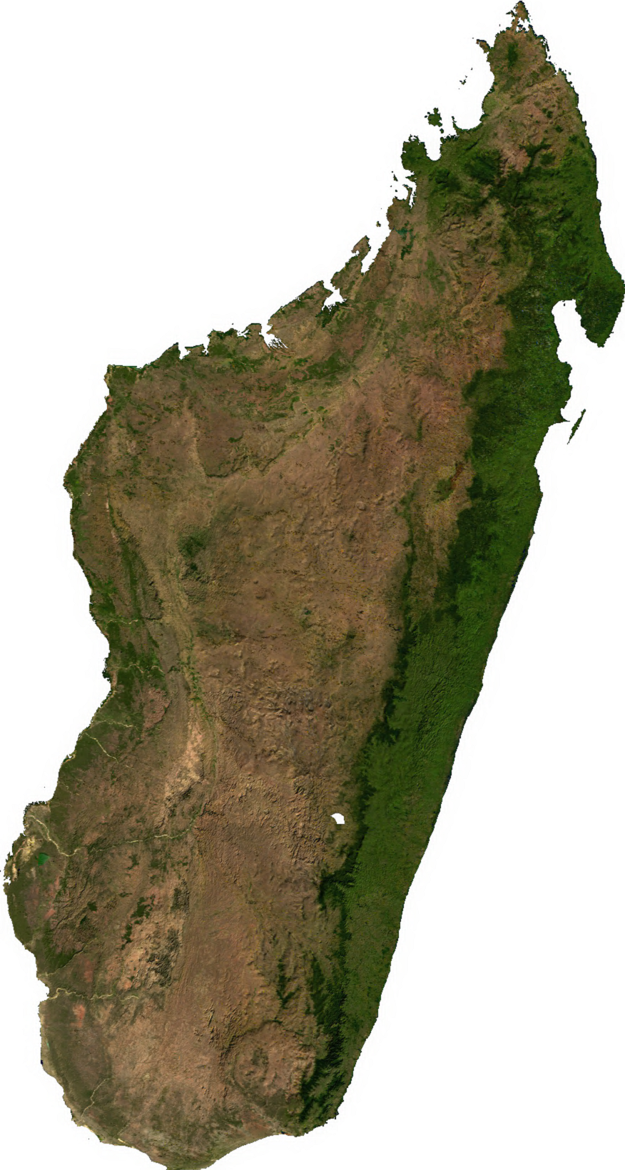
Madagascar is a large island in the Indian Ocean located 400 kilometres (250 mi) off the eastern coast of Southern Africa, east of Mozambique. It has a total area of 587,040 square kilometres (226,660 sq mi) with 581,540 square kilometres (224,530 sq mi) of land and 6,900 square kilometres (2,700 sq mi) of water. Madagascar is the fourth-largest island in the world. The highest point is Maromokotro, in the Tsaratanana Massif region in the north of the island, at 2,876 metres (9,436 ft).
The Republic of Madagascar is the second-largest island country in the world. Its capital Antananarivo is in the Central Highlands near the centre of the island. It has the 25th largest exclusive economic zone of 1,225,259 km2 (473,075 sq mi).
Madagascar can be divided into five general geographical regions: the east coast, the Tsaratanana Massif, the Central Highlands, the west coast, and the southwest. The highest elevations parallel the east coast. The total size is 587,040 square kilometres (226,660 sq mi), which makes it the world's second largest island country.
The east coast consists of a narrow band of lowlands about fifty kilometres (31 mi) wide, formed from the sedimentation of alluvial soils, and an intermediate zone composed of steep bluffs alternating with ravines bordering an escarpment of about 500 metres (1,640 ft) in elevation, which gives access to the Central Highlands. The coastal region runs roughly from north of Baie d'Antongil, the most prominent feature on the Masoala Peninsula, to the far north of the island. The coastline is straight, with the exception of a bay, offering less in the way of natural harbors than the west coast.
The Canal des Pangalanes, an 800-kilometre-long (497 mi) lagoon formed naturally by the washing of sand up on the island by the Indian Ocean currents and by the silting of rivers, is a feature of the coast; it has been used both as a means of transportation up and down the coast and as a fishing area. The beach slopes steeply into deep water. The east coast is considered dangerous for swimmers and sailors because of the large number of sharks that frequent the shoreline.
The Tsaratanana Massif region at the north end of the island contains Maromokotro, the highest point on the island at 2,880 metres (9,449 ft). Further north is the Montagne d'Ambre (Ambohitra), which is of volcanic origin. The coastline is deeply indented; two prominent features are the natural harbor at Antsiranana (Diego Suárez), just south of the Cap d'Ambre (Tanjon' i Bobaomby), and the large island of Nosy Be to the west. The mountainous topography of the Tsaratanana Massif limits the potential of the port at Antsiranana by impeding the flow of traffic from other parts of the island. They are a focus for big wall climbing.
The Central Highlands, which range from 800 to 1,800 m (2,625 to 5,906 ft) in elevation, contain a wide variety of topographies: rounded and eroded hills, massive granite outcrops, extinct volcanoes, eroded peneplains, and alluvial plains and marshes, which have been converted into irrigated rice fields. The Central Highlands extend from the Tsaratanana Massif in the north to the Ivakoany Massif in the south. They are defined rather clearly by the escarpments along the east coast, and they slope gently to the west coast. The Central Highlands include the Anjafy High Plateaus; the volcanic formations of Itasy (Lake Itasy is in a volcanic crater) and the Ankaratra Massif, reaching a height of 2,643 m (8,671 ft). The Isalo Ruiniform Massif lies between the central highlands and the west coast.
Antananarivo, the national capital, is located in the northern portion of the Central Highlands at 1,276 m (4,186 ft) above sea level. A prominent feature of the Central Highlands is a rift valley running north to south, located east of Antananarivo and including Lake Alaotra, the largest body of water on the island. The lake is located 761 m (2,497 ft) above sea level and is bordered by two cliffs, rising 701 m (2,300 ft) to the west and 488 m (1,601 ft) to the east, which form the walls of a valley. This region has experienced geological subsidence, and earth tremors are frequent.
Hub AI
Geography of Madagascar AI simulator
(@Geography of Madagascar_simulator)
Geography of Madagascar
Madagascar is a large island in the Indian Ocean located 400 kilometres (250 mi) off the eastern coast of Southern Africa, east of Mozambique. It has a total area of 587,040 square kilometres (226,660 sq mi) with 581,540 square kilometres (224,530 sq mi) of land and 6,900 square kilometres (2,700 sq mi) of water. Madagascar is the fourth-largest island in the world. The highest point is Maromokotro, in the Tsaratanana Massif region in the north of the island, at 2,876 metres (9,436 ft).
The Republic of Madagascar is the second-largest island country in the world. Its capital Antananarivo is in the Central Highlands near the centre of the island. It has the 25th largest exclusive economic zone of 1,225,259 km2 (473,075 sq mi).
Madagascar can be divided into five general geographical regions: the east coast, the Tsaratanana Massif, the Central Highlands, the west coast, and the southwest. The highest elevations parallel the east coast. The total size is 587,040 square kilometres (226,660 sq mi), which makes it the world's second largest island country.
The east coast consists of a narrow band of lowlands about fifty kilometres (31 mi) wide, formed from the sedimentation of alluvial soils, and an intermediate zone composed of steep bluffs alternating with ravines bordering an escarpment of about 500 metres (1,640 ft) in elevation, which gives access to the Central Highlands. The coastal region runs roughly from north of Baie d'Antongil, the most prominent feature on the Masoala Peninsula, to the far north of the island. The coastline is straight, with the exception of a bay, offering less in the way of natural harbors than the west coast.
The Canal des Pangalanes, an 800-kilometre-long (497 mi) lagoon formed naturally by the washing of sand up on the island by the Indian Ocean currents and by the silting of rivers, is a feature of the coast; it has been used both as a means of transportation up and down the coast and as a fishing area. The beach slopes steeply into deep water. The east coast is considered dangerous for swimmers and sailors because of the large number of sharks that frequent the shoreline.
The Tsaratanana Massif region at the north end of the island contains Maromokotro, the highest point on the island at 2,880 metres (9,449 ft). Further north is the Montagne d'Ambre (Ambohitra), which is of volcanic origin. The coastline is deeply indented; two prominent features are the natural harbor at Antsiranana (Diego Suárez), just south of the Cap d'Ambre (Tanjon' i Bobaomby), and the large island of Nosy Be to the west. The mountainous topography of the Tsaratanana Massif limits the potential of the port at Antsiranana by impeding the flow of traffic from other parts of the island. They are a focus for big wall climbing.
The Central Highlands, which range from 800 to 1,800 m (2,625 to 5,906 ft) in elevation, contain a wide variety of topographies: rounded and eroded hills, massive granite outcrops, extinct volcanoes, eroded peneplains, and alluvial plains and marshes, which have been converted into irrigated rice fields. The Central Highlands extend from the Tsaratanana Massif in the north to the Ivakoany Massif in the south. They are defined rather clearly by the escarpments along the east coast, and they slope gently to the west coast. The Central Highlands include the Anjafy High Plateaus; the volcanic formations of Itasy (Lake Itasy is in a volcanic crater) and the Ankaratra Massif, reaching a height of 2,643 m (8,671 ft). The Isalo Ruiniform Massif lies between the central highlands and the west coast.
Antananarivo, the national capital, is located in the northern portion of the Central Highlands at 1,276 m (4,186 ft) above sea level. A prominent feature of the Central Highlands is a rift valley running north to south, located east of Antananarivo and including Lake Alaotra, the largest body of water on the island. The lake is located 761 m (2,497 ft) above sea level and is bordered by two cliffs, rising 701 m (2,300 ft) to the west and 488 m (1,601 ft) to the east, which form the walls of a valley. This region has experienced geological subsidence, and earth tremors are frequent.
Recent media