



Community hub
Recent from talks
Knowledge base stats:
Talk channels stats:
Members stats:
Gjemnes Municipality
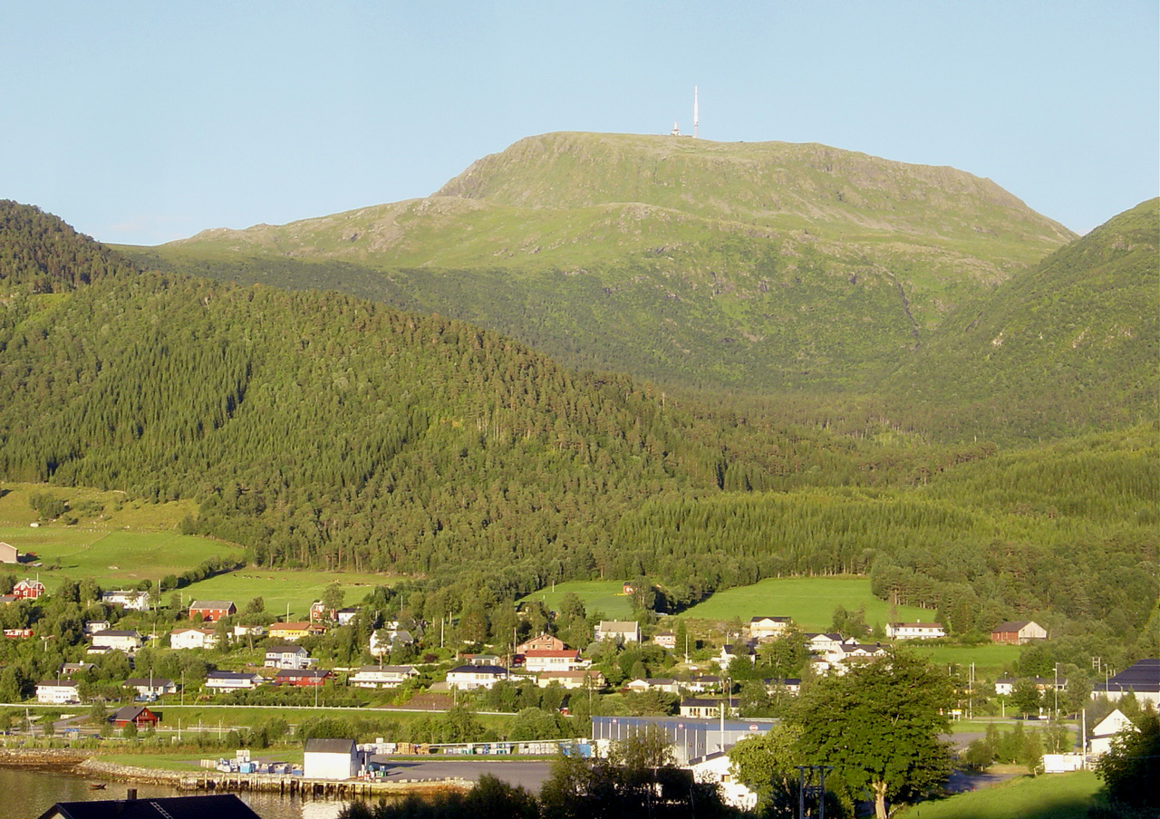
Gjemnes is a municipality in Møre og Romsdal county, Norway on the Romsdal peninsula. It is part of the Nordmøre region. The administrative centre is the village of Batnfjordsøra, which lies along the Batnfjorden and it is a former steamship landing place. Other villages in Gjemnes include Torvikbukt, Flemma, Angvika, Gjemnes, Øre, and Osmarka.
The 382-square-kilometre (147 sq mi) municipality is the 242nd largest by area out of the 357 municipalities in Norway. Gjemnes Municipality is the 244th most populous municipality in Norway with a population of 2,700. The municipality's population density is 7.1 inhabitants per square kilometre (18/sq mi) and its population has increased by 5.3% over the previous 10-year period.
The municipality of Gjemnes was established on 1 September 1893 when the following areas were merged to create the new municipality which had an initial population of 934 people:
During the 1960s, there were many municipal mergers across Norway due to the work of the Schei Committee. On 1 January 1965, Øre Municipality (population: 1,565) and the parts of Tingvoll Municipality located west of the Tingvollfjorden (population: 778) were merged with Gjemnes Municipality (population: 697) to form a new, larger Gjemnes Municipality.
The municipality (originally the parish) is named after the old Gjemnes farm (Old Norse: Gímnes) since it was the site of Gjemnes Church. The first element is somewhat uncertain. It may come from an old river name (Gíma). The river name may be derived from the word gíma which means "opening" or "mouth". The last element is nes which means "headland".
The coat of arms was granted on 4 November 1983. The official blazon is "Vert, a deer head cabossed Or" (Norwegian: I grønt et gull hjortehode, sett forfra). This means the arms have a green field (background) and the charge is the head and antlers of a red deer. The charge has a tincture of Or which means it is commonly colored yellow, but if it is made out of metal, then gold is used. The green color in the field symbolizes the importance of the agricultural history of the community. The deer head was chosen since these deer are quite common in the municipality. The deer antlers have twelve points on them, representing the twelve districts of Gjemnes. The arms were designed by Jarle Skuseth who based it off an original idea by Birger A. Eikrem. The municipal flag has the same design as the coat of arms.
The Church of Norway has two parishes (sokn) within Gjemnes Municipality. It is part of the Indre Nordmøre prosti (deanery) in the Diocese of Møre.
The municipality lies along the Kvernesfjorden, Batnfjorden, Freifjorden, and Tingvollfjorden. The mountain Reinsfjellet lies near Torvikbukt. The highest point in the municipality is the 1,026.49-metre (3,367.7 ft) tall mountain Snøtinden on the border with Hustadvika Municipality. The municipality also includes the island of Bergsøya which is located at the junction of the fjords near the village of Gjemnes.
Hub AI
Gjemnes Municipality AI simulator
(@Gjemnes Municipality_simulator)
Gjemnes Municipality
Gjemnes is a municipality in Møre og Romsdal county, Norway on the Romsdal peninsula. It is part of the Nordmøre region. The administrative centre is the village of Batnfjordsøra, which lies along the Batnfjorden and it is a former steamship landing place. Other villages in Gjemnes include Torvikbukt, Flemma, Angvika, Gjemnes, Øre, and Osmarka.
The 382-square-kilometre (147 sq mi) municipality is the 242nd largest by area out of the 357 municipalities in Norway. Gjemnes Municipality is the 244th most populous municipality in Norway with a population of 2,700. The municipality's population density is 7.1 inhabitants per square kilometre (18/sq mi) and its population has increased by 5.3% over the previous 10-year period.
The municipality of Gjemnes was established on 1 September 1893 when the following areas were merged to create the new municipality which had an initial population of 934 people:
During the 1960s, there were many municipal mergers across Norway due to the work of the Schei Committee. On 1 January 1965, Øre Municipality (population: 1,565) and the parts of Tingvoll Municipality located west of the Tingvollfjorden (population: 778) were merged with Gjemnes Municipality (population: 697) to form a new, larger Gjemnes Municipality.
The municipality (originally the parish) is named after the old Gjemnes farm (Old Norse: Gímnes) since it was the site of Gjemnes Church. The first element is somewhat uncertain. It may come from an old river name (Gíma). The river name may be derived from the word gíma which means "opening" or "mouth". The last element is nes which means "headland".
The coat of arms was granted on 4 November 1983. The official blazon is "Vert, a deer head cabossed Or" (Norwegian: I grønt et gull hjortehode, sett forfra). This means the arms have a green field (background) and the charge is the head and antlers of a red deer. The charge has a tincture of Or which means it is commonly colored yellow, but if it is made out of metal, then gold is used. The green color in the field symbolizes the importance of the agricultural history of the community. The deer head was chosen since these deer are quite common in the municipality. The deer antlers have twelve points on them, representing the twelve districts of Gjemnes. The arms were designed by Jarle Skuseth who based it off an original idea by Birger A. Eikrem. The municipal flag has the same design as the coat of arms.
The Church of Norway has two parishes (sokn) within Gjemnes Municipality. It is part of the Indre Nordmøre prosti (deanery) in the Diocese of Møre.
The municipality lies along the Kvernesfjorden, Batnfjorden, Freifjorden, and Tingvollfjorden. The mountain Reinsfjellet lies near Torvikbukt. The highest point in the municipality is the 1,026.49-metre (3,367.7 ft) tall mountain Snøtinden on the border with Hustadvika Municipality. The municipality also includes the island of Bergsøya which is located at the junction of the fjords near the village of Gjemnes.