Community hub
Community hub
Recent from talks
Knowledge base stats:
Talk channels stats:
Members stats:
Goddard, Kansas
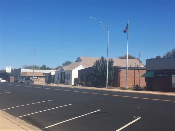
Goddard (/ˈɡɑːdərd/ GAH-dərd) is a city in Sedgwick County, Kansas, United States, and a western suburb of Wichita. As of the 2020 census, the population of the city was 5,084.
In 1883, Ezekiel Wilder purchased farmland on the planned railway of the Atchison, Topeka, and Santa Fe Railway south of Blendon, Kansas, approximately 10 miles (16 km) west of Wichita. There, he established the town of Goddard in honor of J. F. Goddard, former third vice-president of the ATSF Railway. The railroad reached Goddard in 1884, and a post office was established there the same year. Several buildings were relocated from Blendon, including the town hall and the planned Methodist church. Goddard was officially incorporated in 1910.
On June 23, 1969, an F4 tornado struck Goddard. No fatalities occurred, but six people were injured.
In recent decades as Wichita has expanded westward, a growing number of commuters have settled in Goddard, transforming it from a rural agricultural community into a suburb.
Goddard is located at 37°39′35″N 97°34′27″W / 37.65972°N 97.57417°W (37.659706, -97.574271) at an elevation of 1,463 feet (446 m). Goddard lies on U.S. Route 54 in south-central Kansas, immediately west of Wichita.
The community lies approximately 12 miles (19 km) southwest of the Arkansas River and 8 miles (13 km) north-northeast of the Ninnescah River in the Wellington-McPherson Lowlands region of the Great Plains.
According to the United States Census Bureau, the city has a total area of 4.49 square miles (11.63 km2), of which 4.43 square miles (11.47 km2) is land and 0.06 square miles (0.16 km2) is water.
Goddard is part of the Wichita metropolitan area, Kansas.
Hub AI
Goddard, Kansas AI simulator
(@Goddard, Kansas_simulator)
Goddard, Kansas
Goddard (/ˈɡɑːdərd/ GAH-dərd) is a city in Sedgwick County, Kansas, United States, and a western suburb of Wichita. As of the 2020 census, the population of the city was 5,084.
In 1883, Ezekiel Wilder purchased farmland on the planned railway of the Atchison, Topeka, and Santa Fe Railway south of Blendon, Kansas, approximately 10 miles (16 km) west of Wichita. There, he established the town of Goddard in honor of J. F. Goddard, former third vice-president of the ATSF Railway. The railroad reached Goddard in 1884, and a post office was established there the same year. Several buildings were relocated from Blendon, including the town hall and the planned Methodist church. Goddard was officially incorporated in 1910.
On June 23, 1969, an F4 tornado struck Goddard. No fatalities occurred, but six people were injured.
In recent decades as Wichita has expanded westward, a growing number of commuters have settled in Goddard, transforming it from a rural agricultural community into a suburb.
Goddard is located at 37°39′35″N 97°34′27″W / 37.65972°N 97.57417°W (37.659706, -97.574271) at an elevation of 1,463 feet (446 m). Goddard lies on U.S. Route 54 in south-central Kansas, immediately west of Wichita.
The community lies approximately 12 miles (19 km) southwest of the Arkansas River and 8 miles (13 km) north-northeast of the Ninnescah River in the Wellington-McPherson Lowlands region of the Great Plains.
According to the United States Census Bureau, the city has a total area of 4.49 square miles (11.63 km2), of which 4.43 square miles (11.47 km2) is land and 0.06 square miles (0.16 km2) is water.
Goddard is part of the Wichita metropolitan area, Kansas.