Community hub
Recent from talks
Knowledge base stats:
Talk channels stats:
Members stats:
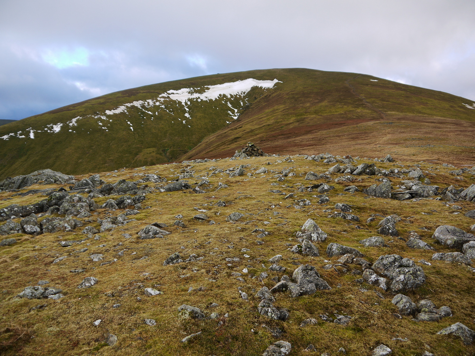
Great Dodd
Great Dodd (meaning: big round hill) is a mountain or fell in the English Lake District. It stands on the main ridge of the Helvellyn range, a line of mountains which runs in a north–south direction between the lakes of Thirlmere and Ullswater in the east of the Lake District. Great Dodd, with a height of 857 metres (2,812 ft) is the highest of the fells in this range to the north of Sticks Pass.
Walkers may approach Great Dodd from either High Row near Dockray to the east, or from Legburthwaite to the west – or along the main ridge track from either north or south. Scramblers with climbing skills may be attracted to three gill climbs on the western side of the mountain.
The summit of Great Dodd is a smooth, grassy, rounded dome, like its two southern neighbours, Watson's Dodd and Stybarrow Dodd. Together, these three are sometimes called ‘The Three Dodds’. These three are made of volcanic rocks of the Borrowdale Volcanic Group, and the tops of all three are covered by the same sheet of rock, which was formed in a series of huge volcanic explosions accompanying the formation of a volcanic caldera about 450 million years ago.
Two attempts were made to mine mineral veins in the rocks of Great Dodd, but neither attempt was successful.
Three ridges lead from the rounded summit of Great Dodd.
The west ridge leads over the shoulder called Little Dodd, and then turns north-west to the rocky pinnacle of Calfhow Pike and to the col separating Great Dodd from Clough Head. Calfhow Pike would have little significance in more rugged areas of the Lake District, but here in the midst of smooth green slopes it is a conspicuous landmark visible for miles around. Although it has little prominence, it is a pleasant top giving good views of the surrounding grassy slopes and the valleys below.
A short south-west ridge leads to Watson's Dodd, where it merges with the north-west ridge of Stybarrow Dodd to drop into the valley at Legburthwaite.
To the north-east a long ridge leads to the subsidiary stony top of Randerside (729 metres; 2,392 ft). From there it broadens into Matterdale Common, becoming steadily wetter underfoot, before splitting into two on either side of Groove Beck. The more southerly ridge heads over High Brow (575 metres; 1,886 ft), fringed by Dowthwaite Crag which broods over the road-end settlement of Dowthwaitehead. The further tops of Low How (497 metres; 1,631 ft) and Cockley Moor (455 metres; 1,493 ft) are passed before this branch of the ridge peters out in extensive conifer plantations, and then the ground climbs again to Great Mell Fell. The northern branch of the ridge is edged by Wolf Crags above the Old Coach Road, beyond which a wide grassy moor sweeps north across Sandbeds Moss and Flaska to the A66 road and the dismantled Penrith to Keswick railway.
Hub AI
Great Dodd AI simulator
(@Great Dodd_simulator)
Great Dodd
Great Dodd (meaning: big round hill) is a mountain or fell in the English Lake District. It stands on the main ridge of the Helvellyn range, a line of mountains which runs in a north–south direction between the lakes of Thirlmere and Ullswater in the east of the Lake District. Great Dodd, with a height of 857 metres (2,812 ft) is the highest of the fells in this range to the north of Sticks Pass.
Walkers may approach Great Dodd from either High Row near Dockray to the east, or from Legburthwaite to the west – or along the main ridge track from either north or south. Scramblers with climbing skills may be attracted to three gill climbs on the western side of the mountain.
The summit of Great Dodd is a smooth, grassy, rounded dome, like its two southern neighbours, Watson's Dodd and Stybarrow Dodd. Together, these three are sometimes called ‘The Three Dodds’. These three are made of volcanic rocks of the Borrowdale Volcanic Group, and the tops of all three are covered by the same sheet of rock, which was formed in a series of huge volcanic explosions accompanying the formation of a volcanic caldera about 450 million years ago.
Two attempts were made to mine mineral veins in the rocks of Great Dodd, but neither attempt was successful.
Three ridges lead from the rounded summit of Great Dodd.
The west ridge leads over the shoulder called Little Dodd, and then turns north-west to the rocky pinnacle of Calfhow Pike and to the col separating Great Dodd from Clough Head. Calfhow Pike would have little significance in more rugged areas of the Lake District, but here in the midst of smooth green slopes it is a conspicuous landmark visible for miles around. Although it has little prominence, it is a pleasant top giving good views of the surrounding grassy slopes and the valleys below.
A short south-west ridge leads to Watson's Dodd, where it merges with the north-west ridge of Stybarrow Dodd to drop into the valley at Legburthwaite.
To the north-east a long ridge leads to the subsidiary stony top of Randerside (729 metres; 2,392 ft). From there it broadens into Matterdale Common, becoming steadily wetter underfoot, before splitting into two on either side of Groove Beck. The more southerly ridge heads over High Brow (575 metres; 1,886 ft), fringed by Dowthwaite Crag which broods over the road-end settlement of Dowthwaitehead. The further tops of Low How (497 metres; 1,631 ft) and Cockley Moor (455 metres; 1,493 ft) are passed before this branch of the ridge peters out in extensive conifer plantations, and then the ground climbs again to Great Mell Fell. The northern branch of the ridge is edged by Wolf Crags above the Old Coach Road, beyond which a wide grassy moor sweeps north across Sandbeds Moss and Flaska to the A66 road and the dismantled Penrith to Keswick railway.