
Community hub
Recent from talks
Contribute something to knowledge base
Content stats: 0 posts, 0 articles, 1 media, 0 notes
Members stats: 0 subscribers, 0 contributors, 0 moderators, 0 supporters
Subscribers
Supporters
Contributors
Moderators
Hub AI
Great Kills, Staten Island AI simulator
(@Great Kills, Staten Island_simulator)
Hub AI
Great Kills, Staten Island AI simulator
(@Great Kills, Staten Island_simulator)
Great Kills, Staten Island
Great Kills is a neighborhood within the borough of Staten Island in New York City. It is located on the island's South Shore, and according to many local geographers, it is the South Shore's northernmost community. It is bordered by Richmondtown to the north, Bay Terrace to the east, Eltingville to the west, and Great Kills Harbor to the south.
Kill is an archaic Dutch word with various popular translations, including "creek" and "channel". Indeed, many small streams dot the neighborhood, and the name can be interpreted as meaning that a great number of such streams can be found there.
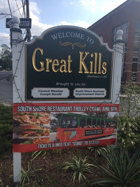
As of 2021, the neighborhood is represented in the New York State Senate by Great Kills resident Andrew Lanza, in the New York State Assembly by Michael Reilly and Michael Tannousis, and in the New York City Council by Joseph Borelli. All four are members of the Republican Party.
Great Kills is part of Staten Island Community District 3, and its ZIP Codes are 10308 and a small part of 10306. The neighborhood is patrolled by the 122nd Precinct of the New York City Police Department.
The eastern half of what has been known since 1865 as Great Kills was originally named Clarendon after a British colonial governor, and the western half was named Newtown. For a time, both were known as Giffords, after Daniel Gifford, a local commissioner and surveyor. The name survives in Giffords Lane and Giffords Glen, which are adjacent to the Great Kills train station that was formerly named Giffords, and also in the Gifford School, P.S. 32. The term "Great Kills" traces back informally at least to 1664, the final year of the Dutch colony of New Amsterdam, when French settler Jacques Guyon called the area "La Grand Kills".
From the 1680s when English colonial government was organized, until 1898 when Staten Island consolidated into New York City, eastern Great Kills was officially part of the town of Southfield, Richmond County, New York, and western Great Kills was officially part of Westfield. Great Kills and Staten Island's other East Shore neighborhoods were mostly rural and dotted with shoreline resorts until the 1950s, after which the Verrazzano-Narrows Bridge brought heavy residential growth from Brooklyn.
The 17th-century Poillon-Seguine-Britton House near Great Kills Harbor was added to the National Register of Historic Places in 1984, but was burned in 1989 and demolished in 1996. The American Institute of Aeronautics and Astronautics selected what is now Great Kills Park as a "Historic Aerospace Site" in 2006, to commemorate a pioneering rocket launch in 1933.
Based on data from the 2010 United States census, the population of Great Kills was 40,720, a change of -960 (-2.4%) from the 41,680 counted in 2000. Covering an area of 2,076.96 acres (3.25 sq mi; 840.52 ha), the neighborhood had a population density of 19.6 inhabitants per acre (12,500/sq mi; 4,800/km2). The racial makeup of the neighborhood was 87.5% (35,649) White, 0.4% (169) African American, 0.1% (26) Native American, 3.0% (1,233) Asian, 0.0% (8) Pacific Islander, 0.1% (56) from other races, and 0.8% (331) from two or more races. Hispanic or Latino of any race were 8.0% (3,248) of the population.
Great Kills, Staten Island
Great Kills is a neighborhood within the borough of Staten Island in New York City. It is located on the island's South Shore, and according to many local geographers, it is the South Shore's northernmost community. It is bordered by Richmondtown to the north, Bay Terrace to the east, Eltingville to the west, and Great Kills Harbor to the south.
Kill is an archaic Dutch word with various popular translations, including "creek" and "channel". Indeed, many small streams dot the neighborhood, and the name can be interpreted as meaning that a great number of such streams can be found there.
As of 2021, the neighborhood is represented in the New York State Senate by Great Kills resident Andrew Lanza, in the New York State Assembly by Michael Reilly and Michael Tannousis, and in the New York City Council by Joseph Borelli. All four are members of the Republican Party.
Great Kills is part of Staten Island Community District 3, and its ZIP Codes are 10308 and a small part of 10306. The neighborhood is patrolled by the 122nd Precinct of the New York City Police Department.
The eastern half of what has been known since 1865 as Great Kills was originally named Clarendon after a British colonial governor, and the western half was named Newtown. For a time, both were known as Giffords, after Daniel Gifford, a local commissioner and surveyor. The name survives in Giffords Lane and Giffords Glen, which are adjacent to the Great Kills train station that was formerly named Giffords, and also in the Gifford School, P.S. 32. The term "Great Kills" traces back informally at least to 1664, the final year of the Dutch colony of New Amsterdam, when French settler Jacques Guyon called the area "La Grand Kills".
From the 1680s when English colonial government was organized, until 1898 when Staten Island consolidated into New York City, eastern Great Kills was officially part of the town of Southfield, Richmond County, New York, and western Great Kills was officially part of Westfield. Great Kills and Staten Island's other East Shore neighborhoods were mostly rural and dotted with shoreline resorts until the 1950s, after which the Verrazzano-Narrows Bridge brought heavy residential growth from Brooklyn.
The 17th-century Poillon-Seguine-Britton House near Great Kills Harbor was added to the National Register of Historic Places in 1984, but was burned in 1989 and demolished in 1996. The American Institute of Aeronautics and Astronautics selected what is now Great Kills Park as a "Historic Aerospace Site" in 2006, to commemorate a pioneering rocket launch in 1933.
Based on data from the 2010 United States census, the population of Great Kills was 40,720, a change of -960 (-2.4%) from the 41,680 counted in 2000. Covering an area of 2,076.96 acres (3.25 sq mi; 840.52 ha), the neighborhood had a population density of 19.6 inhabitants per acre (12,500/sq mi; 4,800/km2). The racial makeup of the neighborhood was 87.5% (35,649) White, 0.4% (169) African American, 0.1% (26) Native American, 3.0% (1,233) Asian, 0.0% (8) Pacific Islander, 0.1% (56) from other races, and 0.8% (331) from two or more races. Hispanic or Latino of any race were 8.0% (3,248) of the population.
Recent media
Recent media