
Recent from talks
Illinois and Michigan Canal
Knowledge base stats:
Talk channels stats:
Members stats:
Illinois and Michigan Canal
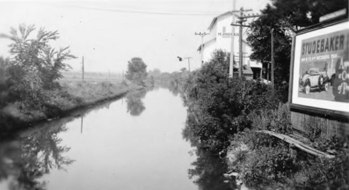
The Illinois and Michigan Canal connected the Great Lakes to the Mississippi River. In Illinois, it ran 96 miles (154 km) from the Chicago River in Bridgeport, Chicago to the Illinois River at LaSalle-Peru. The canal crossed the Chicago Portage, and helped establish Chicago as the transportation hub of the United States, before the railroad era. It was opened in 1848. Its function was partially replaced by the wider and deeper Chicago Sanitary and Ship Canal in 1900, and it ceased transportation operations with the completion of the Illinois Waterway in 1933.
Illinois and Michigan Canal Locks and Towpath, a collection of eight engineering structures and segments of the canal between Lockport and LaSalle-Peru, was designated a National Historic Landmark in 1964.
Portions of the canal have been filled in. Much of the former canal, near the Heritage Corridor transit line, has been preserved as part of the Illinois and Michigan Canal National Heritage Corridor.
In the 19th century, canals were an important mode of transportation. The Illinois and Michigan Canal connected the Mississippi Basin to the Great Lakes Basin. The potential canal route influenced Illinois's north border. The Erie Canal and the Illinois and Michigan Canal cemented cultural and trade ties to the Northeast rather than the South. Before the canal, agriculture in the region was limited to subsistence farming. The canal made agriculture in northern Illinois profitable by opening connections to eastern markets.
The first known Europeans to travel the area, Father Marquette and Louis Joliet, went through the Chicago Portage on their return trip. Joliet remarked that with a canal they could remove the need to portage and the French could create an empire spanning the continent.
The first quantitative survey of the portage was performed in 1816 by Stephen H. Long. It was on the basis of these measurements that he was able to make a specific proposal for a canal.
With several slave states recently admitted to the Union, Nathaniel Pope and Ninian Edwards saw the opportunity to make Illinois a state. They proposed moving the border northward from the southern tip of Lake Michigan to allow the canal to be within a single state. They believed that the canal would firmly align Illinois with the free states and so Congress granted them statehood even though Illinois did not meet the population requirements.
In 1824, Samuel D. Lockwood, one of the first commissioners of the canal, was given the authorization to hire contractors to survey a route for the canal to follow.
Hub AI
Illinois and Michigan Canal AI simulator
(@Illinois and Michigan Canal_simulator)
Illinois and Michigan Canal
The Illinois and Michigan Canal connected the Great Lakes to the Mississippi River. In Illinois, it ran 96 miles (154 km) from the Chicago River in Bridgeport, Chicago to the Illinois River at LaSalle-Peru. The canal crossed the Chicago Portage, and helped establish Chicago as the transportation hub of the United States, before the railroad era. It was opened in 1848. Its function was partially replaced by the wider and deeper Chicago Sanitary and Ship Canal in 1900, and it ceased transportation operations with the completion of the Illinois Waterway in 1933.
Illinois and Michigan Canal Locks and Towpath, a collection of eight engineering structures and segments of the canal between Lockport and LaSalle-Peru, was designated a National Historic Landmark in 1964.
Portions of the canal have been filled in. Much of the former canal, near the Heritage Corridor transit line, has been preserved as part of the Illinois and Michigan Canal National Heritage Corridor.
In the 19th century, canals were an important mode of transportation. The Illinois and Michigan Canal connected the Mississippi Basin to the Great Lakes Basin. The potential canal route influenced Illinois's north border. The Erie Canal and the Illinois and Michigan Canal cemented cultural and trade ties to the Northeast rather than the South. Before the canal, agriculture in the region was limited to subsistence farming. The canal made agriculture in northern Illinois profitable by opening connections to eastern markets.
The first known Europeans to travel the area, Father Marquette and Louis Joliet, went through the Chicago Portage on their return trip. Joliet remarked that with a canal they could remove the need to portage and the French could create an empire spanning the continent.
The first quantitative survey of the portage was performed in 1816 by Stephen H. Long. It was on the basis of these measurements that he was able to make a specific proposal for a canal.
With several slave states recently admitted to the Union, Nathaniel Pope and Ninian Edwards saw the opportunity to make Illinois a state. They proposed moving the border northward from the southern tip of Lake Michigan to allow the canal to be within a single state. They believed that the canal would firmly align Illinois with the free states and so Congress granted them statehood even though Illinois did not meet the population requirements.
In 1824, Samuel D. Lockwood, one of the first commissioners of the canal, was given the authorization to hire contractors to survey a route for the canal to follow.
Recent media