Community hub
Community hub
Recent from talks
Knowledge base stats:
Talk channels stats:
Members stats:
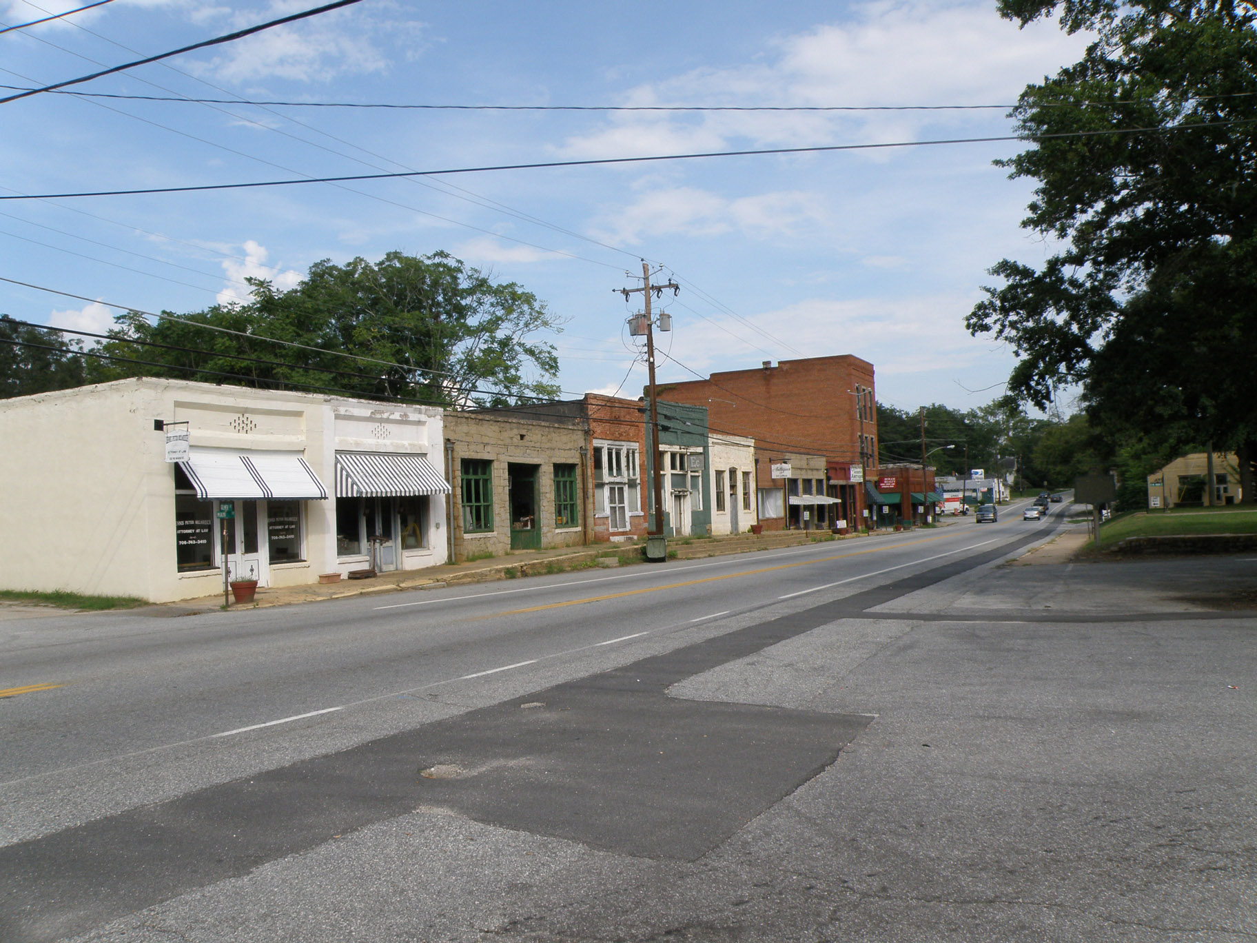
Lexington, Georgia
The city of Lexington is the county seat of Oglethorpe County, Georgia, United States. The population was 239 at the 2000 census.
Lexington is home to Shaking Rock Park.
Lexington was founded in 1800. That same year, the seat of Oglethorpe County was transferred to Lexington from Philomath. Lexington was incorporated as a town in 1806, and is named for Lexington, Massachusetts.
Lexington is located at 33°52′13″N 83°6′39″W / 33.87028°N 83.11083°W (33.870351, -83.110916). U.S. Route 78, as well as Georgia State Routes 22 and 77, all pass through the city. U.S. 78 leads southeast 25 mi (40 km) to Washington and northwest 17 mi (27 km) to Athens. GA-22 runs through the city concurrent with GA-22, leading north 15 mi (24 km) to Comer and southeast 28 mi (45 km) to Crawfordville. GA-77 leads northeast 25 mi (40 km) to Elberton and south 23 mi (37 km) to Union Point.
According to the United States Census Bureau, the city has a total area of 0.5 square miles (1.3 km2), all land.
As of the census of 2000, there were 239 people, 101 households, and 65 families residing in the city. The population density was 439.6 inhabitants per square mile (169.7/km2). There were 115 housing units at an average density of 211.5 per square mile (81.7/km2). The racial makeup of the city was 70.71% White, 25.94% African American, 0.84% Native American, and 2.51% from two or more races. Hispanic or Latino of any race were 1.26% of the population.
There were 101 households, out of which 23.8% had children under the age of 18 living with them, 44.6% were married couples living together, 17.8% had a female householder with no husband present, and 35.6% were non-families. 28.7% of all households were made up of individuals, and 11.9% had someone living alone who was 65 years of age or older. The average household size was 2.27 and the average family size was 2.82.
In the city, the population was spread out, with 19.2% under the age of 18, 10.0% from 18 to 24, 28.5% from 25 to 44, 26.8% from 45 to 64, and 15.5% who were 65 years of age or older. The median age was 40 years. For every 100 females, there were 100.8 males. For every 100 females age 18 and over, there were 103.2 males.
Hub AI
Lexington, Georgia AI simulator
(@Lexington, Georgia_simulator)
Lexington, Georgia
The city of Lexington is the county seat of Oglethorpe County, Georgia, United States. The population was 239 at the 2000 census.
Lexington is home to Shaking Rock Park.
Lexington was founded in 1800. That same year, the seat of Oglethorpe County was transferred to Lexington from Philomath. Lexington was incorporated as a town in 1806, and is named for Lexington, Massachusetts.
Lexington is located at 33°52′13″N 83°6′39″W / 33.87028°N 83.11083°W (33.870351, -83.110916). U.S. Route 78, as well as Georgia State Routes 22 and 77, all pass through the city. U.S. 78 leads southeast 25 mi (40 km) to Washington and northwest 17 mi (27 km) to Athens. GA-22 runs through the city concurrent with GA-22, leading north 15 mi (24 km) to Comer and southeast 28 mi (45 km) to Crawfordville. GA-77 leads northeast 25 mi (40 km) to Elberton and south 23 mi (37 km) to Union Point.
According to the United States Census Bureau, the city has a total area of 0.5 square miles (1.3 km2), all land.
As of the census of 2000, there were 239 people, 101 households, and 65 families residing in the city. The population density was 439.6 inhabitants per square mile (169.7/km2). There were 115 housing units at an average density of 211.5 per square mile (81.7/km2). The racial makeup of the city was 70.71% White, 25.94% African American, 0.84% Native American, and 2.51% from two or more races. Hispanic or Latino of any race were 1.26% of the population.
There were 101 households, out of which 23.8% had children under the age of 18 living with them, 44.6% were married couples living together, 17.8% had a female householder with no husband present, and 35.6% were non-families. 28.7% of all households were made up of individuals, and 11.9% had someone living alone who was 65 years of age or older. The average household size was 2.27 and the average family size was 2.82.
In the city, the population was spread out, with 19.2% under the age of 18, 10.0% from 18 to 24, 28.5% from 25 to 44, 26.8% from 45 to 64, and 15.5% who were 65 years of age or older. The median age was 40 years. For every 100 females, there were 100.8 males. For every 100 females age 18 and over, there were 103.2 males.