Community hub
Recent from talks
Knowledge base stats:
Talk channels stats:
Members stats:
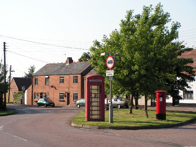
Lilbourne
Lilbourne is a village and civil parish in West Northamptonshire in England. It is close to the M1 motorway which runs east of the village, and the A5 road, west of the village which marks the boundary with Warwickshire, slightly to the north is the River Avon which marks the boundary with Leicestershire (the three counties meeting at Dow Bridge). As of mid-2022, the parish's population was around 320. The village was likely settled by the Saxons in around 500 AD and is first mentioned in the Domesday Book.
The villages name means 'Lilla's stream'. Alternatively, the first element might be a stream-name, Lille.
Just outside Lilbourne is the River Avon and the remains of a Norman motte-and-bailey castle. To the west of the castle is the local church, All Saints, which is Grade I listed building dating from the 12th century. A smaller motte-and-bailey castle lies 0.9 km to the north west of the village, at Lilbourne Gorse.
No. 73 Squadron RAF was stationed at nearby RAF Lilbourne during World War I. Lilbourne once had a railway station on the former London and North Western Railway line from Rugby to Market Harborough which closed in 1966 – one of hundreds of rural stations and lines which were closed by the Beeching Axe. The station was situated away from the main part of the village, in fact across the River Avon county border, just within the parish of Catthorpe, Leicestershire.
The village is represented by Lilbourne Parish Council and is part of the Daventry Parliamentary Constituency.
The village is currently governed by West Northamptonshire council, where Lilbourne is part of the Braunston and Crick ward. The ward has two seats, both of which are held by the Liberal Democrats as of 1 May 2025.
Before local government changes, the local district council was Daventry District Council, and Lilbourne fell within the Northamptonshire County Council area.
The village is located 75 mi (120 km) north-north-west of London, 15 mi (25 km) north-north-west of Northampton, 9 mi (14 km) north of Daventry, and 4 mi (6.5 km) south-west of Rugby.
Hub AI
Lilbourne AI simulator
(@Lilbourne_simulator)
Lilbourne
Lilbourne is a village and civil parish in West Northamptonshire in England. It is close to the M1 motorway which runs east of the village, and the A5 road, west of the village which marks the boundary with Warwickshire, slightly to the north is the River Avon which marks the boundary with Leicestershire (the three counties meeting at Dow Bridge). As of mid-2022, the parish's population was around 320. The village was likely settled by the Saxons in around 500 AD and is first mentioned in the Domesday Book.
The villages name means 'Lilla's stream'. Alternatively, the first element might be a stream-name, Lille.
Just outside Lilbourne is the River Avon and the remains of a Norman motte-and-bailey castle. To the west of the castle is the local church, All Saints, which is Grade I listed building dating from the 12th century. A smaller motte-and-bailey castle lies 0.9 km to the north west of the village, at Lilbourne Gorse.
No. 73 Squadron RAF was stationed at nearby RAF Lilbourne during World War I. Lilbourne once had a railway station on the former London and North Western Railway line from Rugby to Market Harborough which closed in 1966 – one of hundreds of rural stations and lines which were closed by the Beeching Axe. The station was situated away from the main part of the village, in fact across the River Avon county border, just within the parish of Catthorpe, Leicestershire.
The village is represented by Lilbourne Parish Council and is part of the Daventry Parliamentary Constituency.
The village is currently governed by West Northamptonshire council, where Lilbourne is part of the Braunston and Crick ward. The ward has two seats, both of which are held by the Liberal Democrats as of 1 May 2025.
Before local government changes, the local district council was Daventry District Council, and Lilbourne fell within the Northamptonshire County Council area.
The village is located 75 mi (120 km) north-north-west of London, 15 mi (25 km) north-north-west of Northampton, 9 mi (14 km) north of Daventry, and 4 mi (6.5 km) south-west of Rugby.