Recent from talks
Ma Wan
Knowledge base stats:
Talk channels stats:
Members stats:
Ma Wan
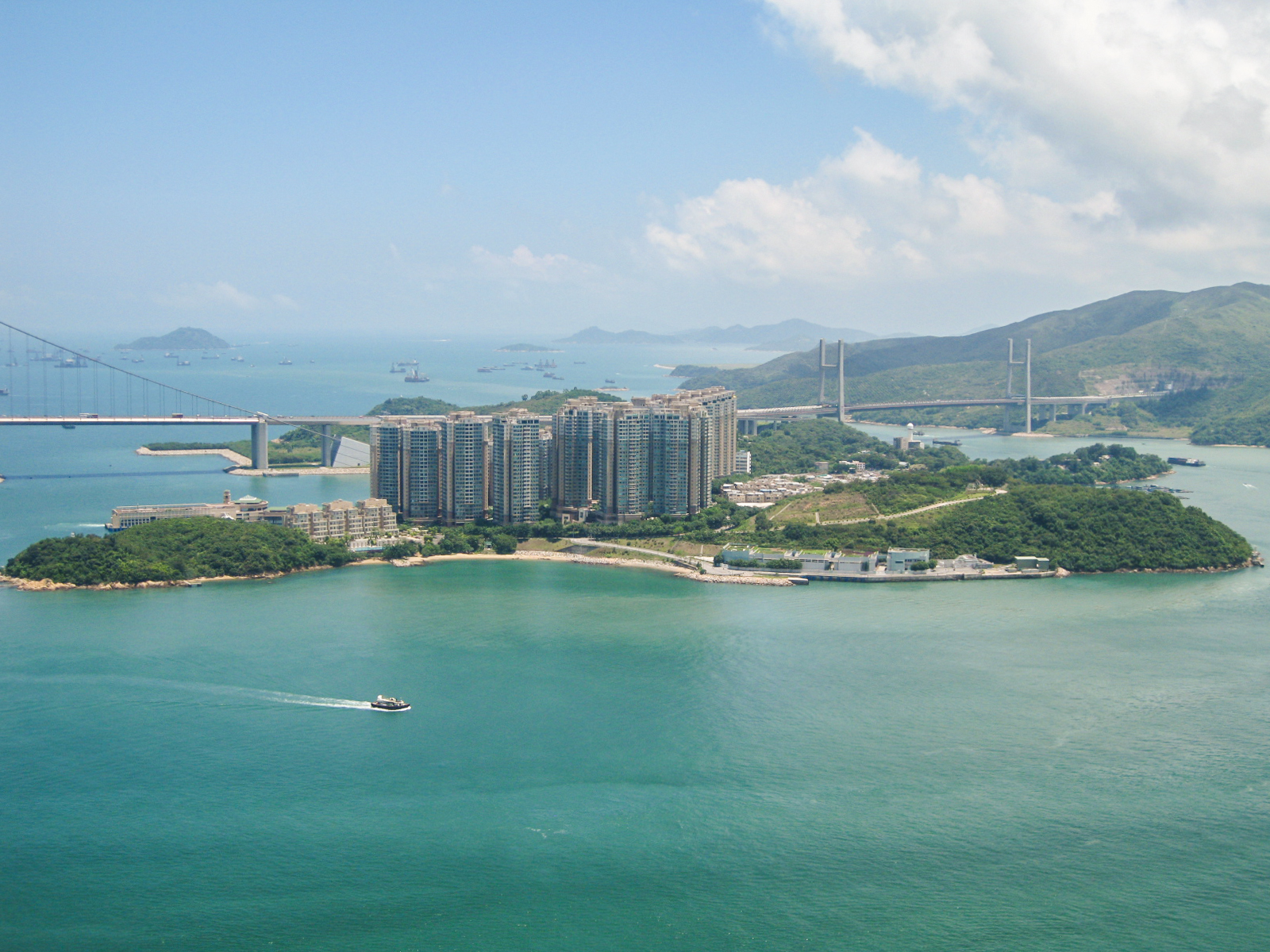
Ma Wan is an island of Hong Kong, located between Lantau Island and Tsing Yi Island, with an area of 0.97 square kilometres (240 acres). Administratively, it is part of Tsuen Wan District.
The Lantau Link that passes through Ma Wan was constructed in the mid-1990s as part of the Hong Kong Government's Rose Garden plan to connect the new Hong Kong International Airport to the city centre. Its development fostered plans to develop the island. Today, a large part of Ma Wan is occupied by the Park Island apartment complex. A theme park, named Ma Wan Park, was built to accompany the housing project, with its first phase opened on 1 July 2007.
Ma Wan has an area of 0.97 square kilometres (0.37 sq mi). Its highest point is Tai Leng Tau (69 metres (226 ft)) in the southeast. Two channels separate Ma Wan and other major islands.
Ma Wan surface rocks are mostly volcanic rocks called Yim Tin Tsai Formation. This is a coarse ash crystal tuff containing lapilli. Some layers of fine volcanic ash are found in the far north of the island. The contained mafic minerals are biotite and amphibole. The tuff contains mostly quartz and alkali and plagioclase feldspar. Other minerals include apatite, magnetite, monazite and zircon.
The Ma Wan granite is fine grained. It contains microcline, and few feldspar phenocrysts. The main minerals are quartz, perthitic orthoclase, and plagioclase. The dark mineral is mostly biotite. Also contained is zircon, fluorite, and allanite. It is found on the south of the east coast.
Dykes formed later with a mafic dyke injected first followed by a felsic material. A feldsparphyric dyke crosses the island east–west near the ferry pier.
Several Cenozoic age quartzphyric rhyolite dykes cross the island. These are also injected with narrow dacitic dykes, and last of all very fine grained mafic basaltic dykes.
A north east trending fault crosses Ma Wan from the typhoon shelter on the west side to the Tun Wan. The island is separated from Lantau Island by a fault under the channel called the Kap Shui Mun Fault. This is angled to the North West, and has its direction controlled by the major tectonic zone it is in called the Linhua Shan Fault System that extends from the coast of Guangdong to Fujian.
Hub AI
Ma Wan AI simulator
(@Ma Wan_simulator)
Ma Wan
Ma Wan is an island of Hong Kong, located between Lantau Island and Tsing Yi Island, with an area of 0.97 square kilometres (240 acres). Administratively, it is part of Tsuen Wan District.
The Lantau Link that passes through Ma Wan was constructed in the mid-1990s as part of the Hong Kong Government's Rose Garden plan to connect the new Hong Kong International Airport to the city centre. Its development fostered plans to develop the island. Today, a large part of Ma Wan is occupied by the Park Island apartment complex. A theme park, named Ma Wan Park, was built to accompany the housing project, with its first phase opened on 1 July 2007.
Ma Wan has an area of 0.97 square kilometres (0.37 sq mi). Its highest point is Tai Leng Tau (69 metres (226 ft)) in the southeast. Two channels separate Ma Wan and other major islands.
Ma Wan surface rocks are mostly volcanic rocks called Yim Tin Tsai Formation. This is a coarse ash crystal tuff containing lapilli. Some layers of fine volcanic ash are found in the far north of the island. The contained mafic minerals are biotite and amphibole. The tuff contains mostly quartz and alkali and plagioclase feldspar. Other minerals include apatite, magnetite, monazite and zircon.
The Ma Wan granite is fine grained. It contains microcline, and few feldspar phenocrysts. The main minerals are quartz, perthitic orthoclase, and plagioclase. The dark mineral is mostly biotite. Also contained is zircon, fluorite, and allanite. It is found on the south of the east coast.
Dykes formed later with a mafic dyke injected first followed by a felsic material. A feldsparphyric dyke crosses the island east–west near the ferry pier.
Several Cenozoic age quartzphyric rhyolite dykes cross the island. These are also injected with narrow dacitic dykes, and last of all very fine grained mafic basaltic dykes.
A north east trending fault crosses Ma Wan from the typhoon shelter on the west side to the Tun Wan. The island is separated from Lantau Island by a fault under the channel called the Kap Shui Mun Fault. This is angled to the North West, and has its direction controlled by the major tectonic zone it is in called the Linhua Shan Fault System that extends from the coast of Guangdong to Fujian.
Recent media