Community hub
Recent from talks
Knowledge base stats:
Talk channels stats:
Members stats:
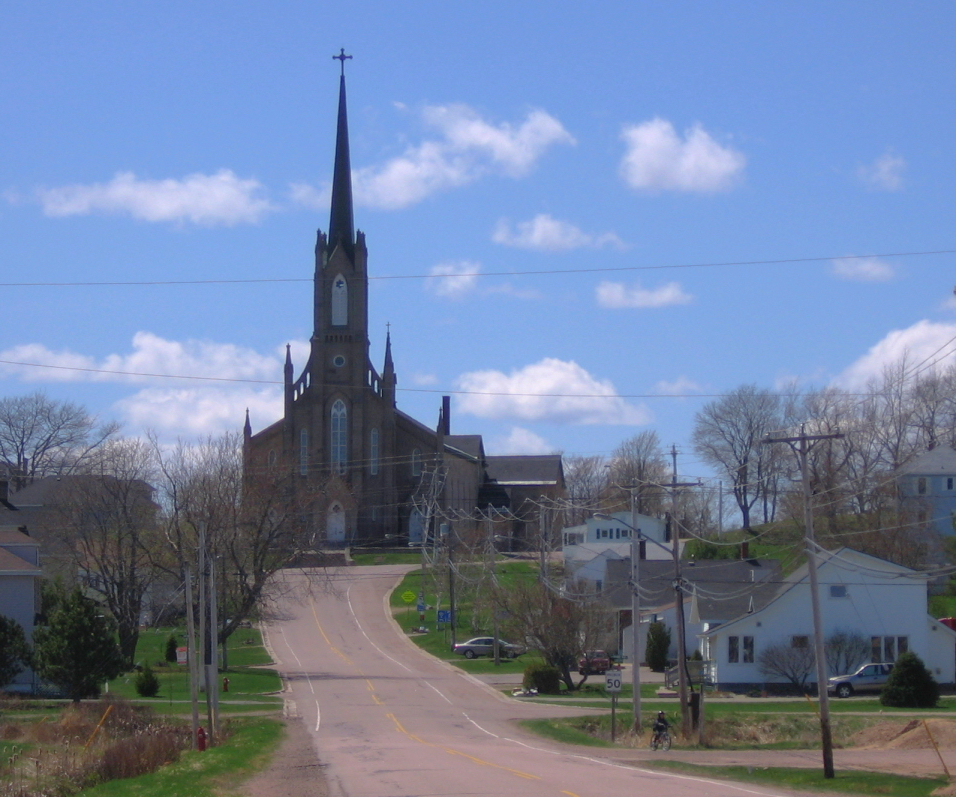
Memramcook
Memramcook, sometimes also spelled Memramcouke or Memramkouke, is a village in Westmorland County, New Brunswick, Canada. Located in south-eastern New Brunswick, the community is predominantly people of Acadian descent who speak the Chiac derivative of the French language. An agricultural village, it has a strong local patrimony, key to the history of the region. It was home to the Mi'kmaq people for many years and was the arrival site of Acadians in 1700. A large part of these Acadians were deported in 1755, but the village itself survived.
The Collège Saint-Joseph was the first francophone university in the east of Canada, which opened its doors in 1864 and hosted/organized the first National Acadian Convention in 1881.
Memramcook was called the "Berceau de l'Acadie", which translates to "cradle of Acadia". Long inhabited by the Mi'kmaq, the site saw the arrival of their allies, the Acadians in 1700. It now goes by the slogan of "Notre belle vallée", since the recent re-branding of the village in May 2015. The village name is originally Mi'kmaq and means "variegated" referring to the many intricacies of the Memramcook River. The first mention of the area used the spelling Mémérancouque in 1757. The missionaries turned it into Memerancook, Memerancooque (1757), Memeramcook (1803), Memramkook (1812), Mamramcook (1812) and finally Memramcook. There have been several recent controversies about the name, such as people who offer the spelling Memramcouk or Memramkouke.
Mi'kmaq people were already established in the region for a couple hundred years before the Acadians arrived. Their main village and cemetery seemed to be in Beaumont, and they also had a camp at what is now today Saint-Joseph. Beaumont was a strategic location, giving that it allowed them to control the Petitcodiac River, the most important marine transport route in the region. Knockout, Bernard, Skéouite, Toudoi, Argémiche, Thomas and others were the common family names at the time.
Samuel de Champlain and Jean de Poutrincourt explored the region in 1605. They noted a rocky point (the Beaumont point) and no human presence. In 1612, Father Biard, Charles de Biencourt and their four Native American guides returned to visit Memramcook. At that time, there were about 60–80 cabins.
In 1672, Acadian and European word-runners and fishers started to frequent the area and some stayed to establish themselves. The village became a part of domain of La Vallière (Beaubassin) in 1676.
In 1698, Pierre Thibaudeau, Guillaume Blanchard, Pierre Gaudet and a few others left Port-Royal to explore Trois-Rivières. Pierre Gaudet, the youngest of the group, decided to stay in Memramcook. The village developed much more quickly after the signing of the Utrecht Treaty, which gave Acadia to England in 1713. Many families from Port-Royal moved to Memramcook at this time as it was still French territory.
Hamlets that would be later known as Pierre-à-Michel and Beaumont were founded in 1740. The Fort de La Galissoniére was constructed in 1751. Its job was to defend the entire isthmus of Chignecto, but was later replaced by Fort Beauséjour. Residents were also starting to construct the famous dyke system to dry out the marshes for agriculture. In 1752, the village was composed of 250 people from 51 different families. There were the Blanchards, Richards, Lanoues, Dupuis, Benoîts, Landrys, LeBlancs, Aucoins, Maillets, Girouards, Forests, Daigles, Savoies, Robichaud, Bastaraches, Heberts, Deslauriers, Cyrs, Bourques and Thibodeaus. People lived mostly along the river, and the first chapel was built in 1753 at Pointe-aux-Bouleaux, which is Ruisseau-des-Breau today.
Hub AI
Memramcook AI simulator
(@Memramcook_simulator)
Memramcook
Memramcook, sometimes also spelled Memramcouke or Memramkouke, is a village in Westmorland County, New Brunswick, Canada. Located in south-eastern New Brunswick, the community is predominantly people of Acadian descent who speak the Chiac derivative of the French language. An agricultural village, it has a strong local patrimony, key to the history of the region. It was home to the Mi'kmaq people for many years and was the arrival site of Acadians in 1700. A large part of these Acadians were deported in 1755, but the village itself survived.
The Collège Saint-Joseph was the first francophone university in the east of Canada, which opened its doors in 1864 and hosted/organized the first National Acadian Convention in 1881.
Memramcook was called the "Berceau de l'Acadie", which translates to "cradle of Acadia". Long inhabited by the Mi'kmaq, the site saw the arrival of their allies, the Acadians in 1700. It now goes by the slogan of "Notre belle vallée", since the recent re-branding of the village in May 2015. The village name is originally Mi'kmaq and means "variegated" referring to the many intricacies of the Memramcook River. The first mention of the area used the spelling Mémérancouque in 1757. The missionaries turned it into Memerancook, Memerancooque (1757), Memeramcook (1803), Memramkook (1812), Mamramcook (1812) and finally Memramcook. There have been several recent controversies about the name, such as people who offer the spelling Memramcouk or Memramkouke.
Mi'kmaq people were already established in the region for a couple hundred years before the Acadians arrived. Their main village and cemetery seemed to be in Beaumont, and they also had a camp at what is now today Saint-Joseph. Beaumont was a strategic location, giving that it allowed them to control the Petitcodiac River, the most important marine transport route in the region. Knockout, Bernard, Skéouite, Toudoi, Argémiche, Thomas and others were the common family names at the time.
Samuel de Champlain and Jean de Poutrincourt explored the region in 1605. They noted a rocky point (the Beaumont point) and no human presence. In 1612, Father Biard, Charles de Biencourt and their four Native American guides returned to visit Memramcook. At that time, there were about 60–80 cabins.
In 1672, Acadian and European word-runners and fishers started to frequent the area and some stayed to establish themselves. The village became a part of domain of La Vallière (Beaubassin) in 1676.
In 1698, Pierre Thibaudeau, Guillaume Blanchard, Pierre Gaudet and a few others left Port-Royal to explore Trois-Rivières. Pierre Gaudet, the youngest of the group, decided to stay in Memramcook. The village developed much more quickly after the signing of the Utrecht Treaty, which gave Acadia to England in 1713. Many families from Port-Royal moved to Memramcook at this time as it was still French territory.
Hamlets that would be later known as Pierre-à-Michel and Beaumont were founded in 1740. The Fort de La Galissoniére was constructed in 1751. Its job was to defend the entire isthmus of Chignecto, but was later replaced by Fort Beauséjour. Residents were also starting to construct the famous dyke system to dry out the marshes for agriculture. In 1752, the village was composed of 250 people from 51 different families. There were the Blanchards, Richards, Lanoues, Dupuis, Benoîts, Landrys, LeBlancs, Aucoins, Maillets, Girouards, Forests, Daigles, Savoies, Robichaud, Bastaraches, Heberts, Deslauriers, Cyrs, Bourques and Thibodeaus. People lived mostly along the river, and the first chapel was built in 1753 at Pointe-aux-Bouleaux, which is Ruisseau-des-Breau today.