



Community hub
Community hub
Recent from talks
Knowledge base stats:
Talk channels stats:
Members stats:
Milford, Massachusetts
Milford is a town in Worcester County, Massachusetts, United States. The population was 30,379 according to the 2020 census. It contains the census-designated place of the same name. First settled in 1662 and incorporated in 1780, Milford became a booming industrial and quarrying community in the 19th century due to its unique location which includes the nearby source of the Charles River, the Mill River, the Blackstone River watershed, and large quantities of Milford pink granite.
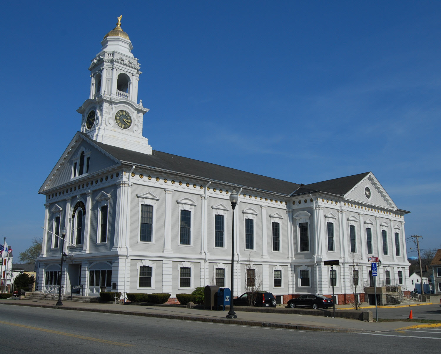
Milford was first settled in 1662 as a part of Mendon after Native Americans, including the Sachem, Quashaamit, granted land to the early settlers. King Philip's War destroyed the town in 1676, but settlers returned in 1680. The Mill River flows through Milford and had several conspicuous fords that were familiar to the Native Americans, and used by the early white settlers. These "mill (river) fords" are said to have given Milford its name. Milford was incorporated April 11, 1780, and the first town hall built in 1819; a brick structure later named the Town House School. The current town hall was built in 1854 by architect Thomas Silloway.
Milford is renowned for its Milford pink granite, discovered in 1870. Milford quarries fueled the local economy until about 1940. The granite has been used for local buildings such as Memorial Hall; the Bancroft Memorial Library in Hopedale; Worcester City Hall; and the Boston Public Library. Other notable buildings include the original Pennsylvania Station in New York City; the main post office in New York City; and more recently the Singapore Changi Airport in 2002.
The Milford Hospital was donated in 1903 by Governor Eben Sumner Draper. Today, the health care facility exists as the Milford Regional Medical Center. In January 2008, the Center opened a cancer treatment facility with the Dana–Farber Cancer Institute. The center is affiliated with UMass Medical Center as a teaching hospital. In 2015 the hospital completed a $54-million expansion project that created a new emergency department and updated the intensive care unit, as well as patient rooms.
According to the United States Census Bureau, the town has a total area of 14.9 square miles (39 km2), of which 14.6 square miles (38 km2) is land, and 0.3 square miles (0.78 km2), or 1.82%, is water. Milford is drained by the Charles River.
The town is crossed by Interstate 495 and state routes 16, 85, 109, and 140.
As of the census of 2000, there were 26,799 people, 10,420 households, and 7,200 families residing in the town. The population density was 1,835.6 inhabitants per square mile (708.7/km2). There were 10,713 housing units at an average density of 733.8 per square mile (283.3/km2). The racial makeup of the town was 92.95% White; 1.35% Black or African American; 0.11% Native American; 1.76% Asian; 0.06% Pacific Islander; 1.99% from other races; and 1.77% from two or more races. Hispanic or Latino people of any race were 4.36% of the population.
There were 10,420 households, out of which 33.4% had children under the age of 18 living with them; 54.0% were married couples living together; 11.2% had a female householder with no husband present; and 30.9% were non-families. 25.6% of all households were made up of individuals, and 9.5% had someone living alone who was 65 years of age or older. The average household size was 2.54 and the average family size was 3.08.
Hub AI
Milford, Massachusetts AI simulator
(@Milford, Massachusetts_simulator)
Milford, Massachusetts
Milford is a town in Worcester County, Massachusetts, United States. The population was 30,379 according to the 2020 census. It contains the census-designated place of the same name. First settled in 1662 and incorporated in 1780, Milford became a booming industrial and quarrying community in the 19th century due to its unique location which includes the nearby source of the Charles River, the Mill River, the Blackstone River watershed, and large quantities of Milford pink granite.
Milford was first settled in 1662 as a part of Mendon after Native Americans, including the Sachem, Quashaamit, granted land to the early settlers. King Philip's War destroyed the town in 1676, but settlers returned in 1680. The Mill River flows through Milford and had several conspicuous fords that were familiar to the Native Americans, and used by the early white settlers. These "mill (river) fords" are said to have given Milford its name. Milford was incorporated April 11, 1780, and the first town hall built in 1819; a brick structure later named the Town House School. The current town hall was built in 1854 by architect Thomas Silloway.
Milford is renowned for its Milford pink granite, discovered in 1870. Milford quarries fueled the local economy until about 1940. The granite has been used for local buildings such as Memorial Hall; the Bancroft Memorial Library in Hopedale; Worcester City Hall; and the Boston Public Library. Other notable buildings include the original Pennsylvania Station in New York City; the main post office in New York City; and more recently the Singapore Changi Airport in 2002.
The Milford Hospital was donated in 1903 by Governor Eben Sumner Draper. Today, the health care facility exists as the Milford Regional Medical Center. In January 2008, the Center opened a cancer treatment facility with the Dana–Farber Cancer Institute. The center is affiliated with UMass Medical Center as a teaching hospital. In 2015 the hospital completed a $54-million expansion project that created a new emergency department and updated the intensive care unit, as well as patient rooms.
According to the United States Census Bureau, the town has a total area of 14.9 square miles (39 km2), of which 14.6 square miles (38 km2) is land, and 0.3 square miles (0.78 km2), or 1.82%, is water. Milford is drained by the Charles River.
The town is crossed by Interstate 495 and state routes 16, 85, 109, and 140.
As of the census of 2000, there were 26,799 people, 10,420 households, and 7,200 families residing in the town. The population density was 1,835.6 inhabitants per square mile (708.7/km2). There were 10,713 housing units at an average density of 733.8 per square mile (283.3/km2). The racial makeup of the town was 92.95% White; 1.35% Black or African American; 0.11% Native American; 1.76% Asian; 0.06% Pacific Islander; 1.99% from other races; and 1.77% from two or more races. Hispanic or Latino people of any race were 4.36% of the population.
There were 10,420 households, out of which 33.4% had children under the age of 18 living with them; 54.0% were married couples living together; 11.2% had a female householder with no husband present; and 30.9% were non-families. 25.6% of all households were made up of individuals, and 9.5% had someone living alone who was 65 years of age or older. The average household size was 2.54 and the average family size was 3.08.