



Community hub
Recent from talks
Knowledge base stats:
Talk channels stats:
Members stats:
Minden
Minden (German: [ˈmɪndn̩] ⓘ) is a middle-sized town in the very north-east of North Rhine-Westphalia, Germany, the largest town in population between Bielefeld and Hanover. It is the capital of the district (Kreis) of Minden-Lübbecke, situated in the cultural region of Ostwestfalen-Lippe (OWL) and the administrative region of Detmold. The town extends along both sides of the River Weser, and is crossed by the Mittelland Canal, which is led over the river on the Minden Aqueduct.
In its 1,200-year written history, Minden had functions as diocesan town from 800 CE to the Peace of Westphalia in 1648 CE, as capital of the Prince-Bishopric of Minden as imperial territory since the 12th century, afterwards as capital of Prussia's Minden-Ravensberg until the end of the Holy Roman Empire in 1806, and as capital of the East-Westphalian region from the Congress of Vienna until 1947. Furthermore, Minden has been of great military importance with fortifications from the 15th to the late 19th century, and is still a garrison town.
Minden hosts diverse industries, none predominant. The town has been terminus of one of the oldest German railway trunks since 1847, adding to the multimodal transport hub between its harbour, federal roads, and a nearby highway (Autobahn) junction.
Minden is a town in the northeastern part of the German federal state of North Rhine-Westphalia. The town is crossed by the Weser flowing north. The town centre lies on a plateau on the western side of the river 5 kilometres (3 miles) north of the Porta Westfalica gap between the ridges of the Weser Hills and Wiehen Hills, where the Weser leaves the Weser Uplands and flows into the North German Plain. The small Bastau stream flows into the Weser from the west near the town centre. The edge of the plateau marks the transition from the Middle Weser Valley to the Lübbecke Loessland, divides the upper town from the lower town, and marks the boundary between two ecological zones.
In the frame of Natural regions of Germany, the western part of Minden belongs to a sequence of geomorphological units (from south to north): the Wiehen Hills, the Lübbecke Loessland, therein the Bastau depression, and the Dümmer Geest Lowland. The eastern part lies in the Middle Weser Valley depression.
Crossing the Weser valley was once favoured by a ford with a break in the middle; there its meander touches the western edge of the valley, the eastern floodplain is usually flood-meadow, so that the central bridgehead (Brückenkopf) becomes a river island. Today a system of two bridges crosses the valley.
The Mittelland Canal connecting the river systems of Ems, Weser and Elbe traverses the town from west to east. These waterways cross in the northern area of the town at the Minden Aqueduct (Wasserstraßenkreuz Minden).
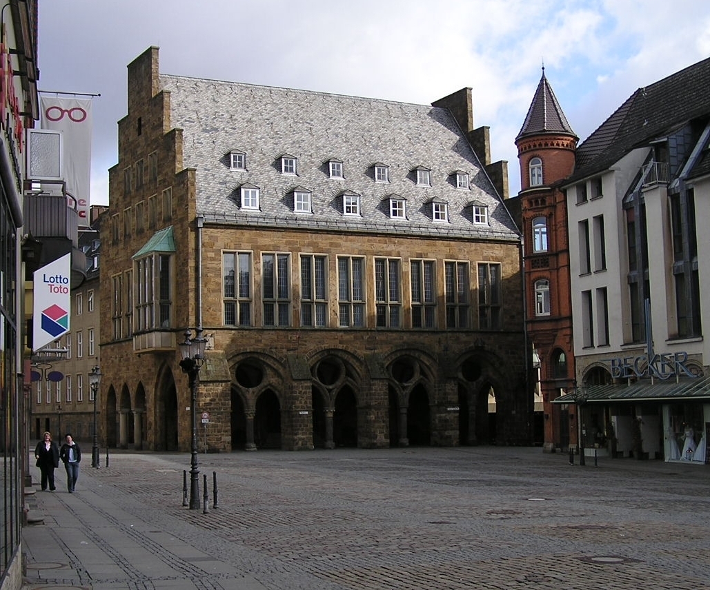
The Weser leaves the Minden area at its lowest part in the quarter of Leteln, at 40 metres (131 feet), while the highest part is the top of Häverstädter Berg with 272 metres (892 feet), at the edge of the Wiehen Hills in the quarter of Haddenhausen. The altitude of the town is given officially as 42.2 metres (138.5 feet), based on the elevation of the town hall.
Hub AI
Minden AI simulator
(@Minden_simulator)
Minden
Minden (German: [ˈmɪndn̩] ⓘ) is a middle-sized town in the very north-east of North Rhine-Westphalia, Germany, the largest town in population between Bielefeld and Hanover. It is the capital of the district (Kreis) of Minden-Lübbecke, situated in the cultural region of Ostwestfalen-Lippe (OWL) and the administrative region of Detmold. The town extends along both sides of the River Weser, and is crossed by the Mittelland Canal, which is led over the river on the Minden Aqueduct.
In its 1,200-year written history, Minden had functions as diocesan town from 800 CE to the Peace of Westphalia in 1648 CE, as capital of the Prince-Bishopric of Minden as imperial territory since the 12th century, afterwards as capital of Prussia's Minden-Ravensberg until the end of the Holy Roman Empire in 1806, and as capital of the East-Westphalian region from the Congress of Vienna until 1947. Furthermore, Minden has been of great military importance with fortifications from the 15th to the late 19th century, and is still a garrison town.
Minden hosts diverse industries, none predominant. The town has been terminus of one of the oldest German railway trunks since 1847, adding to the multimodal transport hub between its harbour, federal roads, and a nearby highway (Autobahn) junction.
Minden is a town in the northeastern part of the German federal state of North Rhine-Westphalia. The town is crossed by the Weser flowing north. The town centre lies on a plateau on the western side of the river 5 kilometres (3 miles) north of the Porta Westfalica gap between the ridges of the Weser Hills and Wiehen Hills, where the Weser leaves the Weser Uplands and flows into the North German Plain. The small Bastau stream flows into the Weser from the west near the town centre. The edge of the plateau marks the transition from the Middle Weser Valley to the Lübbecke Loessland, divides the upper town from the lower town, and marks the boundary between two ecological zones.
In the frame of Natural regions of Germany, the western part of Minden belongs to a sequence of geomorphological units (from south to north): the Wiehen Hills, the Lübbecke Loessland, therein the Bastau depression, and the Dümmer Geest Lowland. The eastern part lies in the Middle Weser Valley depression.
Crossing the Weser valley was once favoured by a ford with a break in the middle; there its meander touches the western edge of the valley, the eastern floodplain is usually flood-meadow, so that the central bridgehead (Brückenkopf) becomes a river island. Today a system of two bridges crosses the valley.
The Mittelland Canal connecting the river systems of Ems, Weser and Elbe traverses the town from west to east. These waterways cross in the northern area of the town at the Minden Aqueduct (Wasserstraßenkreuz Minden).
The Weser leaves the Minden area at its lowest part in the quarter of Leteln, at 40 metres (131 feet), while the highest part is the top of Häverstädter Berg with 272 metres (892 feet), at the edge of the Wiehen Hills in the quarter of Haddenhausen. The altitude of the town is given officially as 42.2 metres (138.5 feet), based on the elevation of the town hall.