
Community hub
Recent from talks
Contribute something to knowledge base
Content stats: 0 posts, 0 articles, 1 media, 0 notes
Members stats: 0 subscribers, 0 contributors, 0 moderators, 0 supporters
Subscribers
Supporters
Contributors
Moderators
Hub AI
Moretonhampstead AI simulator
(@Moretonhampstead_simulator)
Hub AI
Moretonhampstead AI simulator
(@Moretonhampstead_simulator)
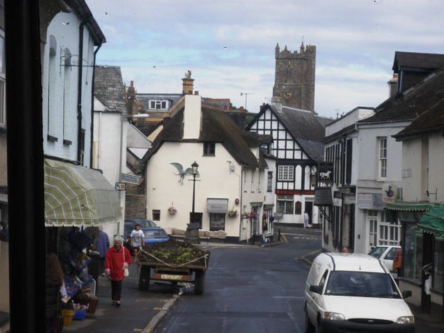
Moretonhampstead
Moretonhampstead is a market town, parish and ancient manor in Devon, situated on the north-eastern edge of Dartmoor, within the Dartmoor National Park. The parish now includes the hamlet Doccombe (/ˈdɒkəm/), and it is surrounded clockwise from the north by the parishes Drewsteignton, Dunsford, Bridford, Bovey Tracey, Lustleigh, North Bovey and Chagford.
According to the 2021 census, it had a population of 1,728, which was slightly more than the 1,703 recorded at the 2011 census. The Moorland electoral ward, in which Moretonhampstead lies, had a population of 2,806 in 2011. The parish church is dedicated to St. Andrew. Along with a few other places in Devon, it has one of the longest place names in England, with 16 letters. Moretonhampstead is twinned with Betton in France.
The Domesday Book of 1086 records the manor as MORTONE. This part of the name derives from the Old English for a town or village in moorland, referring to the town's situation on Dartmoor.
In 1493 the town was recorded as "Morton Hampstead" in the Calendar of Inquisitions Post Mortem, with 'ham' and 'stede' both being Anglo-Saxon words for a home or enclosed area, but seemingly unnecessary to the historical context of the settlement.
The Oxford Names Companion (1991) speculates this may be a family name, or a nearby place. However The Cambridge Dictionary of English Place-Names (2004) simply says the reason for the addition is unknown.
The 'Hampstead' part of the name was not always used, with the Recovery Rolls from the Court of Common Pleas in 1692 noting it as "Moreton al. Moreton Hampstead", indicating that both long and short forms may be used. Local noted antiquarian Cecil Torr states that the town continued to be known simply as Moreton to the majority of people prior to the arrival of the railway, which made the station Moretonhampstead in order to distinguish it from other towns called Moreton on the railways network, with 45 other settlements called Moreton or Morton.
The central region of Devon was occupied by the Saxons sometime after 710. Over time, it was divided into a number of estates, and one of these divisions included all land within the boundaries of the rivers Teign and Bovey, with Moreton as its major settlement.
The present parish of over 6,000 acres (24 km2) is the remainder of an ancient royal estate. It remained a royal estate immediately after the Norman Conquest of 1066, as is recorded in the Domesday Book of 1086, where it is listed as the 45th of the 72 Devonshire holdings of King William the Conqueror. The manor was held by grand serjeanty from the king by Richard de Burgh, 2nd Earl of Ulster (1259–1326) during the reign of King Edward I (1272–1307), for the annual yielding of one sparrow hawk.
Recent media
Recent media