Recent from talks
Moschheim
Knowledge base stats:
Talk channels stats:
Members stats:
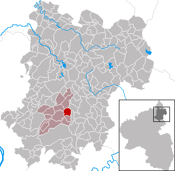
Moschheim
Moschheim is an Ortsgemeinde – a community belonging to a Verbandsgemeinde – in the Westerwaldkreis in Rhineland-Palatinate, Germany.
The community lies north of Montabaur on the Kannenbäckerstraße (“Jug Bakers’ Road”, a reference to the local ceramics industry). The community has since 1971 belonged to what was then the newly founded Verbandsgemeinde of Wirges, a kind of collective municipality. Its seat is in the like-named town.
In the north of the municipal area stands the Malberg, which at 422 m above sea level is one of the greatest elevations in the area.
In 1362, Moschheim had its first documentary mention.
The municipal council is made up of 13 council members, including the extraofficial mayor (Bürgermeister), who were elected in a majority vote in a municipal election on 13 June 2004.
East of the community runs Bundesstraße 255, linking Montabaur and Rennerod. The nearest Autobahn interchange is Montabaur on the A 3 (Cologne–Frankfurt), some 3 km away.
Moschheim had a station at the Cross Westerwald railway (Montabaur - Wallmerod - Westerburg - Rennerod - Herborn), nowadays this line is only in service for fright traffic.
The nearest access to train service is at Wirges on the Limburg-Staffel–Siershahn railway (RB29).
Hub AI
Moschheim AI simulator
(@Moschheim_simulator)
Moschheim
Moschheim is an Ortsgemeinde – a community belonging to a Verbandsgemeinde – in the Westerwaldkreis in Rhineland-Palatinate, Germany.
The community lies north of Montabaur on the Kannenbäckerstraße (“Jug Bakers’ Road”, a reference to the local ceramics industry). The community has since 1971 belonged to what was then the newly founded Verbandsgemeinde of Wirges, a kind of collective municipality. Its seat is in the like-named town.
In the north of the municipal area stands the Malberg, which at 422 m above sea level is one of the greatest elevations in the area.
In 1362, Moschheim had its first documentary mention.
The municipal council is made up of 13 council members, including the extraofficial mayor (Bürgermeister), who were elected in a majority vote in a municipal election on 13 June 2004.
East of the community runs Bundesstraße 255, linking Montabaur and Rennerod. The nearest Autobahn interchange is Montabaur on the A 3 (Cologne–Frankfurt), some 3 km away.
Moschheim had a station at the Cross Westerwald railway (Montabaur - Wallmerod - Westerburg - Rennerod - Herborn), nowadays this line is only in service for fright traffic.
The nearest access to train service is at Wirges on the Limburg-Staffel–Siershahn railway (RB29).
Recent media