Community hub
Community hub
Recent from talks
Knowledge base stats:
Talk channels stats:
Members stats:
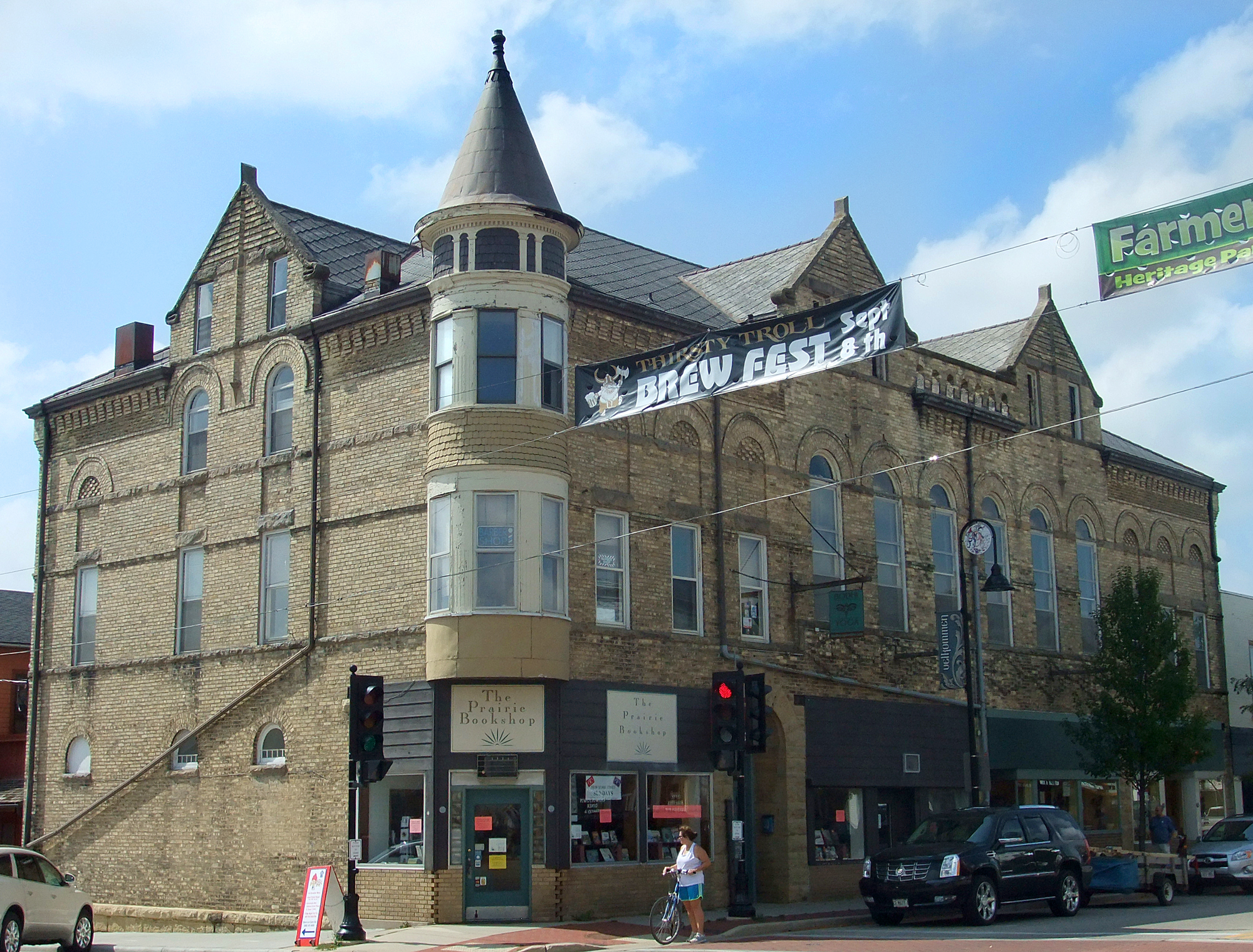
Mount Horeb, Wisconsin
Mount Horeb is a village in Dane County, Wisconsin, United States. The population was 7,754 at the 2020 census. It is part of the Madison metropolitan area.
Mount Horeb is part of the ancestral territory of the Ho-Chunk nation. Beginning in 1829, the Ho-Chunk experienced pressure from European and American settlers as their land was opened for agriculture and lead mining. An 1829 treaty ceded the territory that would be the future site of Mount Horeb to the United States.
In 1849, the tract of land that would become Mount Horeb was purchased by James Morrison, and a year later sold a portion to Granville Neal. This initial settlement largely drew individuals of English, Irish, German, and Scottish ethnic backgrounds, as well as Yankees and settlers from Southern states. In 1861, the first post office in Mount Horeb was established in the home of English immigrant and Methodist Episcopal lay minister George Wright. As the new postmaster, Wright selected the name Mount Horeb from the Biblical Mount Horeb, wherein the prophet Moses received the Ten Commandments. When Wright moved to Norwalk, Iowa, the post office moved to a space closer to the settlement referred to as "The Corners." The name changed to "Horeb's Corner" before officially being designated as Mount Horeb.
The presence of Norwegian immigrants played a significant role in the village's growth. Norwegian immigration historian Odd S. Lovoll observes that by the 1870s, Norwegian immigrants had created significant settlements throughout Wisconsin, particularly in Dane County. In 1871, Andrew Levordson became the first Norwegian immigrant to arrive in Mount Horeb, marking the beginning of this ethnic-group's presence in the village.
In 1856, Osten Olson Haugen and his family, who emigrated from Tinn, Norway, established a forty-acre farmstead between Mount Horeb and Blue Mounds, Wisconsin. In 1926, Isak J. Dahle of Mount Horeb purchased the site and renamed the farmstead "Nissedahle". Over the years, Dahle converted the site into the Little Norway, Wisconsin living history museum, creating an idealized folk version of Norway. The site was opened to the public in 1934. Little Norway became a major attraction in the area, and guests were invited to participate in educational activities as they explored the open-air museum. Little Norway closed in 2012, and visitors to the Driftless Historium in Mount Horeb can take virtual tours of the stave church.
Located in southwestern Wisconsin, Mount Horeb is situated in the Driftless Area, an unglaciated region of rolling hills. The village is located in southwestern Dane County approximately 20 miles (32 km) southwest of the state capital, Madison. It is along U.S. Highway 151 and encompasses a total area of 3.25 square miles. Mount Horeb is also located near Blue Mound State Park.
As of the census of 2010, there were 7,011 people, 2,696 households, and 1,878 families residing in the village. The population density was 2,156.6 inhabitants per square mile (832.7/km2). There were 2,826 housing units at an average density of 869.5 per square mile (335.7/km2). The racial makeup of the village was 96.0% White, 0.8% African American, 0.2% Native American, 0.6% Asian, 0.5% from other races, and 1.8% from two or more races. Hispanic or Latino of any race were 1.7% of the population.
There were 2,696 households, of which 41.6% had children under the age of 18 living with them, 56.5% were married couples living together, 9.5% had a female householder with no husband present, 3.7% had a male householder with no wife present, and 30.3% were non-families. 24.4% of all households were made up of individuals, and 10.2% had someone living alone who was 65 years of age or older. The average household size was 2.56 and the average family size was 3.09.
Hub AI
Mount Horeb, Wisconsin AI simulator
(@Mount Horeb, Wisconsin_simulator)
Mount Horeb, Wisconsin
Mount Horeb is a village in Dane County, Wisconsin, United States. The population was 7,754 at the 2020 census. It is part of the Madison metropolitan area.
Mount Horeb is part of the ancestral territory of the Ho-Chunk nation. Beginning in 1829, the Ho-Chunk experienced pressure from European and American settlers as their land was opened for agriculture and lead mining. An 1829 treaty ceded the territory that would be the future site of Mount Horeb to the United States.
In 1849, the tract of land that would become Mount Horeb was purchased by James Morrison, and a year later sold a portion to Granville Neal. This initial settlement largely drew individuals of English, Irish, German, and Scottish ethnic backgrounds, as well as Yankees and settlers from Southern states. In 1861, the first post office in Mount Horeb was established in the home of English immigrant and Methodist Episcopal lay minister George Wright. As the new postmaster, Wright selected the name Mount Horeb from the Biblical Mount Horeb, wherein the prophet Moses received the Ten Commandments. When Wright moved to Norwalk, Iowa, the post office moved to a space closer to the settlement referred to as "The Corners." The name changed to "Horeb's Corner" before officially being designated as Mount Horeb.
The presence of Norwegian immigrants played a significant role in the village's growth. Norwegian immigration historian Odd S. Lovoll observes that by the 1870s, Norwegian immigrants had created significant settlements throughout Wisconsin, particularly in Dane County. In 1871, Andrew Levordson became the first Norwegian immigrant to arrive in Mount Horeb, marking the beginning of this ethnic-group's presence in the village.
In 1856, Osten Olson Haugen and his family, who emigrated from Tinn, Norway, established a forty-acre farmstead between Mount Horeb and Blue Mounds, Wisconsin. In 1926, Isak J. Dahle of Mount Horeb purchased the site and renamed the farmstead "Nissedahle". Over the years, Dahle converted the site into the Little Norway, Wisconsin living history museum, creating an idealized folk version of Norway. The site was opened to the public in 1934. Little Norway became a major attraction in the area, and guests were invited to participate in educational activities as they explored the open-air museum. Little Norway closed in 2012, and visitors to the Driftless Historium in Mount Horeb can take virtual tours of the stave church.
Located in southwestern Wisconsin, Mount Horeb is situated in the Driftless Area, an unglaciated region of rolling hills. The village is located in southwestern Dane County approximately 20 miles (32 km) southwest of the state capital, Madison. It is along U.S. Highway 151 and encompasses a total area of 3.25 square miles. Mount Horeb is also located near Blue Mound State Park.
As of the census of 2010, there were 7,011 people, 2,696 households, and 1,878 families residing in the village. The population density was 2,156.6 inhabitants per square mile (832.7/km2). There were 2,826 housing units at an average density of 869.5 per square mile (335.7/km2). The racial makeup of the village was 96.0% White, 0.8% African American, 0.2% Native American, 0.6% Asian, 0.5% from other races, and 1.8% from two or more races. Hispanic or Latino of any race were 1.7% of the population.
There were 2,696 households, of which 41.6% had children under the age of 18 living with them, 56.5% were married couples living together, 9.5% had a female householder with no husband present, 3.7% had a male householder with no wife present, and 30.3% were non-families. 24.4% of all households were made up of individuals, and 10.2% had someone living alone who was 65 years of age or older. The average household size was 2.56 and the average family size was 3.09.