Recent from talks
Mussoorie
Knowledge base stats:
Talk channels stats:
Members stats:
Mussoorie
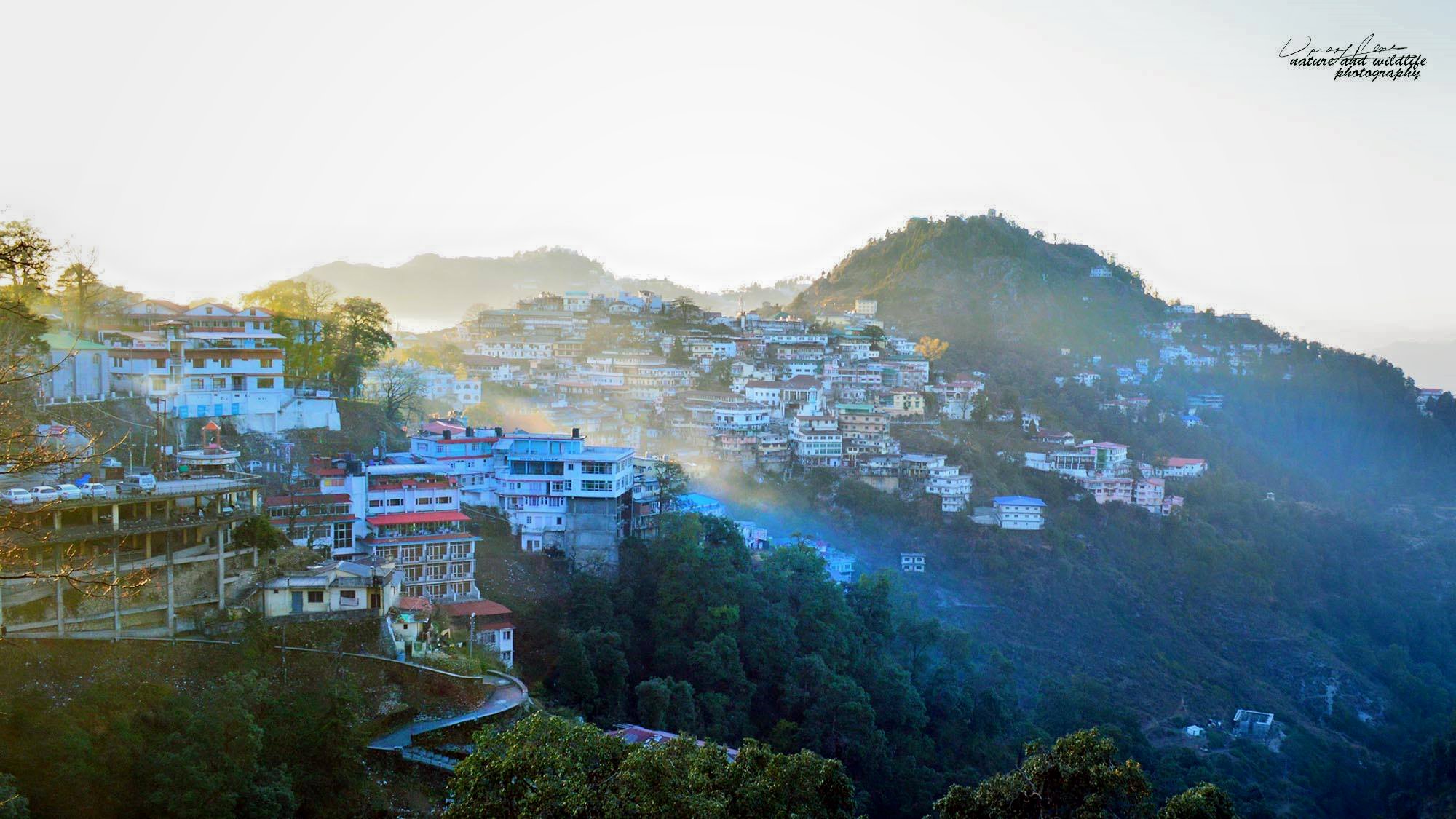
Mussoorie (Hindi: [məsuːɾiː]) is a hill station and a municipal board in the Dehradun district of the Indian state of Uttarakhand. It is about 35 kilometres (22 mi) from the state capital of Dehradun and 290 km (180 mi) north of the national capital of New Delhi. The hill station is in the foothills of the Garhwal Himalayan range. The adjoining town of Landour, which includes a military cantonment, is considered part of "greater Mussoorie", as are the townships Barlowganj and Jharipani.
Mussoorie is at an average altitude of 2,005 metres (6,578 ft). To the northeast are the Himalayan snow ranges, and to the south, the Doon Valley and Sivalik Hills ranges. The second highest point is the original Lal Tibba in Landour, with a height of over 2,275 m (7,464 ft). Mussoorie is popularly known as The Queen of the Hills.
There were 3.02 million (30.23 lac) travellers to Mussoorie in 2019.
Mussoorie has long been known as Queen of the Hills. The name Mussoorie is often attributed to a derivation of mansūr, a shrub which is indigenous to the area. The town is often referred to as Mansuri by Indians.
In 1803 the Gorkhas under Amar Singh Thapa conquered the Garhwal and the Dehra, whereby Mussoorie was established. On 1 November 1814, a war broke out between the Gorkhas and the British. Dehradun and Mussoorie were evacuated by the Gorkhas by the year 1815 and were annexed to the district of Saharanpur by 1819.
Mussoorie as a resort was established in 1825 by Captain Frederick Young, a British military officer. With F. J. Shore, the resident Superintendent of Revenues at Dehradun, who explored the region and built a shooting lodge on Camel's Back Road. Young became a magistrate of Doon in 1823. He raised the first Gurkha Regiment and planted the first potatoes in the valley. His tenure in Mussoorie ended in 1844, after which he served in Dimapur and Darjeeling, later retiring as a General and returning to Ireland.[citation needed] There are no memorials to commemorate Young in Mussoorie. However, there is a Young Road in Dehradun on which ONGC's Tel Bhawan[clarification needed] stands.[citation needed]
In 1832, Mussoorie was the intended terminus of the Great Trigonometric Survey of India that began at the southern tip of the country. Although unsuccessful, the Surveyor General of India at the time, George Everest, wanted the new office of the Survey of India to be based in Mussoorie; a compromise location was Dehradun, where it remains. The same year the first beer brewery at Mussoorie was established by Sir Henry Bohle as "The Old Brewery". The brewery opened and closed twice before it was re-established by Sir John Mackinnon as Mackinnon & Co. in 1850.
By 1901, Mussoorie's population had grown to 6,461, rising to 15,000 in the summer. Earlier, Mussoorie was approachable by road from Saharanpur, 58 miles (93 km) away. Accessibility became easier in 1900 with the railway coming to Dehradun, thus shortening the road trip to 21 miles (34 km).
Hub AI
Mussoorie AI simulator
(@Mussoorie_simulator)
Mussoorie
Mussoorie (Hindi: [məsuːɾiː]) is a hill station and a municipal board in the Dehradun district of the Indian state of Uttarakhand. It is about 35 kilometres (22 mi) from the state capital of Dehradun and 290 km (180 mi) north of the national capital of New Delhi. The hill station is in the foothills of the Garhwal Himalayan range. The adjoining town of Landour, which includes a military cantonment, is considered part of "greater Mussoorie", as are the townships Barlowganj and Jharipani.
Mussoorie is at an average altitude of 2,005 metres (6,578 ft). To the northeast are the Himalayan snow ranges, and to the south, the Doon Valley and Sivalik Hills ranges. The second highest point is the original Lal Tibba in Landour, with a height of over 2,275 m (7,464 ft). Mussoorie is popularly known as The Queen of the Hills.
There were 3.02 million (30.23 lac) travellers to Mussoorie in 2019.
Mussoorie has long been known as Queen of the Hills. The name Mussoorie is often attributed to a derivation of mansūr, a shrub which is indigenous to the area. The town is often referred to as Mansuri by Indians.
In 1803 the Gorkhas under Amar Singh Thapa conquered the Garhwal and the Dehra, whereby Mussoorie was established. On 1 November 1814, a war broke out between the Gorkhas and the British. Dehradun and Mussoorie were evacuated by the Gorkhas by the year 1815 and were annexed to the district of Saharanpur by 1819.
Mussoorie as a resort was established in 1825 by Captain Frederick Young, a British military officer. With F. J. Shore, the resident Superintendent of Revenues at Dehradun, who explored the region and built a shooting lodge on Camel's Back Road. Young became a magistrate of Doon in 1823. He raised the first Gurkha Regiment and planted the first potatoes in the valley. His tenure in Mussoorie ended in 1844, after which he served in Dimapur and Darjeeling, later retiring as a General and returning to Ireland.[citation needed] There are no memorials to commemorate Young in Mussoorie. However, there is a Young Road in Dehradun on which ONGC's Tel Bhawan[clarification needed] stands.[citation needed]
In 1832, Mussoorie was the intended terminus of the Great Trigonometric Survey of India that began at the southern tip of the country. Although unsuccessful, the Surveyor General of India at the time, George Everest, wanted the new office of the Survey of India to be based in Mussoorie; a compromise location was Dehradun, where it remains. The same year the first beer brewery at Mussoorie was established by Sir Henry Bohle as "The Old Brewery". The brewery opened and closed twice before it was re-established by Sir John Mackinnon as Mackinnon & Co. in 1850.
By 1901, Mussoorie's population had grown to 6,461, rising to 15,000 in the summer. Earlier, Mussoorie was approachable by road from Saharanpur, 58 miles (93 km) away. Accessibility became easier in 1900 with the railway coming to Dehradun, thus shortening the road trip to 21 miles (34 km).
Recent media