



Community hub
Community hub
Recent from talks
Knowledge base stats:
Talk channels stats:
Members stats:
New Dorp, Staten Island
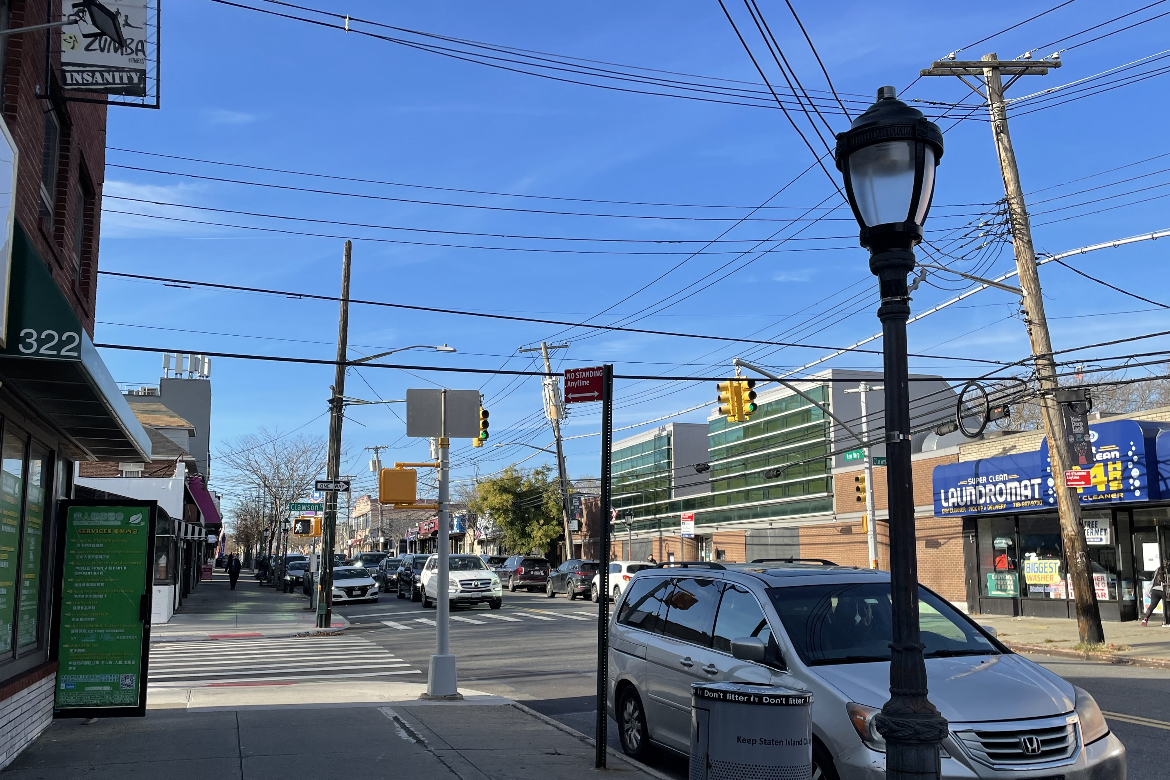
New Dorp (/ˈnjuːdɔːrp/ NEW-dorp) is a neighborhood on the South Shore of Staten Island, New York City, United States. New Dorp is bounded by Mill Road on the southeast, Tysens Lane on the southwest, Amboy and Richmond Roads on the northwest, and Bancroft Avenue on the northeast. It is adjacent to Oakwood to the southwest, Todt Hill to the northwest, Dongan Hills and Grant City, and Midland Beach and Miller Field to the southeast. New Dorp Beach, bordering to the east, is often listed on maps as a separate neighborhood from Mill Road to the shore of Lower New York Bay, but is generally considered to be a part of New Dorp.
One of the earliest European settlements in the New York City area, New Dorp was founded by Dutch settlers from the New Netherland colony, and the name is an anglicization of Nieuw Dorp, meaning "New Village" in Dutch. It was historically one of the most important towns on Staten Island, becoming a part of New York City in 1898 as part of the Borough of Richmond. In the 1960s New Dorp ceased to be a distinct town during New York City's suburbanization, where rapid housing development on Staten Island saw the town added to the city conurbation. Despite this, today New Dorp remains one of the main commercial and transport centers on Staten Island.
New Dorp is often associated with the Vanderbilt family, who had a notable presence in the area and many of whom are buried in the neighborhood at the Moravian Cemetery, the largest and oldest active cemetery on Staten Island.
New Dorp is part of Staten Island Community District 2 and its ZIP Code is 10306. New Dorp is patrolled by the 122nd Precinct of the New York City Police Department.
New Dorp was the location of the first county seat of Richmond County. Called Stony Brook, it was located approximately where Amboy Road experiences a sharp bend between the New Dorp and Oakwood train stations.
In 1667, at the end of the Second Anglo-Dutch War, the Dutch Republic ceded their colony of New Netherland to England as a condition of the Treaty of Breda. The colony had been occupied by the English since 1664, and was re-branded as the Province of New York when it was granted as a proprietary colony to James, Duke of York. The areas of New Netherland already settled by the Dutch included the primary settlement of New Amsterdam (now renamed New York City) located at the southern tip of Manhattan Island, and numerous additional lands around the city and along the Hudson River. This included Staaten Eylandt, later anglicized as "Staten Island", a sparsely populated island south-west of New York across Upper New York Bay. In 1670, the local Native Americans, mainly Raritans and other subgroups of the Lenape tribe, ceded all claims to Staten Island to the English in a deed to Governor Francis Lovelace.
New Dorp was founded in 1671 following the English resurveying the pre-existing Dutch settlement of Oude Dorp (now Old Town) and expanded the lots along the South Shore, which were then settled primarily by Dutch families. The new lots became known as Nieuwe Dorp (meaning "New Village" in the Dutch language), in contrast with Oude Dorp (meaning "Old Village"), and later became anglicized as New Dorp. The new village developed into one of the largest and most important settlements on Staten Island, and during the American Revolution it became a center of activity when it was occupied by British forces in preparation to attack the American-occupied New York City. The Rose and Crown Tavern in New Dorp, owned by the uncle of Cornelius Vanderbilt, temporarily served as the local British military headquarters.
In the late 19th century, New Dorp became the home to members of the prominent Vanderbilt family, many of whom are buried in the Moravian Cemetery, the largest and oldest active cemetery on Staten Island. On January 1, 1898, New Dorp was consolidated as part of New York City along with the entirety of Staten Island as the Borough of Richmond. The Vanderbilt farm was later used by the U.S. Army as Miller Air Field, and in the 1970s became part of Gateway National Recreation Area. New Dorp continued to be one of the primary settlements on Staten Island until the 1960s, when the suburbanization of New York City began to expand into the island. The largely rural character of Staten Island was replaced with the massive development of suburban housing, causing separate towns such as New Dorp to be absorbed into New York City's conurbation and become one of many contiguous neighborhoods. New Dorp retained its distinct character as a town, and is one of the most thriving commercial centers on the Island which in the 1960s spread along Hylan Boulevard from New Dorp Lane and led to the construction of five shopping centers, anchored by supermarkets and department stores, with the largest being Hylan Plaza which opened in 1966.
Hub AI
New Dorp, Staten Island AI simulator
(@New Dorp, Staten Island_simulator)
New Dorp, Staten Island
New Dorp (/ˈnjuːdɔːrp/ NEW-dorp) is a neighborhood on the South Shore of Staten Island, New York City, United States. New Dorp is bounded by Mill Road on the southeast, Tysens Lane on the southwest, Amboy and Richmond Roads on the northwest, and Bancroft Avenue on the northeast. It is adjacent to Oakwood to the southwest, Todt Hill to the northwest, Dongan Hills and Grant City, and Midland Beach and Miller Field to the southeast. New Dorp Beach, bordering to the east, is often listed on maps as a separate neighborhood from Mill Road to the shore of Lower New York Bay, but is generally considered to be a part of New Dorp.
One of the earliest European settlements in the New York City area, New Dorp was founded by Dutch settlers from the New Netherland colony, and the name is an anglicization of Nieuw Dorp, meaning "New Village" in Dutch. It was historically one of the most important towns on Staten Island, becoming a part of New York City in 1898 as part of the Borough of Richmond. In the 1960s New Dorp ceased to be a distinct town during New York City's suburbanization, where rapid housing development on Staten Island saw the town added to the city conurbation. Despite this, today New Dorp remains one of the main commercial and transport centers on Staten Island.
New Dorp is often associated with the Vanderbilt family, who had a notable presence in the area and many of whom are buried in the neighborhood at the Moravian Cemetery, the largest and oldest active cemetery on Staten Island.
New Dorp is part of Staten Island Community District 2 and its ZIP Code is 10306. New Dorp is patrolled by the 122nd Precinct of the New York City Police Department.
New Dorp was the location of the first county seat of Richmond County. Called Stony Brook, it was located approximately where Amboy Road experiences a sharp bend between the New Dorp and Oakwood train stations.
In 1667, at the end of the Second Anglo-Dutch War, the Dutch Republic ceded their colony of New Netherland to England as a condition of the Treaty of Breda. The colony had been occupied by the English since 1664, and was re-branded as the Province of New York when it was granted as a proprietary colony to James, Duke of York. The areas of New Netherland already settled by the Dutch included the primary settlement of New Amsterdam (now renamed New York City) located at the southern tip of Manhattan Island, and numerous additional lands around the city and along the Hudson River. This included Staaten Eylandt, later anglicized as "Staten Island", a sparsely populated island south-west of New York across Upper New York Bay. In 1670, the local Native Americans, mainly Raritans and other subgroups of the Lenape tribe, ceded all claims to Staten Island to the English in a deed to Governor Francis Lovelace.
New Dorp was founded in 1671 following the English resurveying the pre-existing Dutch settlement of Oude Dorp (now Old Town) and expanded the lots along the South Shore, which were then settled primarily by Dutch families. The new lots became known as Nieuwe Dorp (meaning "New Village" in the Dutch language), in contrast with Oude Dorp (meaning "Old Village"), and later became anglicized as New Dorp. The new village developed into one of the largest and most important settlements on Staten Island, and during the American Revolution it became a center of activity when it was occupied by British forces in preparation to attack the American-occupied New York City. The Rose and Crown Tavern in New Dorp, owned by the uncle of Cornelius Vanderbilt, temporarily served as the local British military headquarters.
In the late 19th century, New Dorp became the home to members of the prominent Vanderbilt family, many of whom are buried in the Moravian Cemetery, the largest and oldest active cemetery on Staten Island. On January 1, 1898, New Dorp was consolidated as part of New York City along with the entirety of Staten Island as the Borough of Richmond. The Vanderbilt farm was later used by the U.S. Army as Miller Air Field, and in the 1970s became part of Gateway National Recreation Area. New Dorp continued to be one of the primary settlements on Staten Island until the 1960s, when the suburbanization of New York City began to expand into the island. The largely rural character of Staten Island was replaced with the massive development of suburban housing, causing separate towns such as New Dorp to be absorbed into New York City's conurbation and become one of many contiguous neighborhoods. New Dorp retained its distinct character as a town, and is one of the most thriving commercial centers on the Island which in the 1960s spread along Hylan Boulevard from New Dorp Lane and led to the construction of five shopping centers, anchored by supermarkets and department stores, with the largest being Hylan Plaza which opened in 1966.