| Oudon | |
|---|---|
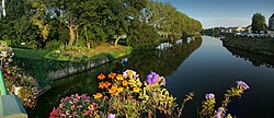
 Sunset on Le Lion-d'Angers | |
  | |
| Native name | L'Oudon (French) |
| Location | |
| Country | France |
| Physical characteristics | |
| Source | |
| • location | La Gravelle |
| • coordinates | 48°04′12″N 01°00′30″W / 48.07000°N 1.00833°W |
| • elevation | 150 m (490 ft) |
| Mouth | |
• location | Mayenne |
• coordinates | 47°36′58″N 0°41′40″W / 47.6162°N 0.6945°W |
• elevation | 18 m (59 ft) |
| Length | 103.2 km (64.1 mi) |
| Basin size | 1,350 km2 (520 sq mi) |
| Discharge | |
| • average | 9.04 m3/s (319 cu ft/s) |
| Basin features | |
| Progression | Mayenne→ Maine→ Loire→ Atlantic Ocean |
The Oudon (French pronunciation: [udɔ̃] ⓘ) is a 103.2 km (64.1 mi) long river in the Mayenne and Maine-et-Loire départements, western France.[1] Its source is near La Gravelle. It flows generally south east. It is a right tributary of the Mayenne into which it flows between Le Lion-d'Angers and Grez-Neuville.
Its main tributary is the Verzée.
The river flows through the following départements and localities, from source to mouth:
The Oudon was canalised in the 19th century from Segré to the river Mayenne, over a distance of 18 km with three locks. The waterway was used to transport timber for construction, granite and slate. The river, restored to navigation in 1980, is now part of the popular Anjou river network, with the Mayenne, Sarthe and their "common trunk" of the Maine down to the river Loire.[2]
")