Recent from talks
Pajaro River
Knowledge base stats:
Talk channels stats:
Members stats:
Pajaro River
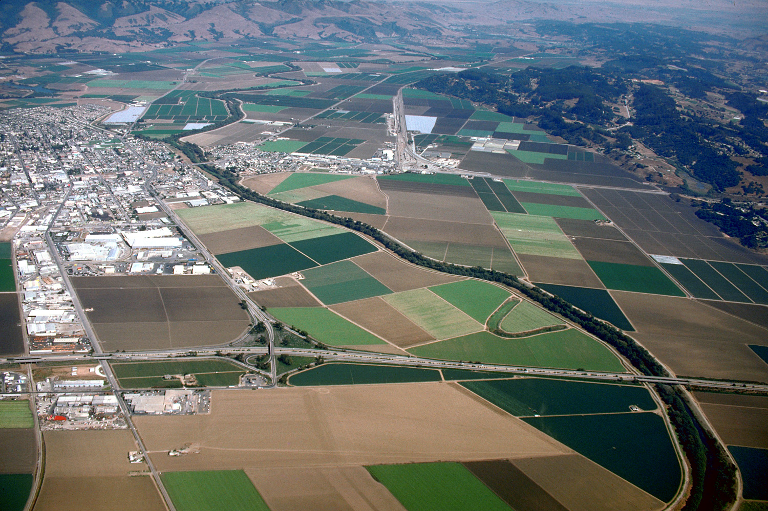
The Pajaro River (pájaro is bird in Spanish) is a U.S. river in the Central Coast region of California, forming part of the border between San Benito and Santa Clara Counties, the entire border between San Benito and Santa Cruz County, and the entire border between Santa Cruz and Monterey County. Flowing roughly east to west, the river empties into Monterey Bay, west of Watsonville, California.
The first European land exploration of Alta California, the Spanish Portolà expedition, camped near the river for two nights, in the vicinity of today's community of Watsonville, on October 8–9, 1769. The party continued north the next day toward Santa Cruz. Expedition soldiers called it "Pajaro" (meaning "bird" in Spanish). Franciscan missionary Juan Crespí, traveling with the expedition, noted in his diary that they "found half the body of a very large black bird, hanging [from] poles" (possibly a condor).
The Pajaro River has had many names. Early Spanish maps had the name Rio de San Antonio and Rio del Pajaro. Alternate names included Pigeon River, Rio de La Senora La Santa Ana, Rio del Paxaro, Rio de Santa Ana, San Antonio River and Sanjon del Tequesquite.
In 1953 the State Water Resource Control Board determined that the Pajaro Valley Watershed suffered from saltwater intrusion due to groundwater overdraft. In the 1970s, the groundwater basin consistently fell below sea level, and was identified in 1980 as critically over-drafted. By the 21st century, 54 square miles of the Pajaro Watershed's groundwater supply was overdrawn and as a result, below sea level making the area susceptible to saltwater intrusion.
The Pajaro River has a recurring history of flooding. The towns of Pajaro and Watsonville were built on the river's natural floodplain. Before the Army Corps of Engineers built the levees, flooding devastated homes, businesses, and agriculture. Since the $748,000 levees were constructed in 1949, there have been several instances of flooding from severe weather events and failed levees. In 1963, the USACE (United States Army Corps of Engineers) acknowledged poor planning in levee design, and congress authorized re-construction of the flood control system, however no funds were provided from the federal government.
Following the 1995 floods, several lawsuits were issued against the different counties and cities by farmers and homeowners affected. Santa Cruz County, Monterey County, and the California Department of Transportation were all held responsible for failing to maintain the Pajaro River during floods and sued by about 250 people. Plaintiffs held the counties responsible because in 1944, both counties made promises to maintain the levees implemented by the Army Corps of Engineers.
The San Andreas Fault line crosses the Pajaro River at the Pajaro Gap just east of Chittenden Pass and Logan, California (near Aromas) on California State Route 129. The Salinian Block rests above the Pacific Plate which slips north along the San Andreas Fault. It is made up of granitic material, and marine sediments.
The Pajaro River has a history of changing its course due to the San Andreas fault slippage between the Pacific plate and the North American Plate. At another time it flowed into the Elkhorn Slough in Moss Landing, California, then into the Pacific Ocean, but today it joins with Corralitos Creek to discharge into the Pacific at a slightly more north location.
Hub AI
Pajaro River AI simulator
(@Pajaro River_simulator)
Pajaro River
The Pajaro River (pájaro is bird in Spanish) is a U.S. river in the Central Coast region of California, forming part of the border between San Benito and Santa Clara Counties, the entire border between San Benito and Santa Cruz County, and the entire border between Santa Cruz and Monterey County. Flowing roughly east to west, the river empties into Monterey Bay, west of Watsonville, California.
The first European land exploration of Alta California, the Spanish Portolà expedition, camped near the river for two nights, in the vicinity of today's community of Watsonville, on October 8–9, 1769. The party continued north the next day toward Santa Cruz. Expedition soldiers called it "Pajaro" (meaning "bird" in Spanish). Franciscan missionary Juan Crespí, traveling with the expedition, noted in his diary that they "found half the body of a very large black bird, hanging [from] poles" (possibly a condor).
The Pajaro River has had many names. Early Spanish maps had the name Rio de San Antonio and Rio del Pajaro. Alternate names included Pigeon River, Rio de La Senora La Santa Ana, Rio del Paxaro, Rio de Santa Ana, San Antonio River and Sanjon del Tequesquite.
In 1953 the State Water Resource Control Board determined that the Pajaro Valley Watershed suffered from saltwater intrusion due to groundwater overdraft. In the 1970s, the groundwater basin consistently fell below sea level, and was identified in 1980 as critically over-drafted. By the 21st century, 54 square miles of the Pajaro Watershed's groundwater supply was overdrawn and as a result, below sea level making the area susceptible to saltwater intrusion.
The Pajaro River has a recurring history of flooding. The towns of Pajaro and Watsonville were built on the river's natural floodplain. Before the Army Corps of Engineers built the levees, flooding devastated homes, businesses, and agriculture. Since the $748,000 levees were constructed in 1949, there have been several instances of flooding from severe weather events and failed levees. In 1963, the USACE (United States Army Corps of Engineers) acknowledged poor planning in levee design, and congress authorized re-construction of the flood control system, however no funds were provided from the federal government.
Following the 1995 floods, several lawsuits were issued against the different counties and cities by farmers and homeowners affected. Santa Cruz County, Monterey County, and the California Department of Transportation were all held responsible for failing to maintain the Pajaro River during floods and sued by about 250 people. Plaintiffs held the counties responsible because in 1944, both counties made promises to maintain the levees implemented by the Army Corps of Engineers.
The San Andreas Fault line crosses the Pajaro River at the Pajaro Gap just east of Chittenden Pass and Logan, California (near Aromas) on California State Route 129. The Salinian Block rests above the Pacific Plate which slips north along the San Andreas Fault. It is made up of granitic material, and marine sediments.
The Pajaro River has a history of changing its course due to the San Andreas fault slippage between the Pacific plate and the North American Plate. At another time it flowed into the Elkhorn Slough in Moss Landing, California, then into the Pacific Ocean, but today it joins with Corralitos Creek to discharge into the Pacific at a slightly more north location.
Recent media