Community hub
Recent from talks
Knowledge base stats:
Talk channels stats:
Members stats:
Ponce de Leon Avenue
Ponce de Leon Avenue (/ˌpɒns də ˈliːən/ PONSS də LEE-ən), often simply called Ponce, provides a link between Atlanta, Decatur, Clarkston, and Stone Mountain, Georgia. It was named for Ponce de Leon Springs, in turn from explorer Juan Ponce de León, but is not pronounced as in Spanish. Several grand and historic buildings are located on the avenue.
The original street extended eastward from Peachtree Street and was called Ponce de Leon Circle. In August 1872, a horsecar line that went from downtown Atlanta up Peachtree to Pine, was extended to Ponce de Leon Circle. At some point later[specify], it was extended to Ponce de Leon Springs, where the Ponce de Leon amusement park would be built; today, Ponce City Market (formerly the Sears building, then City Hall East) stands on the site. Finally in 1889, the line was electrified and extended with the "loop" around what is now Virginia-Highland.
West of Peachtree Street were Kimball Street and 2nd Street, portions of which were renamed Ponce de Leon Avenue. (See maps at Atlanta annexations.)
In the 1890s-1910s, Ponce de Leon between Midtown and Moreland Avenue (the border of Druid Hills) was one of the city's premier residential streets lined with large houses of the city's elite. With the arrival of the automobile, the richest families started to move further out, to what is today Buckhead, to Ansley Park and to Druid Hills. Upscale apartment buildings started to appear on the boulevard. Ponce, as did much of the city, lost many of its middle- to upper-middle-class residents in the 1950s and 1960s, and large parking lot areas and new buildings built away from the street made Ponce lose much of the walkability that it had - and its focus gave way fully to automobile traffic. Though a renaissance was beginning in the 1970s, Ponce still was renowned for prostitution, drug sales, but also for its eclectic character up to the turn of the 21st century, celebrated in books such as George Mitchell's Ponce Deleon : An Intimate Portrait of Atlanta's Most Famous Avenue and Sharon Foster's Atlanta's Ponce de Leon Avenue: A History. Today, the areas that Ponce passes on its way from Midtown to Druid Hills are largely affluent: Midtown, the Old Fourth Ward where gentrification is well underway, and fully gentrified Poncey-Highland and Virginia-Highland.
Sam Venable's home on the northeast corner of Ponce de Leon Avenue and Oakdale Road was bought in 1959 for $60,000 by the St. John's Lutheran Church.
Ponce de Leon Avenue begins at Spring Street at the south edge of Midtown Atlanta, though prior to the construction of the Downtown Connector, it started a block further west at Williams Street (across from Georgia Tech, one block east of Bobby Dodd Stadium) It passes West Peachtree Street and then Peachtree Street, the city block which has the BellSouth Building (now Tower Square) and the historic Fox Theatre on the north side of the street. At the next two intersections, it takes multiple numbered routes from North Avenue, which runs one block to the south and forms the boundary between Midtown and downtown Atlanta. Via one-way Juniper Street southbound and Piedmont Avenue (formerly part of Georgia 237) northbound, it gets U.S. 29 north, U.S. 78 east, U.S. 278 east, and Georgia 8 east.
Passing Piedmont Avenue and the Edward C. Peters House, Ponce forms the border of NRHP-listed Historic Midtown to the north and Old Fourth Ward to the south. Here are found the historic Mary Mac's Tea Room, the Kodak Building, the Atlanta Eagle, Atlanta's original Krispy Kreme store, and Grace United Methodist Church. After drifting toward the east-northeast, it passes Boulevard (which continues north as Monroe Drive), and after Glen Iris Drive it passes the north side of the hulking former Sears building, later used as City Hall East, and now as Ponce City Market, a food hall and mixed-use complex. Before Sears, the Ponce de Leon Amusement Park was located here. On the north side of Ponce is the Midtown Place strip mall, on the site of the Ponce de Leon ballpark, which was home to the Atlanta Crackers and Atlanta Black Crackers baseball teams.
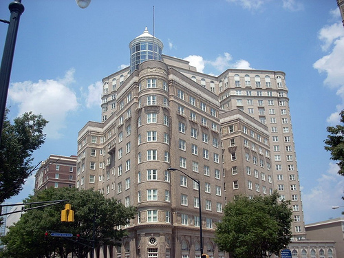
Ponce de Leon Avenue then passes under a former rail bridge which is part of the BeltLine trail, after which it forms the border between the Poncey-Highland neighborhood to the south and Virginia-Highland to the north. After the now-redeveloped Ford Motor Company Assembly Plant bordering the BeltLine, it passes the Clermont Hotel and Clermont Lounge and then the north end of Freedom Parkway, where it also picks up the route designation Georgia 10 east. It then passes 725 Ponce, a mixed-use development on the former site of a supermarket nicknamed "Murder Kroger". A few blocks further east is the intersection with North Highland Avenue (from which the name of Poncey-Highland is derived), and at this intersection are found the historic Plaza Theatre and Briarcliff Hotel, designed by the same architect as Atlanta City Hall and once home to Coca-Cola heir Asa G. Candler Jr. Druid Hills Presbyterian Church, despite the name, is also located in this area, across the street from Briarcliff Plaza.
Hub AI
Ponce de Leon Avenue AI simulator
(@Ponce de Leon Avenue_simulator)
Ponce de Leon Avenue
Ponce de Leon Avenue (/ˌpɒns də ˈliːən/ PONSS də LEE-ən), often simply called Ponce, provides a link between Atlanta, Decatur, Clarkston, and Stone Mountain, Georgia. It was named for Ponce de Leon Springs, in turn from explorer Juan Ponce de León, but is not pronounced as in Spanish. Several grand and historic buildings are located on the avenue.
The original street extended eastward from Peachtree Street and was called Ponce de Leon Circle. In August 1872, a horsecar line that went from downtown Atlanta up Peachtree to Pine, was extended to Ponce de Leon Circle. At some point later[specify], it was extended to Ponce de Leon Springs, where the Ponce de Leon amusement park would be built; today, Ponce City Market (formerly the Sears building, then City Hall East) stands on the site. Finally in 1889, the line was electrified and extended with the "loop" around what is now Virginia-Highland.
West of Peachtree Street were Kimball Street and 2nd Street, portions of which were renamed Ponce de Leon Avenue. (See maps at Atlanta annexations.)
In the 1890s-1910s, Ponce de Leon between Midtown and Moreland Avenue (the border of Druid Hills) was one of the city's premier residential streets lined with large houses of the city's elite. With the arrival of the automobile, the richest families started to move further out, to what is today Buckhead, to Ansley Park and to Druid Hills. Upscale apartment buildings started to appear on the boulevard. Ponce, as did much of the city, lost many of its middle- to upper-middle-class residents in the 1950s and 1960s, and large parking lot areas and new buildings built away from the street made Ponce lose much of the walkability that it had - and its focus gave way fully to automobile traffic. Though a renaissance was beginning in the 1970s, Ponce still was renowned for prostitution, drug sales, but also for its eclectic character up to the turn of the 21st century, celebrated in books such as George Mitchell's Ponce Deleon : An Intimate Portrait of Atlanta's Most Famous Avenue and Sharon Foster's Atlanta's Ponce de Leon Avenue: A History. Today, the areas that Ponce passes on its way from Midtown to Druid Hills are largely affluent: Midtown, the Old Fourth Ward where gentrification is well underway, and fully gentrified Poncey-Highland and Virginia-Highland.
Sam Venable's home on the northeast corner of Ponce de Leon Avenue and Oakdale Road was bought in 1959 for $60,000 by the St. John's Lutheran Church.
Ponce de Leon Avenue begins at Spring Street at the south edge of Midtown Atlanta, though prior to the construction of the Downtown Connector, it started a block further west at Williams Street (across from Georgia Tech, one block east of Bobby Dodd Stadium) It passes West Peachtree Street and then Peachtree Street, the city block which has the BellSouth Building (now Tower Square) and the historic Fox Theatre on the north side of the street. At the next two intersections, it takes multiple numbered routes from North Avenue, which runs one block to the south and forms the boundary between Midtown and downtown Atlanta. Via one-way Juniper Street southbound and Piedmont Avenue (formerly part of Georgia 237) northbound, it gets U.S. 29 north, U.S. 78 east, U.S. 278 east, and Georgia 8 east.
Passing Piedmont Avenue and the Edward C. Peters House, Ponce forms the border of NRHP-listed Historic Midtown to the north and Old Fourth Ward to the south. Here are found the historic Mary Mac's Tea Room, the Kodak Building, the Atlanta Eagle, Atlanta's original Krispy Kreme store, and Grace United Methodist Church. After drifting toward the east-northeast, it passes Boulevard (which continues north as Monroe Drive), and after Glen Iris Drive it passes the north side of the hulking former Sears building, later used as City Hall East, and now as Ponce City Market, a food hall and mixed-use complex. Before Sears, the Ponce de Leon Amusement Park was located here. On the north side of Ponce is the Midtown Place strip mall, on the site of the Ponce de Leon ballpark, which was home to the Atlanta Crackers and Atlanta Black Crackers baseball teams.
Ponce de Leon Avenue then passes under a former rail bridge which is part of the BeltLine trail, after which it forms the border between the Poncey-Highland neighborhood to the south and Virginia-Highland to the north. After the now-redeveloped Ford Motor Company Assembly Plant bordering the BeltLine, it passes the Clermont Hotel and Clermont Lounge and then the north end of Freedom Parkway, where it also picks up the route designation Georgia 10 east. It then passes 725 Ponce, a mixed-use development on the former site of a supermarket nicknamed "Murder Kroger". A few blocks further east is the intersection with North Highland Avenue (from which the name of Poncey-Highland is derived), and at this intersection are found the historic Plaza Theatre and Briarcliff Hotel, designed by the same architect as Atlanta City Hall and once home to Coca-Cola heir Asa G. Candler Jr. Druid Hills Presbyterian Church, despite the name, is also located in this area, across the street from Briarcliff Plaza.